| Basin |
Sheepscot |
| Caption |
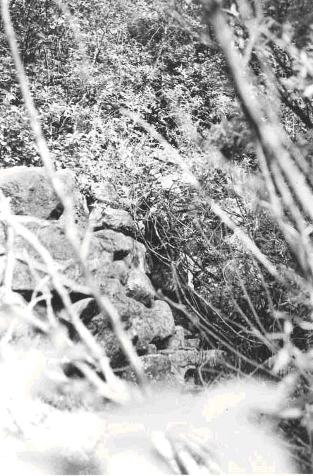
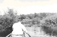
Sheepscot River, July 5, 1950. Abutment and remains, of old dam approximately 200 yards above Somerville Road Bridge, and approximately 21 miles above Alna Bridge. Formerly a tannery, sawmill, etc. located here. Channel now clear. |
| CaptionTemplate |
[Description] |
| Category |
Historical Photos |
| Description |
Sheepscot River, July 5, 1950. Abutment and remains, of old dam approximately 200 yards above Somerville Road Bridge, and approximately 21 miles above Alna Bridge. Formerly a tannery, sawmill, etc. located here. Channel now clear. |
| Filename |
abutments.jpg |
| Filesize |
96745 |
| Meta_Id |
Photo_Historic |
| Notefile |
sheepscot.htm#Pics_Historic1 |
| Path |
us/abutments.jpg |
| Series |
Historical Photos- 1950 Somerville Marsh Area |
| SubBasin |
Upper Sheepscot |
| Basin |
Sheepscot |
| Caption |
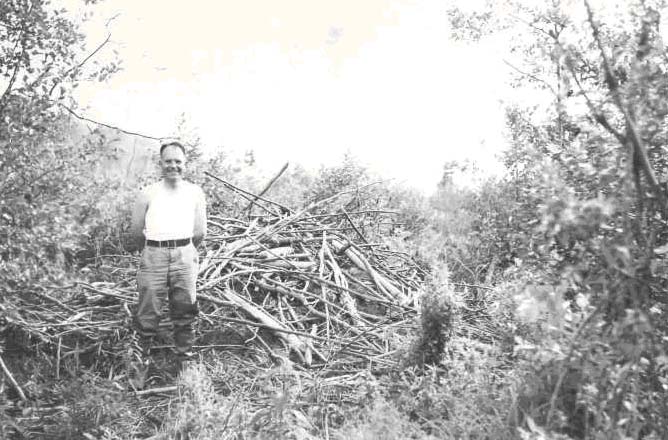
Sheepscot River, June 29, 1950. View of 2nd (upper) of two active beaver dams in deadwater at head of big meadow above Somerville (at 37,290 yards above Alna Bridge). 2 to 3 ft. drop and 12 ft. wide; impassable to salmon. |
| CaptionTemplate |
[Description] |
| Category |
Historical Photos |
| Description |
Sheepscot River, June 29, 1950. View of 2nd (upper) of two active beaver dams in deadwater at head of big meadow above Somerville (at 37,290 yards above Alna Bridge). 2 to 3 ft. drop and 12 ft. wide; impassable to salmon. |
| Filename |
deawater_1.jpg |
| Filesize |
103066 |
| Meta_Id |
Photo_Historic |
| Notefile |
sheepscot.htm#Pics_Historic1 |
| Path |
us/deawater_1.jpg |
| Series |
Historical Photos- 1950 Somerville Marsh Area |
| SubBasin |
Upper Sheepscot |
| Basin |
Sheepscot |
| Caption |
Sheepscot River, June 29, 1950. Lowermost of two active beaver dams in deadwater area at upper end of big meadow above Somerville (at 37,140 yards or 22 miles above Alna Bridge). Water drop is only 8 inches but at this water stage is practically impassable to adult salmon. View looking upstream. |
| CaptionTemplate |
[Description] |
| Category |
Historical Photos |
| Description |
Sheepscot River, June 29, 1950. Lowermost of two active beaver dams in deadwater area at upper end of big meadow above Somerville (at 37,140 yards or 22 miles above Alna Bridge). Water drop is only 8 inches but at this water stage is practically impassable to adult salmon. View looking upstream. |
| Filename |
deawater_2.jpg |
| Filesize |
60531 |
| Meta_Id |
Photo_Historic |
| Notefile |
sheepscot.htm#Pics_Historic1 |
| Path |
us/deawater_2.jpg |
| Series |
Historical Photos- 1950 Somerville Marsh Area |
| SubBasin |
Upper Sheepscot |

| Basin |
Sheepscot |
| Caption |
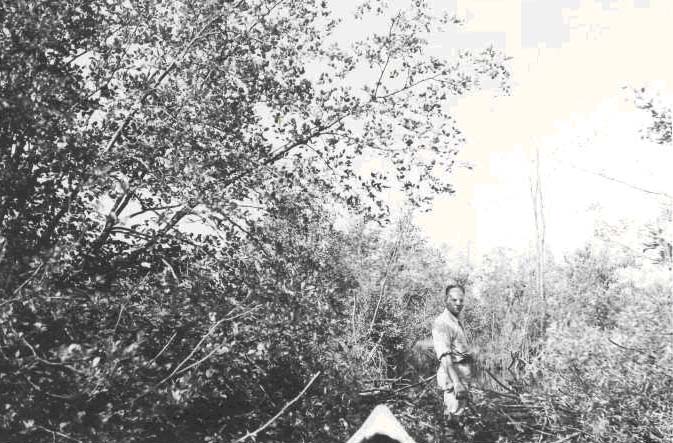
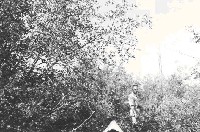
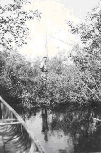
Sheepscot River, June 29, 1950. Bryant standing beside inhabited beaver house, located a few yards above second active beaver dam at head of big meadow above Somerville. Approximately 22.25 miles above Alna Bridge. Also shows extremely difficult hiking encountered at upper end of meadow. |
| CaptionTemplate |
[Description] |
| Category |
Historical Photos |
| Description |
Sheepscot River, June 29, 1950. Bryant standing beside inhabited beaver house, located a few yards above second active beaver dam at head of big meadow above Somerville. Approximately 22.25 miles above Alna Bridge. Also shows extremely difficult hiking encountered at upper end of meadow. |
| Filename |
deawater_3.jpg |
| Filesize |
85320 |
| Meta_Id |
Photo_Historic |
| Notefile |
sheepscot.htm#Pics_Historic1 |
| Path |
us/deawater_3.jpg |
| Series |
Historical Photos- 1950 Somerville Marsh Area |
| SubBasin |
Upper Sheepscot |
| Basin |
Sheepscot |
| Caption |
Sheepscot River, June 29, 1950. View of upper active beaver dam in a big meadow above Somerville (at 37,290 yds. or 22 miles) above Alna Bridge, impassable to salmon. |
| CaptionTemplate |
[Description] |
| Category |
Historical Photos |
| Description |
Sheepscot River, June 29, 1950. View of upper active beaver dam in a big meadow above Somerville (at 37,290 yds. or 22 miles) above Alna Bridge, impassable to salmon. |
| Filename |
deawater_4.jpg |
| Filesize |
77328 |
| Meta_Id |
Photo_Historic |
| Notefile |
sheepscot.htm#Pics_Historic1 |
| Path |
us/deawater_4.jpg |
| Series |
Historical Photos- 1950 Somerville Marsh Area |
| SubBasin |
Upper Sheepscot |

| Basin |
Sheepscot |
| Caption |
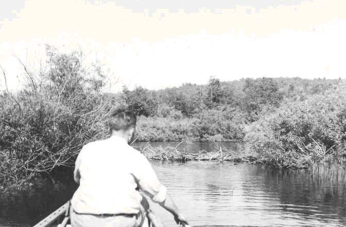
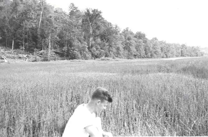
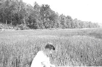
Sheepscot River, June 29, 1950. View of Equisetum and rush covered meadow above Somerville 21.75 miles up, where channel exists only in occasional small pockets of shallow water (back of canoe). One of many red-winged blackbirds can be seen on the rushes above its young, back of the canoe. |
| CaptionTemplate |
[Description] |
| Category |
Historical Photos |
| Description |
Sheepscot River, June 29, 1950. View of Equisetum and rush covered meadow above Somerville 21.75 miles up, where channel exists only in occasional small pockets of shallow water (back of canoe). One of many red-winged blackbirds can be seen on the rushes above its young, back of the canoe. |
| Filename |
somerville_marsh1.jpg |
| Filesize |
57855 |
| Meta_Id |
Photo_Historic |
| Notefile |
sheepscot.htm#Pics_Historic1 |
| Path |
us/somerville_marsh1.jpg |
| Series |
Historical Photos- 1950 Somerville Marsh Area |
| SubBasin |
Upper Sheepscot |

| Basin |
Sheepscot |
| Caption |
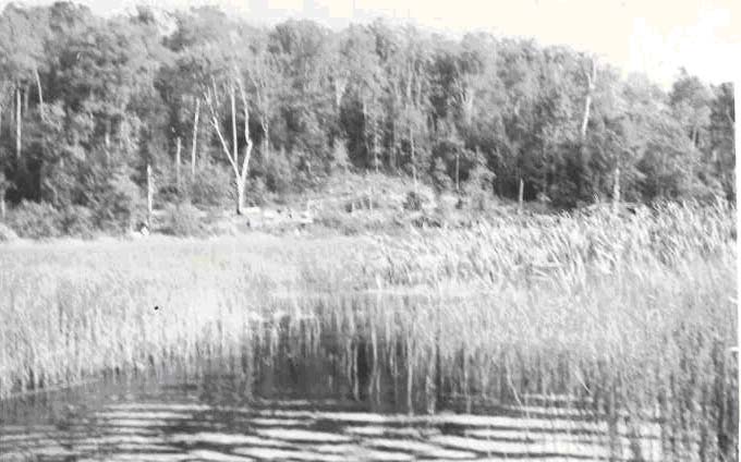
Sheepscot River, June 29, 1950. At approximately 22 miles above Alna Bridge, showing end of upper channel in acres of rush covered meadow above Somerville. Stream channel peters out in foreground. Bad for salmon passage, particularly adults. |
| CaptionTemplate |
[Description] |
| Category |
Historical Photos |
| Description |
Sheepscot River, June 29, 1950. At approximately 22 miles above Alna Bridge, showing end of upper channel in acres of rush covered meadow above Somerville. Stream channel peters out in foreground. Bad for salmon passage, particularly adults. |
| Filename |
somerville_marsh2.jpg |
| Filesize |
62013 |
| Meta_Id |
Photo_Historic |
| Notefile |
sheepscot.htm#Pics_Historic1 |
| Path |
us/somerville_marsh2.jpg |
| Series |
Historical Photos- 1950 Somerville Marsh Area |
| SubBasin |
Upper Sheepscot |
| Basin |
Sheepscot |
| Caption |
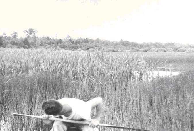
Sheepscot River, June 29, 1950. View in flooded meadow above Somerville (36,400 yds. or 21.75 miles above Alna Bridge) looking back over part of 300 to 500 yard stretch of no definite channel. Water flows (or seeps) thru acres of Equisetium sp. (horsetails). Water is less than a foot deep and hard work pushing a canoe through. This stretch may bother adult salmon moving to spawning grounds, and young seaward migrants, although the latter can probably work their way thru. Dead water above and below harbors pickerel and is a bad area for young salmon. |
| CaptionTemplate |
[Description] |
| Category |
Historical Photos |
| Description |
Sheepscot River, June 29, 1950. View in flooded meadow above Somerville (36,400 yds. or 21.75 miles above Alna Bridge) looking back over part of 300 to 500 yard stretch of no definite channel. Water flows (or seeps) thru acres of Equisetium sp. (horsetails). Water is less than a foot deep and hard work pushing a canoe through. This stretch may bother adult salmon moving to spawning grounds, and young seaward migrants, although the latter can probably work their way thru. Dead water above and below harbors pickerel and is a bad area for young salmon. |
| Filename |
somerville_marsh3.jpg |
| Filesize |
66457 |
| Meta_Id |
Photo_Historic |
| Notefile |
sheepscot.htm#Pics_Historic1 |
| Path |
us/somerville_marsh3.jpg |
| Series |
Historical Photos- 1950 Somerville Marsh Area |
| SubBasin |
Upper Sheepscot |