| Basin |
Sheepscot |
| Caption |
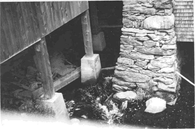
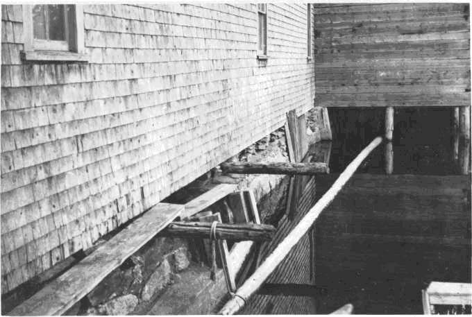
West Branch Sheepscot River, June 26, 1950. Intake of Dinsmores or Branch Mills, thru wooden grills at upper end of mill, built across dam at foot of Branch Pond. Entire flow of pond passes thru mill with total drop of about, l4 feet, impassable to fish. Operator is said to keep up lake level unless he is sawing, or during freshets.
|
| CaptionTemplate |
[Description] |
| Category |
Historical Photos |
| Description |
West Branch Sheepscot River, June 26, 1950. Intake of Dinsmores or Branch Mills, thru wooden grills at upper end of mill, built across dam at foot of Branch Pond. Entire flow of pond passes thru mill with total drop of about, l4 feet, impassable to fish. Operator is said to keep up lake level unless he is sawing, or during freshets.
|
| Filename |
dinsmore_us.jpg |
| Filesize |
62484 |
| Meta_Id |
Photo_Historic |
| Notefile |
sheepscot.htm#Pics_Historic1 |
| Path |
ws/dinsmore_us.jpg |
| Series |
Historical Photos- 1950 West Br. of the Sheepscot R. |
| SubBasin |
West Branch Sheepscot |

| Basin |
Sheepscot |
| Caption |
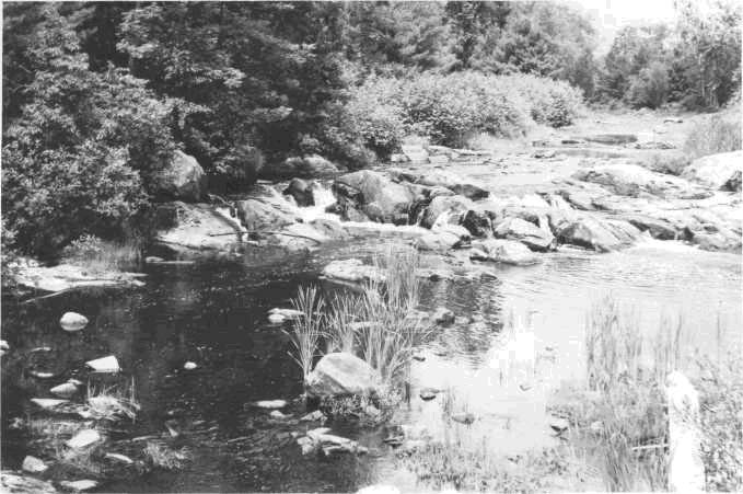
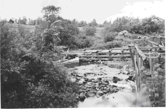
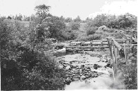
West Branch Sheepscot River, June 28, 1950. Ledge rock and small cascade just above W.P.A. bridge, approximately 450 yards above mouth. Main spill is at left of picture and has a 30 inch drop. Adult passage difficult at low water stages.
|
| CaptionTemplate |
[Description] |
| Category |
Historical Photos |
| Description |
West Branch Sheepscot River, June 28, 1950. Ledge rock and small cascade just above W.P.A. bridge, approximately 450 yards above mouth. Main spill is at left of picture and has a 30 inch drop. Adult passage difficult at low water stages.
|
| Filename |
howe_road1.jpg |
| Filesize |
72670 |
| Meta_Id |
Photo_Historic |
| Notefile |
sheepscot.htm#Pics_Historic1 |
| Path |
ws/howe_road1.jpg |
| Series |
Historical Photos- 1950 West Br. of the Sheepscot R. |
| SubBasin |
West Branch Sheepscot |
| Basin |
Sheepscot |
| Caption |
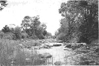
West Branch of the Sheepscot River June 20, l950. Upstream view from approximately 250 yards above the mouth. Lamprey eels were spawning in immediate foreground. |
| CaptionTemplate |
[Description] |
| Category |
Historical Photos |
| Description |
West Branch of the Sheepscot River June 20, l950. Upstream view from approximately 250 yards above the mouth. Lamprey eels were spawning in immediate foreground. |
| Filename |
howe_road2.jpg |
| Filesize |
63064 |
| Meta_Id |
Photo_Historic |
| Notefile |
sheepscot.htm#Pics_Historic1 |
| Path |
ws/howe_road2.jpg |
| Series |
Historical Photos- 1950 West Br. of the Sheepscot R. |
| SubBasin |
West Branch Sheepscot |
| Basin |
Sheepscot |
| Caption |
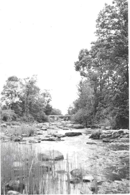
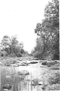
West Branch Sheepscot River - June 20, 1950. Ledge rock and some boulders approximately l50 yards above mouth of West Branch. WPA Bridge in
background. West Branch is 25 miles long, enters at approximately 12.5 miles above the mouth of the Sheepscot River.
|
| CaptionTemplate |
[Description] |
| Category |
Historical Photos |
| Description |
West Branch Sheepscot River - June 20, 1950. Ledge rock and some boulders approximately l50 yards above mouth of West Branch. WPA Bridge in
background. West Branch is 25 miles long, enters at approximately 12.5 miles above the mouth of the Sheepscot River.
|
| Filename |
howe_road3.jpg |
| Filesize |
56861 |
| Meta_Id |
Photo_Historic |
| Notefile |
sheepscot.htm#Pics_Historic1 |
| Path |
ws/howe_road3.jpg |
| Series |
Historical Photos- 1950 West Br. of the Sheepscot R. |
| SubBasin |
West Branch Sheepscot |
| Basin |
Sheepscot |
| Caption |
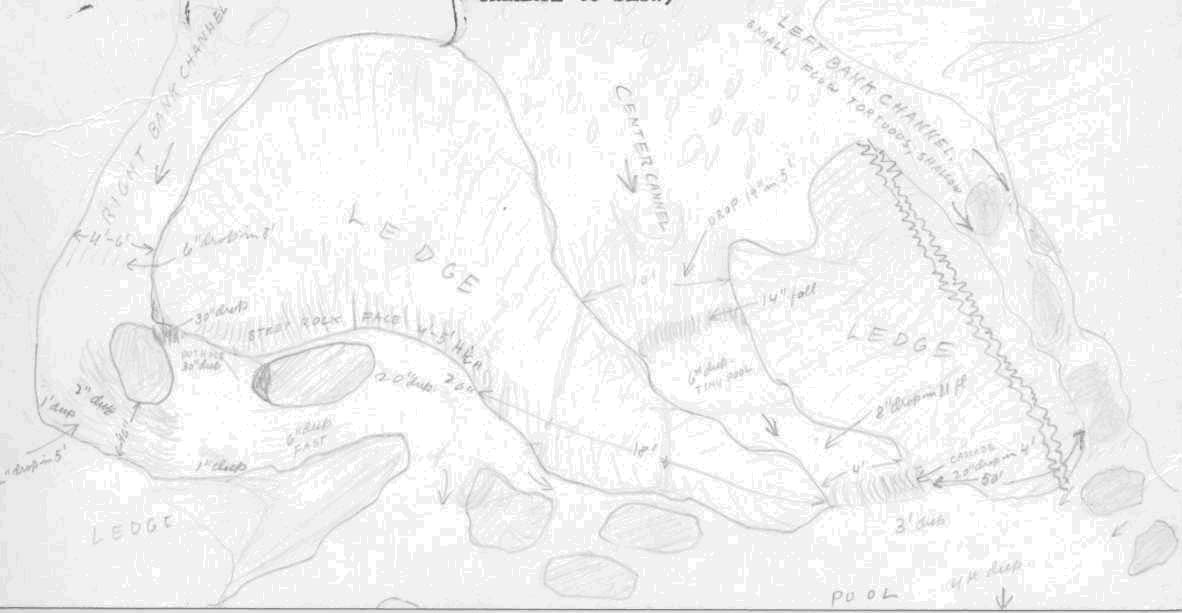
Sketch of the area upstream of the WPA bridge (Howe Road) by Floyd G. Bryant and John V. Mahoney. |
| CaptionTemplate |
[Description] |
| Category |
Historical Photos |
| Description |
Sketch of the area upstream of the WPA bridge (Howe Road) by Floyd G. Bryant and John V. Mahoney. |
| Filename |
howe_road_sketch.jpg |
| Filesize |
60531 |
| Meta_Id |
Photo_Historic |
| Notefile |
sheepscot.htm#Pics_Historic1 |
| Path |
ws/howe_road_sketch.jpg |
| Series |
Historical Photos- 1950 West Br. of the Sheepscot R. |
| SubBasin |
West Branch Sheepscot |
| Basin |
Sheepscot |
| Caption |
West Branch Sheepscot River, June 26, 1950. Weeks Mils and dam. Channel opening 8 feet wide, with drop of 2 feet into cement. Passable. Dam formerly at least 6 feet high and impassable. Estimated flow about. 20 c.f.s. after a rain. Weeks Mills is approximately 12.5 miles above the mouth of the West Branch.
|
| CaptionTemplate |
[Description] |
| Category |
Historical Photos |
| Description |
West Branch Sheepscot River, June 26, 1950. Weeks Mils and dam. Channel opening 8 feet wide, with drop of 2 feet into cement. Passable. Dam formerly at least 6 feet high and impassable. Estimated flow about. 20 c.f.s. after a rain. Weeks Mills is approximately 12.5 miles above the mouth of the West Branch.
|
| Filename |
weeks_mills.jpg |
| Filesize |
62323 |
| Meta_Id |
Photo_Historic |
| Notefile |
sheepscot.htm#Pics_Historic1 |
| Path |
ws/weeks_mills.jpg |
| Series |
Historical Photos- 1950 West Br. of the Sheepscot R. |
| SubBasin |
West Branch Sheepscot |