| Basin |
Sheepscot |
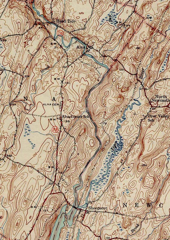
| Caption |
1944 topographic map of the Alna area of the Sheepscot River. From the Wiscasset SE 1944 quad downloaded from http://docs.unh.edu/nhtopos/nhtopos.htm. |
| CaptionTemplate |
[Description] |
| Category |
Historical Topo Maps |
| Description |
1944 topographic map of the Alna area of the Sheepscot River. From the Wiscasset SE 1944 quad downloaded from http://docs.unh.edu/nhtopos/nhtopos.htm. |
| Filename |
wiscasset_44.jpg |
| Filesize |
237975 |
| Meta_Id |
UNH_topos |
| Notefile |
sheepscot.htm#UNH_topos |
| Path |
bh/wiscasset_44.jpg |
| Series |
Historical Topographic Maps- Alna Area |
| SubBasin |
Below Head Tide |
| Basin |
Sheepscot |
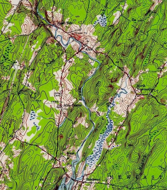
| Caption |
1957 topographic map of the Alna area of the Sheepscot River. From the Wiscasset SE 1957 quad downloaded from http://docs.unh.edu/nhtopos/nhtopos.htm. |
| CaptionTemplate |
[Description] |
| Category |
Historical Topo Maps |
| Description |
1957 topographic map of the Alna area of the Sheepscot River. From the Wiscasset SE 1957 quad downloaded from http://docs.unh.edu/nhtopos/nhtopos.htm. |
| Filename |
wiscasset_57.jpg |
| Filesize |
301191 |
| Meta_Id |
UNH_topos |
| Notefile |
sheepscot.htm#UNH_topos |
| Path |
bh/wiscasset_57.jpg |
| Series |
Historical Topographic Maps- Alna Area |
| SubBasin |
Below Head Tide |
| Basin |
Sheepscot |
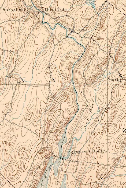
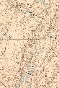
| Caption |
1893 topographic map of the Alna area of the Sheepscot River. From the Wiscasset SE 1893 quad downloaded from http://docs.unh.edu/nhtopos/nhtopos.htm. |
| CaptionTemplate |
[Description] |
| Category |
Historical Topo Maps |
| Description |
1893 topographic map of the Alna area of the Sheepscot River. From the Wiscasset SE 1893 quad downloaded from http://docs.unh.edu/nhtopos/nhtopos.htm. |
| Filename |
wiscasset_93.jpg |
| Filesize |
170467 |
| Meta_Id |
UNH_topos |
| Notefile |
sheepscot.htm#UNH_topos |
| Path |
bh/wiscasset_93.jpg |
| Series |
Historical Topographic Maps- Alna Area |
| SubBasin |
Below Head Tide |