| Basin |
Sheepscot |
| Caption |
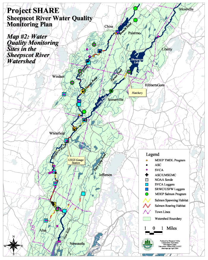
This map from Arter (2004) shows the location of water quality monitoring sites in the Sheepscot River watershed. Green circles are the Maine Department of Environmental Protection monitoring stations.
|
| CaptionTemplate |
[Description] |
| Category |
Monitoring |
| Description |
This map from Arter (2004) shows the location of water quality monitoring sites in the Sheepscot River watershed. Green circles are the Maine Department of Environmental Protection monitoring stations.
|
| Filename |
arter2004_sheep_wq_map.jpg |
| Filesize |
168444 |
| Meta_Id |
DEP_Stormwater |
| Notefile |
sheepscot.htm#DEP_WQ |
| Path |
bw/arter2004_sheep_wq_map.jpg |
| Series |
Monitoring- Sheepscot WQ Monitoring Locations |
| SubBasin |
Basinwide / Regional |