| Agency |
Institute for Fisheries Resources |
| Basin |
Sheepscot |
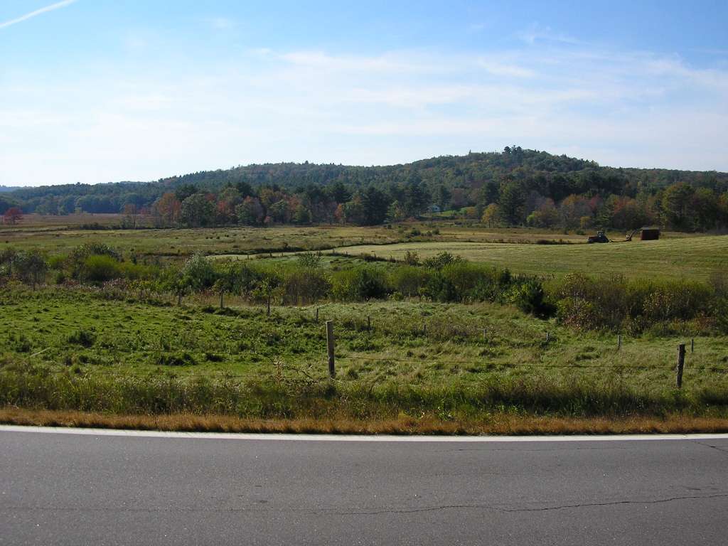
| Caption |
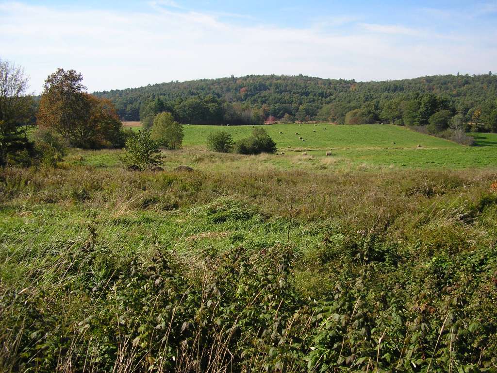
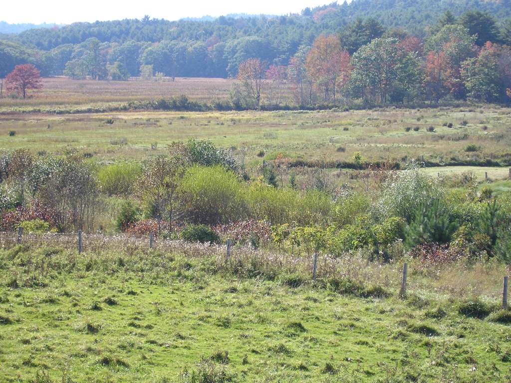
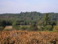
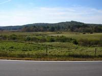
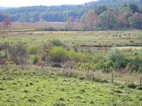
This photograph shows the view looking west from North Newcastle Road, south of its junction with Highway 194, a typical landscape in the lower portion of the Dyer River sub-basin. Rolls of harvested hay are visible in the valley bottom, with forested sloped beyond. This picture was taken looking just to the right of the previous picture. This site is located in the Dyer River sub-basin. Photograph was taken by Eli Asarian on 10/8/2004. |
| CaptionTemplate |
[description] This site is located in the [SubBasin] sub-basin. Photograph was taken by [photographer] on [photodate]. |
| Category |
Watershed Tour |
| Description |
This photograph shows the view looking west from North Newcastle Road, south of its junction with Highway 194, a typical landscape in the lower portion of the Dyer River sub-basin. Rolls of harvested hay are visible in the valley bottom, with forested sloped beyond. This picture was taken looking just to the right of the previous picture. |
| Filename |
sheep_2004-10-08_11-06-17.jpg |
| Filesize |
150890 |
| Path |
sheep_ifr_04\sheep_2004-10-08_11-06-17.jpg |
| Photodate |
10/8/2004 |
| Photographer |
Eli Asarian |
| Restriction |
None |
| Series |
Tour- Agriculture in Dyer River Sub-basin 2004 |
| SubBasin |
Dyer River |
| UpdateDate |
10/20/2004 |
| UpdateName |
JEA |
| Agency |
Institute for Fisheries Resources |
| Basin |
Sheepscot |
| Caption |
This photograph shows the view looking west from North Newcastle Road, south of its junction with Highway 194, a typical landscape in the lower portion of the Dyer River sub-basin. Rolls of harvested hay are visible in the valley bottom, with forested sloped beyond. This site is located in the Dyer River sub-basin. Photograph was taken by Eli Asarian on 10/8/2004. |
| CaptionTemplate |
[description] This site is located in the [SubBasin] sub-basin. Photograph was taken by [photographer] on [photodate]. |
| Category |
Watershed Tour |
| Description |
This photograph shows the view looking west from North Newcastle Road, south of its junction with Highway 194, a typical landscape in the lower portion of the Dyer River sub-basin. Rolls of harvested hay are visible in the valley bottom, with forested sloped beyond. |
| Filename |
sheep_2004-10-08_11-07-20.jpg |
| Filesize |
127296 |
| Path |
sheep_ifr_04\sheep_2004-10-08_11-07-20.jpg |
| Photodate |
10/8/2004 |
| Photographer |
Eli Asarian |
| Restriction |
None |
| Series |
Tour- Agriculture in Dyer River Sub-basin 2004 |
| SubBasin |
Dyer River |
| UpdateDate |
10/20/2004 |
| UpdateName |
JEA |
| Agency |
Institute for Fisheries Resources |
| Basin |
Sheepscot |
| Caption |
This photograph shows the view looking west from North Newcastle Road, south of its junction with Highway 194, a typical landscape in the lower portion of the Dyer River sub-basin. Rolls of harvested hay are visible in the valley bottom, with forested sloped beyond. This site is located in the Dyer River sub-basin. Photograph was taken by Eli Asarian on 10/8/2004. |
| CaptionTemplate |
[description] This site is located in the [SubBasin] sub-basin. Photograph was taken by [photographer] on [photodate]. |
| Category |
Watershed Tour |
| Description |
This photograph shows the view looking west from North Newcastle Road, south of its junction with Highway 194, a typical landscape in the lower portion of the Dyer River sub-basin. Rolls of harvested hay are visible in the valley bottom, with forested sloped beyond. |
| Filename |
sheep_2004-10-08_11-07-28.jpg |
| Filesize |
103509 |
| Path |
sheep_ifr_04\sheep_2004-10-08_11-07-28.jpg |
| Photodate |
10/8/2004 |
| Photographer |
Eli Asarian |
| Restriction |
None |
| Series |
Tour- Agriculture in Dyer River Sub-basin 2004 |
| SubBasin |
Dyer River |
| UpdateDate |
10/20/2004 |
| UpdateName |
JEA |
| Agency |
Institute for Fisheries Resources |
| Basin |
Sheepscot |
| Caption |
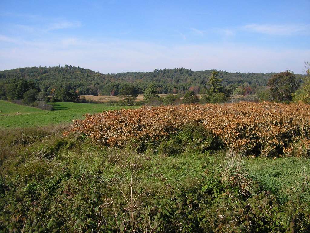
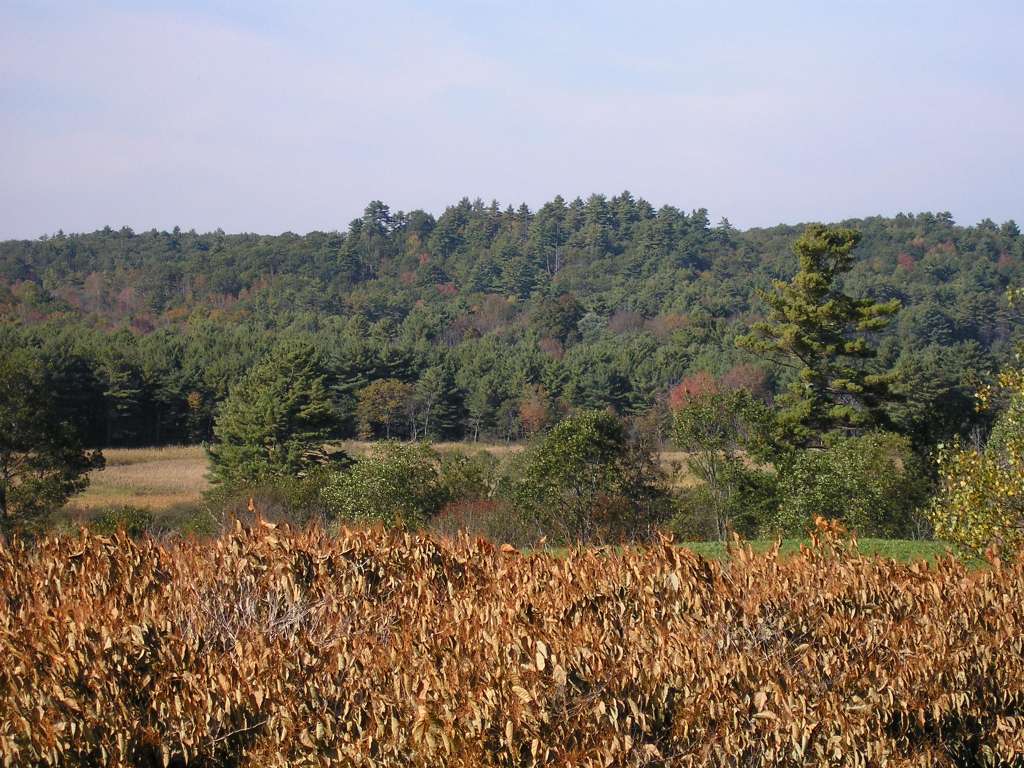
This photograph shows the view looking west from North Newcastle Road, south of its junction with Highway 194, a typical landscape in the lower portion of the Dyer River sub-basin. This site is located in the Dyer River sub-basin. Photograph was taken by Eli Asarian on 10/8/2004. |
| CaptionTemplate |
[description] This site is located in the [SubBasin] sub-basin. Photograph was taken by [photographer] on [photodate]. |
| Category |
Watershed Tour |
| Description |
This photograph shows the view looking west from North Newcastle Road, south of its junction with Highway 194, a typical landscape in the lower portion of the Dyer River sub-basin. |
| Filename |
sheep_2004-10-08_11-08-41.jpg |
| Filesize |
144575 |
| Path |
sheep_ifr_04\sheep_2004-10-08_11-08-41.jpg |
| Photodate |
10/8/2004 |
| Photographer |
Eli Asarian |
| Restriction |
None |
| Series |
Tour- Agriculture in Dyer River Sub-basin 2004 |
| SubBasin |
Dyer River |
| UpdateDate |
10/20/2004 |
| UpdateName |
JEA |
| Agency |
Institute for Fisheries Resources |
| Basin |
Sheepscot |
| Caption |
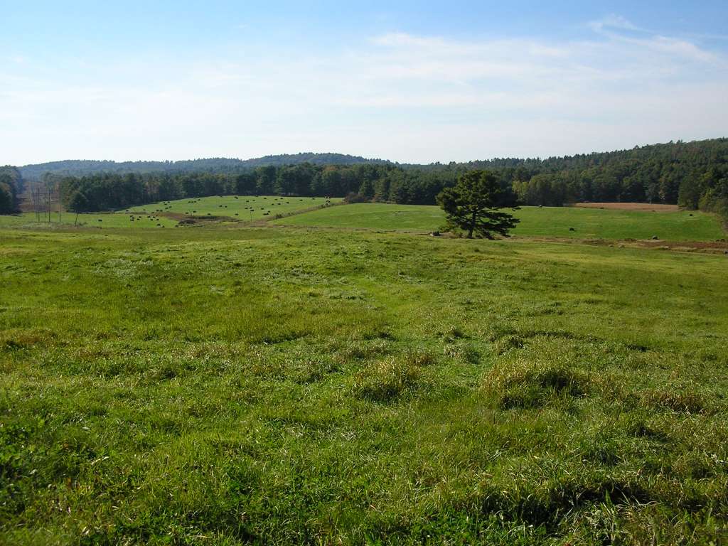
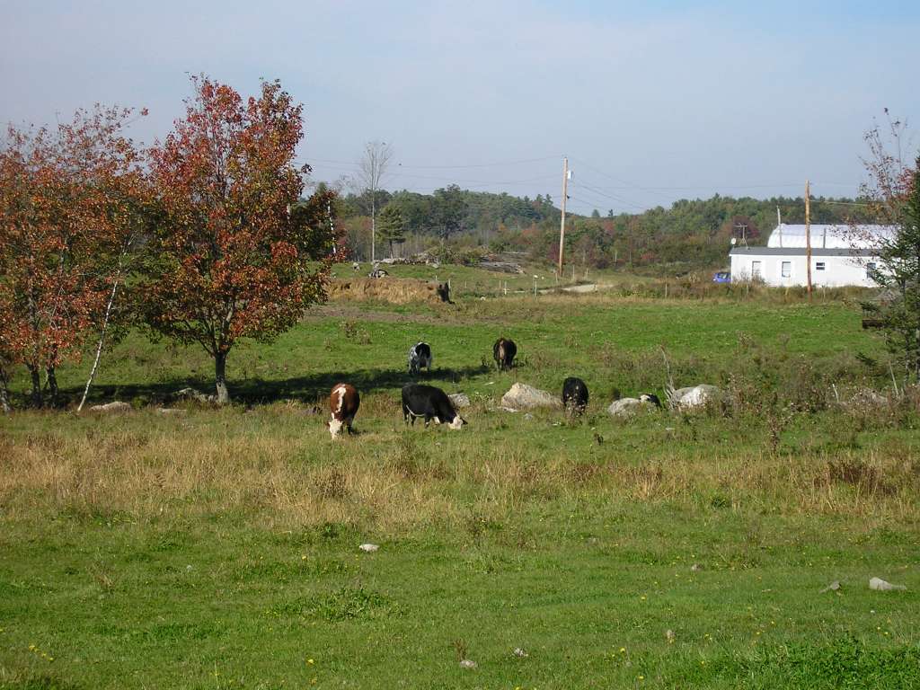
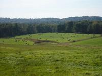
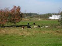
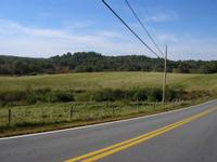
This photograph shows the view looking north from Highway 194, west of its junction with Highway 215. Dairy cows are grazing in a pasture. This site is located in the Dyer River sub-basin. Photograph was taken by Eli Asarian on 10/8/2004. |
| CaptionTemplate |
[description] This site is located in the [SubBasin] sub-basin. Photograph was taken by [photographer] on [photodate]. |
| Category |
Watershed Tour |
| Description |
This photograph shows the view looking north from Highway 194, west of its junction with Highway 215. Dairy cows are grazing in a pasture. |
| Filename |
sheep_2004-10-08_11-13-10.jpg |
| Filesize |
126660 |
| Path |
sheep_ifr_04\sheep_2004-10-08_11-13-10.jpg |
| Photodate |
10/8/2004 |
| Photographer |
Eli Asarian |
| Restriction |
None |
| Series |
Tour- Agriculture in Dyer River Sub-basin 2004 |
| SubBasin |
Dyer River |
| UpdateDate |
10/20/2004 |
| UpdateName |
JEA |
| Agency |
Institute for Fisheries Resources |
| Basin |
Sheepscot |
| Caption |
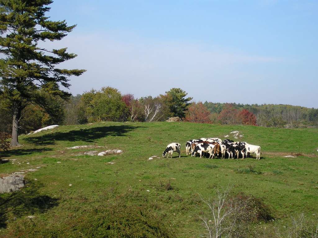
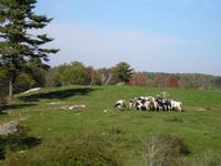
This photograph shows the view looking north from Highway 194, west of its junction with Highway 215. Dairy cows are gathered at a feeding or watering station. This site is located in the Dyer River sub-basin. Photograph was taken by Eli Asarian on 10/8/2004. |
| CaptionTemplate |
[description] This site is located in the [SubBasin] sub-basin. Photograph was taken by [photographer] on [photodate]. |
| Category |
Watershed Tour |
| Description |
This photograph shows the view looking north from Highway 194, west of its junction with Highway 215. Dairy cows are gathered at a feeding or watering station. |
| Filename |
sheep_2004-10-08_11-13-38.jpg |
| Filesize |
105488 |
| Path |
sheep_ifr_04\sheep_2004-10-08_11-13-38.jpg |
| Photodate |
10/8/2004 |
| Photographer |
Eli Asarian |
| Restriction |
None |
| Series |
Tour- Agriculture in Dyer River Sub-basin 2004 |
| SubBasin |
Dyer River |
| UpdateDate |
10/20/2004 |
| UpdateName |
JEA |
| Agency |
Institute for Fisheries Resources |
| Basin |
Sheepscot |
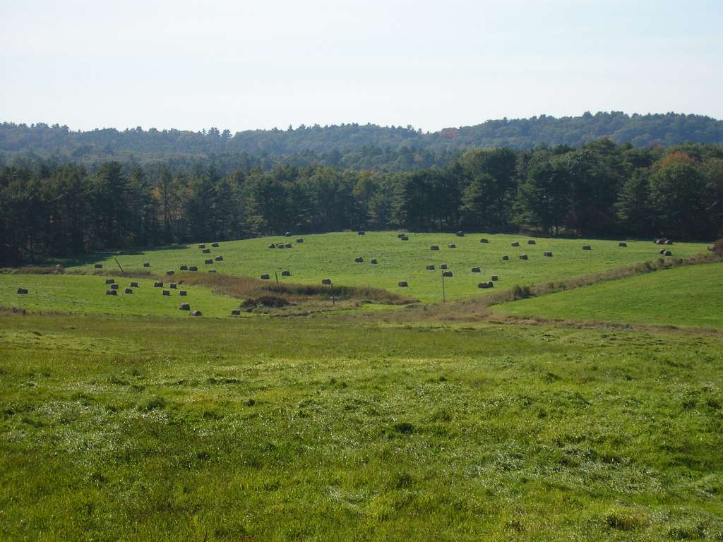
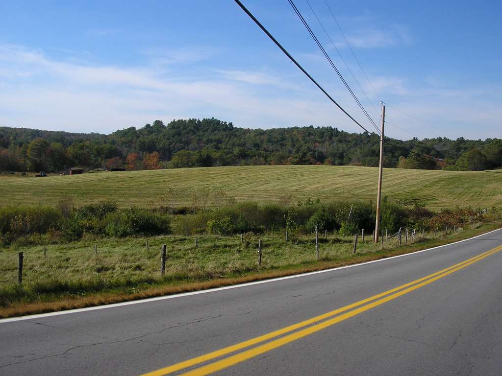
| Caption |
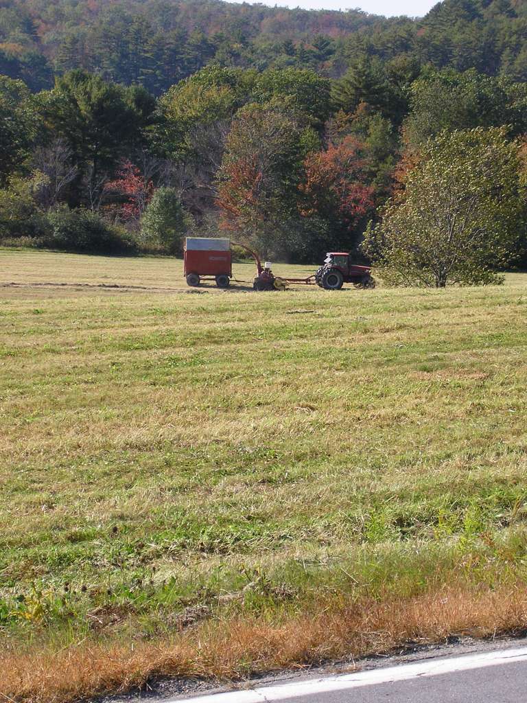
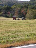
This photograph shows the view looking west from Highway 194, east of where the highway crosses over the Dyer River. A farmer is harvesting hay. This site is located in the Dyer River sub-basin. Photograph was taken by Eli Asarian on 10/8/2004. |
| CaptionTemplate |
[description] This site is located in the [SubBasin] sub-basin. Photograph was taken by [photographer] on [photodate]. |
| Category |
Watershed Tour |
| Description |
This photograph shows the view looking west from Highway 194, east of where the highway crosses over the Dyer River. A farmer is harvesting hay. |
| Filename |
sheep_2004-10-08_11-15-32.jpg |
| Filesize |
179282 |
| Path |
sheep_ifr_04\sheep_2004-10-08_11-15-32.jpg |
| Photodate |
10/8/2004 |
| Photographer |
Eli Asarian |
| Restriction |
None |
| Series |
Tour- Agriculture in Dyer River Sub-basin 2004 |
| SubBasin |
Dyer River |
| UpdateDate |
10/20/2004 |
| UpdateName |
JEA |
| Agency |
Institute for Fisheries Resources |
| Basin |
Sheepscot |
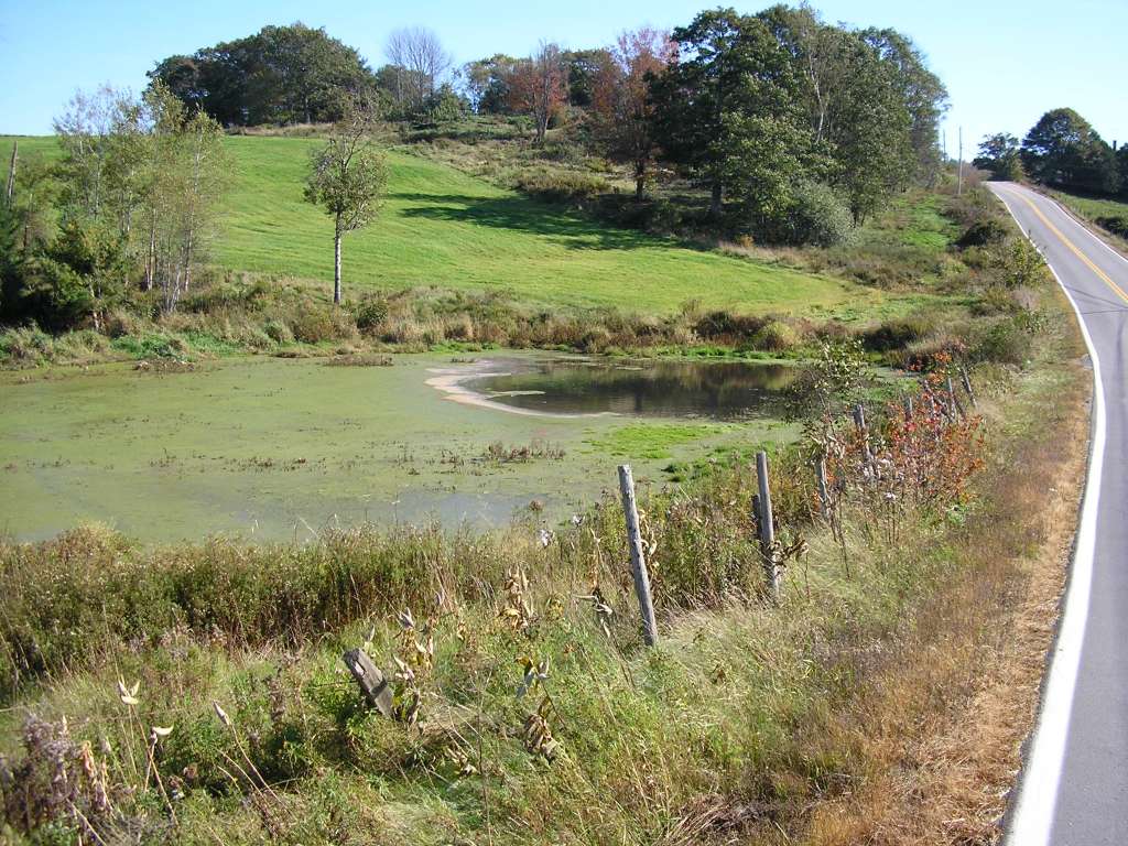
| Caption |
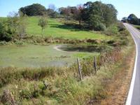
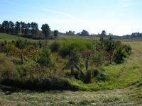
This photograph shows the view looking south along Highway 194, east of where the highway crosses over the Dyer River. At the left side of the picture is a nutrient-rich pond mostly covered with thick mats of algae and other plants. The pond drains under the road through a culvert whose outlet is shown in the following picture. This site is located in the Dyer River sub-basin. Photograph was taken by Eli Asarian on 10/8/2004. |
| CaptionTemplate |
[description] This site is located in the [SubBasin] sub-basin. Photograph was taken by [photographer] on [photodate]. |
| Category |
Watershed Tour |
| Description |
This photograph shows the view looking south along Highway 194, east of where the highway crosses over the Dyer River. At the left side of the picture is a nutrient-rich pond mostly covered with thick mats of algae and other plants. The pond drains under the road through a culvert whose outlet is shown in the following picture. |
| Filename |
sheep_2004-10-08_11-16-32.jpg |
| Filesize |
164050 |
| Path |
sheep_ifr_04\sheep_2004-10-08_11-16-32.jpg |
| Photodate |
10/8/2004 |
| Photographer |
Eli Asarian |
| Restriction |
None |
| Series |
Tour- Agriculture in Dyer River Sub-basin 2004 |
| SubBasin |
Dyer River |
| UpdateDate |
10/20/2004 |
| UpdateName |
JEA |
| Agency |
Institute for Fisheries Resources |
| Basin |
Sheepscot |
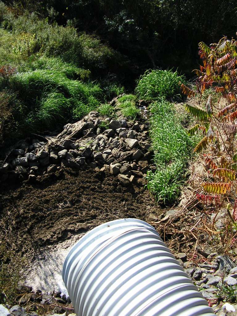
| Caption |
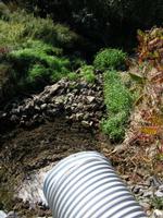
This photograph shows the outlet of the pond shown in the previous picture. Brown matter (likely manure) appears to be accumulating at the outfall the pipe and generates a strong smell. This site is located in the Dyer River sub-basin. Photograph was taken by Eli Asarian on 10/8/2004. |
| CaptionTemplate |
[description] This site is located in the [SubBasin] sub-basin. Photograph was taken by [photographer] on [photodate]. |
| Category |
Watershed Tour |
| Description |
This photograph shows the outlet of the pond shown in the previous picture. Brown matter (likely manure) appears to be accumulating at the outfall the pipe and generates a strong smell. |
| Filename |
sheep_2004-10-08_11-17-13.jpg |
| Filesize |
196442 |
| Path |
sheep_ifr_04\sheep_2004-10-08_11-17-13.jpg |
| Photodate |
10/8/2004 |
| Photographer |
Eli Asarian |
| Restriction |
None |
| Series |
Tour- Agriculture in Dyer River Sub-basin 2004 |
| SubBasin |
Dyer River |
| UpdateDate |
10/20/2004 |
| UpdateName |
JEA |
| Agency |
Institute for Fisheries Resources |
| Basin |
Sheepscot |
| Caption |
This photograph shows the riparian area through which the pond effluent shown in the previous picture flows. This site is located in the Dyer River sub-basin. Photograph was taken by Eli Asarian on 10/8/2004. |
| CaptionTemplate |
[description] This site is located in the [SubBasin] sub-basin. Photograph was taken by [photographer] on [photodate]. |
| Category |
Watershed Tour |
| Description |
This photograph shows the riparian area through which the pond effluent shown in the previous picture flows. |
| Filename |
sheep_2004-10-08_11-18-26.jpg |
| Filesize |
81696 |
| Path |
sheep_ifr_04\sheep_2004-10-08_11-18-26.jpg |
| Photodate |
10/8/2004 |
| Photographer |
Eli Asarian |
| Restriction |
None |
| Series |
Tour- Agriculture in Dyer River Sub-basin 2004 |
| SubBasin |
Dyer River |
| UpdateDate |
10/20/2004 |
| UpdateName |
JEA |
| Agency |
Institute for Fisheries Resources |
| Basin |
Sheepscot |
| Caption |
This photograph shows the riparian area through which the pond effluent shown one of the previous pictures flows. This site is located in the Dyer River sub-basin. Photograph was taken by Eli Asarian on 10/8/2004. |
| CaptionTemplate |
[description] This site is located in the [SubBasin] sub-basin. Photograph was taken by [photographer] on [photodate]. |
| Category |
Watershed Tour |
| Description |
This photograph shows the riparian area through which the pond effluent shown one of the previous pictures flows. |
| Filename |
sheep_2004-10-08_11-18-33.jpg |
| Filesize |
90093 |
| Path |
sheep_ifr_04\sheep_2004-10-08_11-18-33.jpg |
| Photodate |
10/8/2004 |
| Photographer |
Eli Asarian |
| Restriction |
None |
| Series |
Tour- Agriculture in Dyer River Sub-basin 2004 |
| SubBasin |
Dyer River |
| UpdateDate |
10/20/2004 |
| UpdateName |
JEA |
| Agency |
Institute for Fisheries Resources |
| Basin |
Sheepscot |
| Caption |
This photograph shows the riparian area through which the pond effluent shown one of the previous pictures flows. This site is located in the Dyer River sub-basin. Photograph was taken by Eli Asarian on 10/8/2004. |
| CaptionTemplate |
[description] This site is located in the [SubBasin] sub-basin. Photograph was taken by [photographer] on [photodate]. |
| Category |
Watershed Tour |
| Description |
This photograph shows the riparian area through which the pond effluent shown one of the previous pictures flows. |
| Filename |
sheep_2004-10-08_11-19-08.jpg |
| Filesize |
161635 |
| Path |
sheep_ifr_04\sheep_2004-10-08_11-19-08.jpg |
| Photodate |
10/8/2004 |
| Photographer |
Eli Asarian |
| Restriction |
None |
| Series |
Tour- Agriculture in Dyer River Sub-basin 2004 |
| SubBasin |
Dyer River |
| UpdateDate |
10/20/2004 |
| UpdateName |
JEA |
| Agency |
Institute for Fisheries Resources |
| Basin |
Sheepscot |
| Caption |
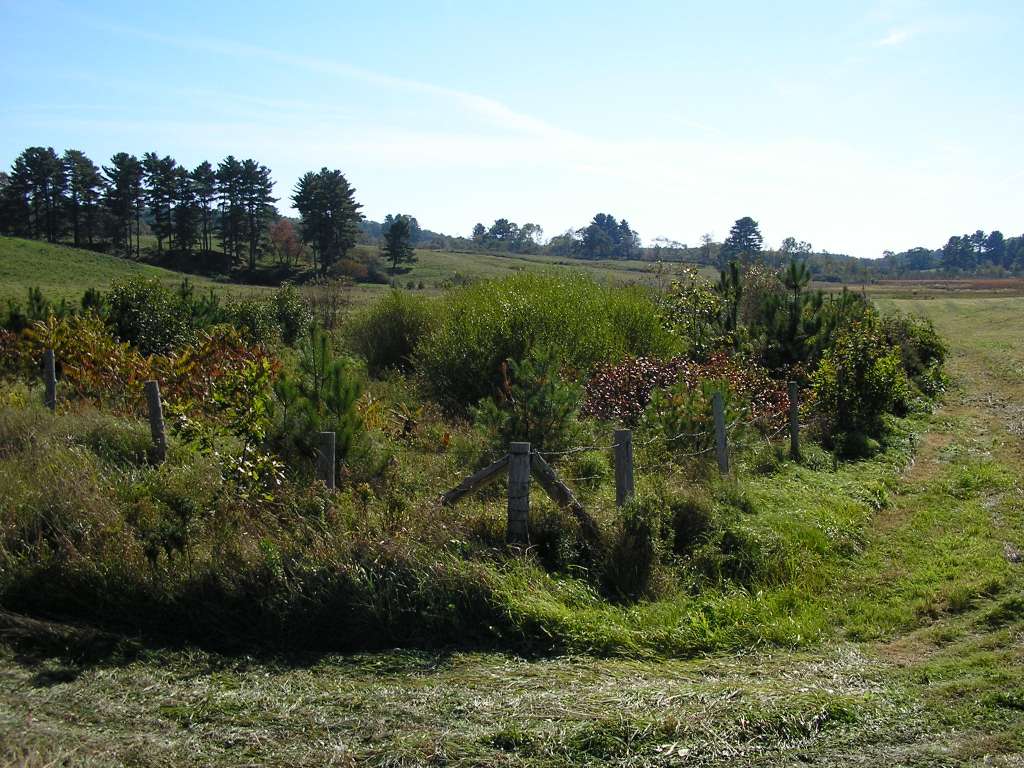
This photograph shows the riparian area through which the pond effluent shown one of the previous pictures flows. A fence protects the riparian zone from cows and mowing, and many small trees are regenerating, indicating that the riparian zone is recovering. This site is located in the Dyer River sub-basin. Photograph was taken by Eli Asarian on 10/8/2004. |
| CaptionTemplate |
[description] This site is located in the [SubBasin] sub-basin. Photograph was taken by [photographer] on [photodate]. |
| Category |
Watershed Tour |
| Description |
This photograph shows the riparian area through which the pond effluent shown one of the previous pictures flows. A fence protects the riparian zone from cows and mowing, and many small trees are regenerating, indicating that the riparian zone is recovering. |
| Filename |
sheep_2004-10-08_11-20-34.jpg |
| Filesize |
142863 |
| Path |
sheep_ifr_04\sheep_2004-10-08_11-20-34.jpg |
| Photodate |
10/8/2004 |
| Photographer |
Eli Asarian |
| Restriction |
None |
| Series |
Tour- Agriculture in Dyer River Sub-basin 2004 |
| SubBasin |
Dyer River |
| UpdateDate |
10/20/2004 |
| UpdateName |
JEA |