| Agency |
Institute for Fisheries Resources |
| Basin |
Sheepscot |
| Caption |
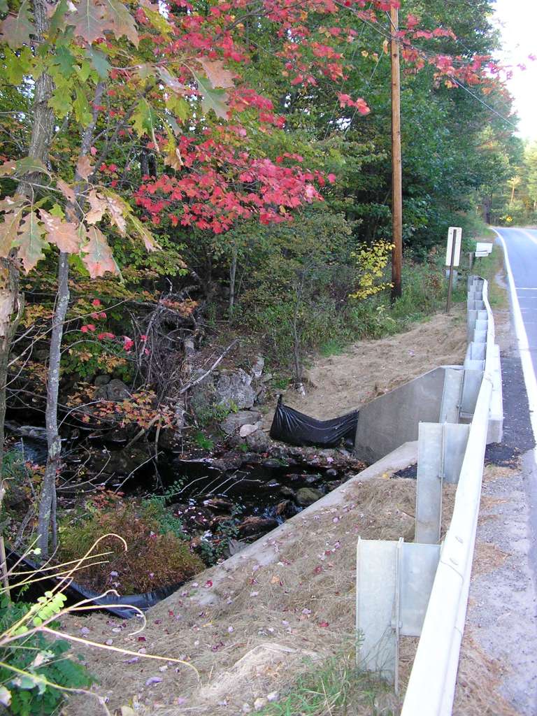
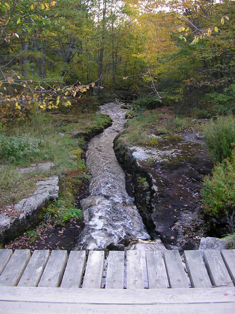
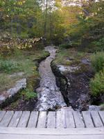
This photograph shows the stream that flows from Kerr pond to Dyer Long Pond. This photograph shows the downstream side of the culvert where the stream passes under Highway 213. Large amounts of fine sand, likely applied to the road during winter to melt snow, has accumulated on the side of the road. Silt fence caught some portion of the sand, but some portion passed into the stream. This site is located in the Dyer River sub-basin. Photograph was taken by Eli Asarian on 10/8/2004. |
| CaptionTemplate |
[description] This site is located in the [SubBasin] sub-basin. Photograph was taken by [photographer] on [photodate]. |
| Category |
Watershed Tour |
| Description |
This photograph shows the stream that flows from Kerr pond to Dyer Long Pond. This photograph shows the downstream side of the culvert where the stream passes under Highway 213. Large amounts of fine sand, likely applied to the road during winter to melt snow, has accumulated on the side of the road. Silt fence caught some portion of the sand, but some portion passed into the stream. |
| Filename |
sheep_2004-10-08_14-17-37.jpg |
| Filesize |
164617 |
| Path |
sheep_ifr_04\sheep_2004-10-08_14-17-37.jpg |
| Photodate |
10/8/2004 |
| Photographer |
Eli Asarian |
| Restriction |
None |
| Series |
Tour- Dyer Long Pond and Surrounding Areas 2004 |
| SubBasin |
Dyer River |
| UpdateDate |
10/20/2004 |
| UpdateName |
JEA |
| Agency |
Institute for Fisheries Resources |
| Basin |
Sheepscot |
| Caption |
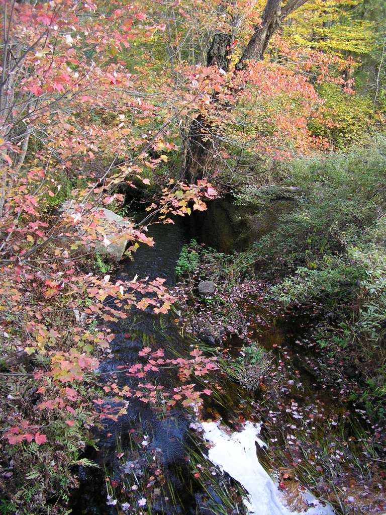
This photograph shows the stream that flows from Kerr pond to Dyer Long Pond. This photograph looks upstream from culvert where the stream passes under Highway 213. This site is located in the Dyer River sub-basin. Photograph was taken by Eli Asarian on 10/8/2004. |
| CaptionTemplate |
[description] This site is located in the [SubBasin] sub-basin. Photograph was taken by [photographer] on [photodate]. |
| Category |
Watershed Tour |
| Description |
This photograph shows the stream that flows from Kerr pond to Dyer Long Pond. This photograph looks upstream from culvert where the stream passes under Highway 213. |
| Filename |
sheep_2004-10-08_14-18-12.jpg |
| Filesize |
209093 |
| Path |
sheep_ifr_04\sheep_2004-10-08_14-18-12.jpg |
| Photodate |
10/8/2004 |
| Photographer |
Eli Asarian |
| Restriction |
None |
| Series |
Tour- Dyer Long Pond and Surrounding Areas 2004 |
| SubBasin |
Dyer River |
| UpdateDate |
10/20/2004 |
| UpdateName |
JEA |

| Agency |
Institute for Fisheries Resources |
| Basin |
Sheepscot |
| Caption |
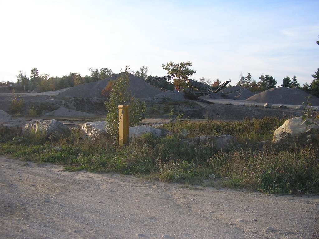
This photograph shows a gravel pit near Highway 215 and the stream shown in previous photographs that flows from Kerr pond to Dyer Long Pond. This site is located in the Dyer River sub-basin. Photograph was taken by Eli Asarian on 10/8/2004. |
| CaptionTemplate |
[description] This site is located in the [SubBasin] sub-basin. Photograph was taken by [photographer] on [photodate]. |
| Category |
Watershed Tour |
| Description |
This photograph shows a gravel pit near Highway 215 and the stream shown in previous photographs that flows from Kerr pond to Dyer Long Pond. |
| Filename |
sheep_2004-10-08_14-19-45.jpg |
| Filesize |
90301 |
| Path |
sheep_ifr_04\sheep_2004-10-08_14-19-45.jpg |
| Photodate |
10/8/2004 |
| Photographer |
Eli Asarian |
| Restriction |
None |
| Series |
Tour- Dyer Long Pond and Surrounding Areas 2004 |
| SubBasin |
Dyer River |
| UpdateDate |
10/20/2004 |
| UpdateName |
JEA |
| Agency |
Institute for Fisheries Resources |
| Basin |
Sheepscot |
| Caption |
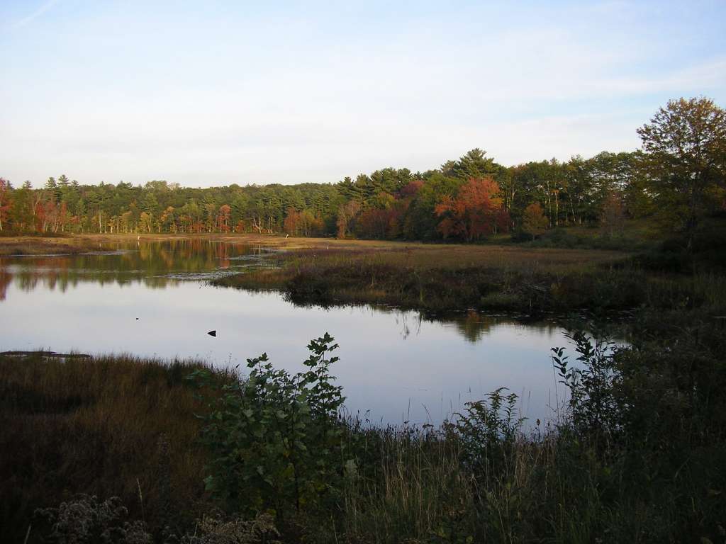
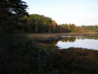
This photograph shows the southern tip of Dyer Long Pond, just above the dam at the pond's outlet, looking east. This photograph was taken looking just to the left of the following photograph. This site is located in the Dyer River sub-basin. Photograph was taken by Eli Asarian on 10/8/2004. |
| CaptionTemplate |
[description] This site is located in the [SubBasin] sub-basin. Photograph was taken by [photographer] on [photodate]. |
| Category |
Watershed Tour |
| Description |
This photograph shows the southern tip of Dyer Long Pond, just above the dam at the pond's outlet, looking east. This photograph was taken looking just to the left of the following photograph. |
| Filename |
sheep_2004-10-08_14-24-06.jpg |
| Filesize |
74040 |
| Path |
sheep_ifr_04\sheep_2004-10-08_14-24-06.jpg |
| Photodate |
10/8/2004 |
| Photographer |
Eli Asarian |
| Restriction |
None |
| Series |
Tour- Dyer Long Pond and Surrounding Areas 2004 |
| SubBasin |
Dyer River |
| UpdateDate |
10/20/2004 |
| UpdateName |
JEA |

| Agency |
Institute for Fisheries Resources |
| Basin |
Sheepscot |
| Caption |
This photograph shows the southern tip of Dyer Long Pond, just above the dam at the pond's outlet, looking east. This photograph was taken looking just to the right of the previous photograph. This site is located in the Dyer River sub-basin. Photograph was taken by Eli Asarian on 10/8/2004. |
| CaptionTemplate |
[description] This site is located in the [SubBasin] sub-basin. Photograph was taken by [photographer] on [photodate]. |
| Category |
Watershed Tour |
| Description |
This photograph shows the southern tip of Dyer Long Pond, just above the dam at the pond's outlet, looking east. This photograph was taken looking just to the right of the previous photograph. |
| Filename |
sheep_2004-10-08_14-24-14.jpg |
| Filesize |
72945 |
| Path |
sheep_ifr_04\sheep_2004-10-08_14-24-14.jpg |
| Photodate |
10/8/2004 |
| Photographer |
Eli Asarian |
| Restriction |
None |
| Series |
Tour- Dyer Long Pond and Surrounding Areas 2004 |
| SubBasin |
Dyer River |
| UpdateDate |
10/20/2004 |
| UpdateName |
JEA |
| Agency |
Institute for Fisheries Resources |
| Basin |
Sheepscot |
| Caption |
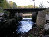
This photograph shows the Dyer River at the outlet of Dyer Long Pond, taken from the dam, looking west. This site is located in the Dyer River sub-basin. Photograph was taken by Eli Asarian on 10/8/2004. |
| CaptionTemplate |
[description] This site is located in the [SubBasin] sub-basin. Photograph was taken by [photographer] on [photodate]. |
| Category |
Watershed Tour |
| Description |
This photograph shows the Dyer River at the outlet of Dyer Long Pond, taken from the dam, looking west. |
| Filename |
sheep_2004-10-08_14-24-56.jpg |
| Filesize |
162800 |
| Path |
sheep_ifr_04\sheep_2004-10-08_14-24-56.jpg |
| Photodate |
10/8/2004 |
| Photographer |
Eli Asarian |
| Restriction |
None |
| Series |
Tour- Dyer Long Pond and Surrounding Areas 2004 |
| SubBasin |
Dyer River |
| UpdateDate |
10/20/2004 |
| UpdateName |
JEA |
| Agency |
Institute for Fisheries Resources |
| Basin |
Sheepscot |
| Caption |
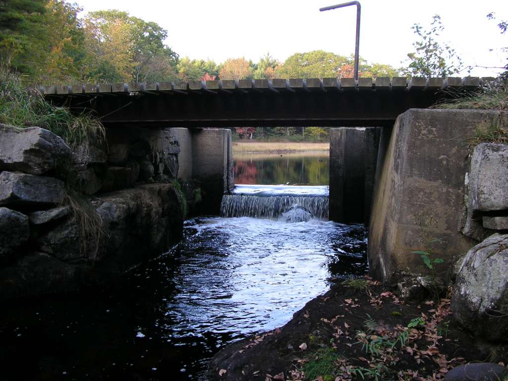
This photograph shows the Dyer River at the outlet of Dyer Long Pond and its dam. Flashboards in the dam allow its height to be adjusted. In this photograph, no flashboards are currently installed. This site is located in the Dyer River sub-basin. Photograph was taken by Eli Asarian on 10/8/2004. |
| CaptionTemplate |
[description] This site is located in the [SubBasin] sub-basin. Photograph was taken by [photographer] on [photodate]. |
| Category |
Watershed Tour |
| Description |
This photograph shows the Dyer River at the outlet of Dyer Long Pond and its dam. Flashboards in the dam allow its height to be adjusted. In this photograph, no flashboards are currently installed. |
| Filename |
sheep_2004-10-08_14-25-16.jpg |
| Filesize |
104633 |
| Path |
sheep_ifr_04\sheep_2004-10-08_14-25-16.jpg |
| Photodate |
10/8/2004 |
| Photographer |
Eli Asarian |
| Restriction |
None |
| Series |
Tour- Dyer Long Pond and Surrounding Areas 2004 |
| SubBasin |
Dyer River |
| UpdateDate |
10/20/2004 |
| UpdateName |
JEA |

| Agency |
Institute for Fisheries Resources |
| Basin |
Sheepscot |
| Caption |
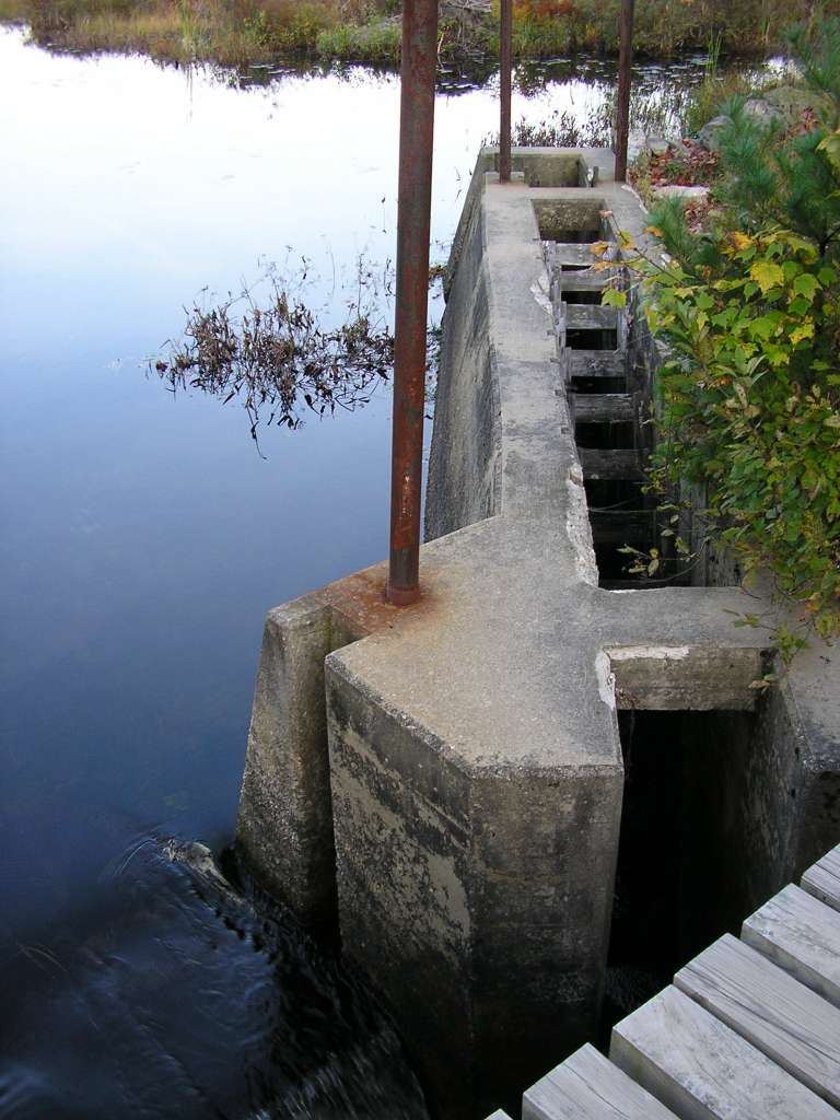
This photograph shows the fish ladder on the dam at the outlet of Dyer Long Pond. No water is currently flowing down the fish ladder, and the reservoir elevation is at a low level. This site is located in the Dyer River sub-basin. Photograph was taken by Eli Asarian on 10/8/2004. |
| CaptionTemplate |
[description] This site is located in the [SubBasin] sub-basin. Photograph was taken by [photographer] on [photodate]. |
| Category |
Watershed Tour |
| Description |
This photograph shows the fish ladder on the dam at the outlet of Dyer Long Pond. No water is currently flowing down the fish ladder, and the reservoir elevation is at a low level. |
| Filename |
sheep_2004-10-08_14-25-36.jpg |
| Filesize |
95091 |
| Path |
sheep_ifr_04\sheep_2004-10-08_14-25-36.jpg |
| Photodate |
10/8/2004 |
| Photographer |
Eli Asarian |
| Restriction |
None |
| Series |
Tour- Dyer Long Pond and Surrounding Areas 2004 |
| SubBasin |
Dyer River |
| UpdateDate |
10/20/2004 |
| UpdateName |
JEA |
| Agency |
Institute for Fisheries Resources |
| Basin |
Sheepscot |
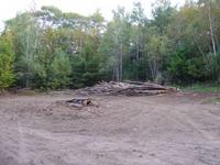
| Caption |
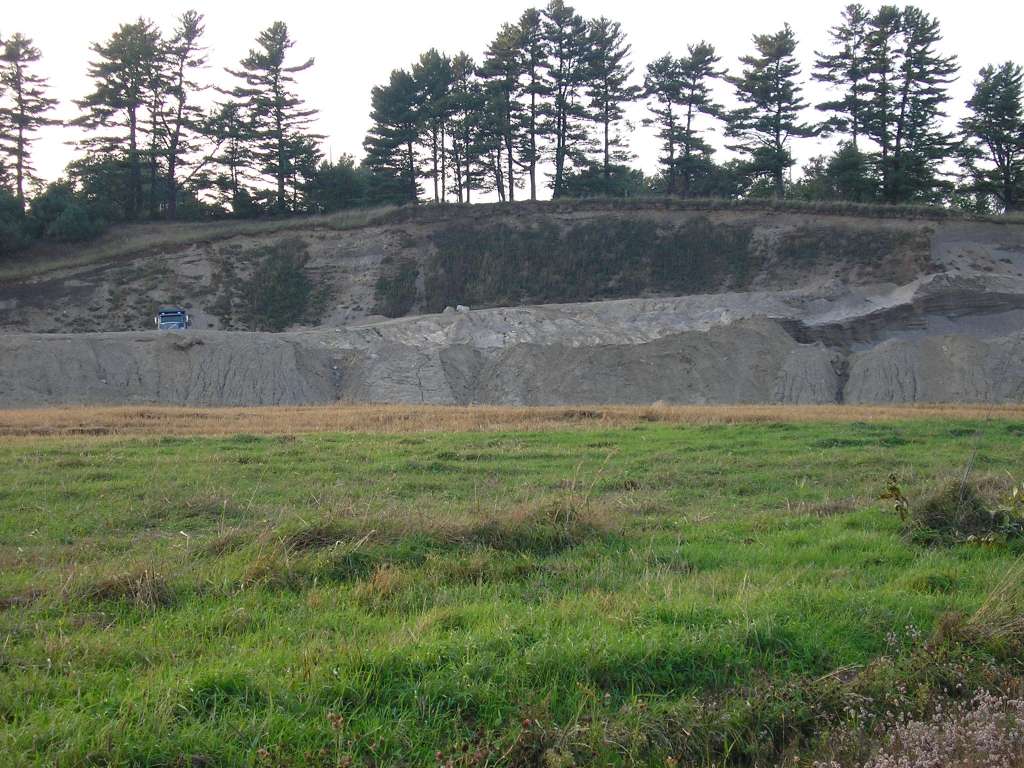
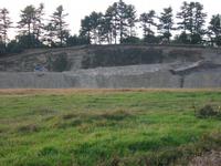
This photograph shows a sand and gravel pit along Weeks Road near the outlet of Dyer Long Pond. This site is located in the Dyer River sub-basin. Photograph was taken by Eli Asarian on 10/8/2004. |
| CaptionTemplate |
[description] This site is located in the [SubBasin] sub-basin. Photograph was taken by [photographer] on [photodate]. |
| Category |
Watershed Tour |
| Description |
This photograph shows a sand and gravel pit along Weeks Road near the outlet of Dyer Long Pond. |
| Filename |
sheep_2004-10-08_14-29-29.jpg |
| Filesize |
136922 |
| Path |
sheep_ifr_04\sheep_2004-10-08_14-29-29.jpg |
| Photodate |
10/8/2004 |
| Photographer |
Eli Asarian |
| Restriction |
None |
| Series |
Tour- Dyer Long Pond and Surrounding Areas 2004 |
| SubBasin |
Dyer River |
| UpdateDate |
10/20/2004 |
| UpdateName |
JEA |
| Agency |
Institute for Fisheries Resources |
| Basin |
Sheepscot |
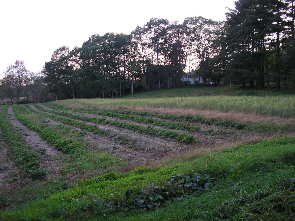
| Caption |
This photograph shows rows of strawberries being grown on a farm along an un-named road adjacent to Highway 215 (Clary Road). The location is within approximately one mile of the outlet of Dyer Long Pond. This site is located in the Dyer River sub-basin. Photograph was taken by Eli Asarian on 10/8/2004. |
| CaptionTemplate |
[description] This site is located in the [SubBasin] sub-basin. Photograph was taken by [photographer] on [photodate]. |
| Category |
Watershed Tour |
| Description |
This photograph shows rows of strawberries being grown on a farm along an un-named road adjacent to Highway 215 (Clary Road). The location is within approximately one mile of the outlet of Dyer Long Pond. |
| Filename |
sheep_2004-10-08_14-33-10.jpg |
| Filesize |
134270 |
| Path |
sheep_ifr_04\sheep_2004-10-08_14-33-10.jpg |
| Photodate |
10/8/2004 |
| Photographer |
Eli Asarian |
| Restriction |
None |
| Series |
Tour- Dyer Long Pond and Surrounding Areas 2004 |
| SubBasin |
Dyer River |
| UpdateDate |
10/20/2004 |
| UpdateName |
JEA |
| Agency |
Institute for Fisheries Resources |
| Basin |
Sheepscot |
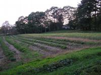
| Caption |
This photograph shows cornfields on a farm along an un-named road adjacent to Highway 215 (Clary Road). The location is within approximately one mile of the outlet of Dyer Long Pond. This site is located in the Dyer River sub-basin. Photograph was taken by Eli Asarian on 10/8/2004. |
| CaptionTemplate |
[description] This site is located in the [SubBasin] sub-basin. Photograph was taken by [photographer] on [photodate]. |
| Category |
Watershed Tour |
| Description |
This photograph shows cornfields on a farm along an un-named road adjacent to Highway 215 (Clary Road). The location is within approximately one mile of the outlet of Dyer Long Pond. |
| Filename |
sheep_2004-10-08_14-33-43.jpg |
| Filesize |
102262 |
| Path |
sheep_ifr_04\sheep_2004-10-08_14-33-43.jpg |
| Photodate |
10/8/2004 |
| Photographer |
Eli Asarian |
| Restriction |
None |
| Series |
Tour- Dyer Long Pond and Surrounding Areas 2004 |
| SubBasin |
Dyer River |
| UpdateDate |
10/20/2004 |
| UpdateName |
JEA |
| Agency |
Institute for Fisheries Resources |
| Basin |
Sheepscot |
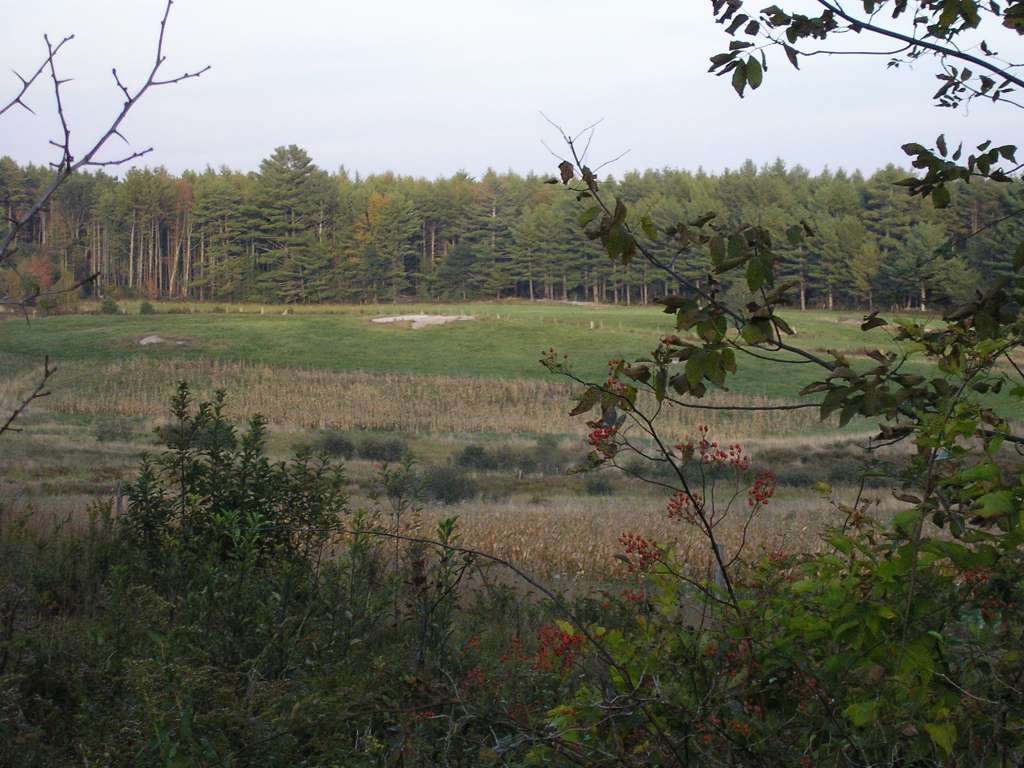
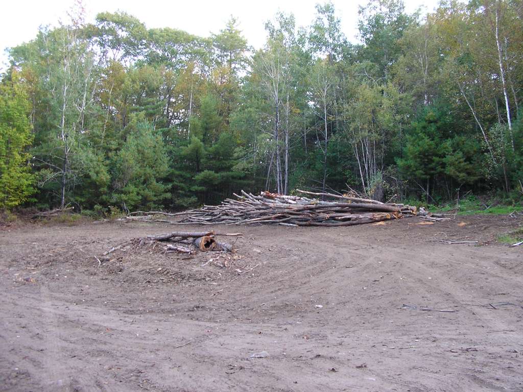
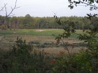
| Caption |
This photograph shows a forest clearing along Highway 215 (Clary Road) between Weeks Road and Egypt Road. This site is located in the Dyer River sub-basin. Photograph was taken by Eli Asarian on 10/8/2004. |
| CaptionTemplate |
[description] This site is located in the [SubBasin] sub-basin. Photograph was taken by [photographer] on [photodate]. |
| Category |
Watershed Tour |
| Description |
This photograph shows a forest clearing along Highway 215 (Clary Road) between Weeks Road and Egypt Road. |
| Filename |
sheep_2004-10-08_14-37-48.jpg |
| Filesize |
135776 |
| Path |
sheep_ifr_04\sheep_2004-10-08_14-37-48.jpg |
| Photodate |
10/8/2004 |
| Photographer |
Eli Asarian |
| Restriction |
None |
| Series |
Tour- Dyer Long Pond and Surrounding Areas 2004 |
| SubBasin |
Dyer River |
| UpdateDate |
10/20/2004 |
| UpdateName |
JEA |