|
Area/Topic | Bibliography | Background | Hypotheses | Home |
Photo Database: Meta Information Page
This page contains detailed information from the KRIS Photodatabase table about photos in series Tour- Dyer River Stream Photos 2004.
| Agency | Institute for Fisheries Resources |
| Basin | Sheepscot |
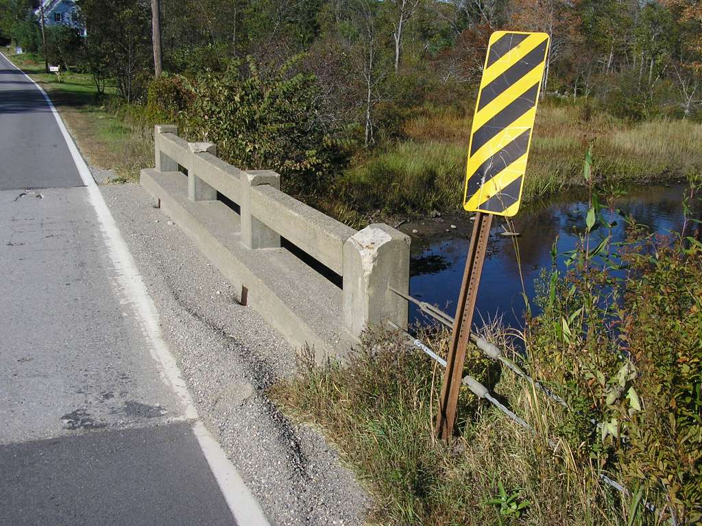
| Caption | This photograph shows the view looking south at where the Dyer River crosses under highway 194. This site is located in the Dyer River sub-basin. Photograph was taken by Eli Asarian on 10/8/2004. |
| CaptionTemplate | [description] This site is located in the [SubBasin] sub-basin. Photograph was taken by [photographer] on [photodate]. |
| Category | Watershed Tour |
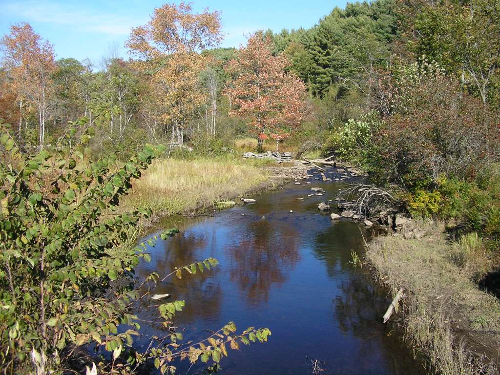
| Description | This photograph shows the view looking south at where the Dyer River crosses under highway 194. |
| Filename | sheep_2004-10-08_11-24-56.jpg |
| Filesize | 171463 |
| Path | sheep_ifr_04\sheep_2004-10-08_11-24-56.jpg |
| Photodate | 10/8/2004 |
| Photographer | Eli Asarian |
| Restriction | None |
| Series | Tour- Dyer River Stream Photos 2004 |
| SubBasin | Dyer River |
| UpdateDate | 10/20/2004 |
| UpdateName | JEA |
| Agency | Institute for Fisheries Resources |
| Basin | Sheepscot |
| Caption | This photograph shows the view looking north upstream from Highway 194 where it crosses over the Dyer River. This site is located in the Dyer River sub-basin. Photograph was taken by Eli Asarian on 10/8/2004. |
| CaptionTemplate | [description] This site is located in the [SubBasin] sub-basin. Photograph was taken by [photographer] on [photodate]. |
| Category | Watershed Tour |
| Description | This photograph shows the view looking north upstream from Highway 194 where it crosses over the Dyer River. |
| Filename | sheep_2004-10-08_11-25-13.jpg |
| Filesize | 178677 |
| Path | sheep_ifr_04\sheep_2004-10-08_11-25-13.jpg |
| Photodate | 10/8/2004 |
| Photographer | Eli Asarian |
| Restriction | None |
| Series | Tour- Dyer River Stream Photos 2004 |
| SubBasin | Dyer River |
| UpdateDate | 10/20/2004 |
| UpdateName | JEA |
| Agency | Institute for Fisheries Resources |
| Basin | Sheepscot |
| Caption | This photograph shows the view looking south downstream from Highway 194 where it crosses over the Dyer River. This site is located in the Dyer River sub-basin. Photograph was taken by Eli Asarian on 10/8/2004. |
| CaptionTemplate | [description] This site is located in the [SubBasin] sub-basin. Photograph was taken by [photographer] on [photodate]. |
| Category | Watershed Tour |
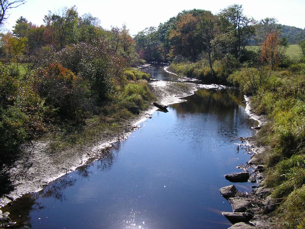
| Description | This photograph shows the view looking south downstream from Highway 194 where it crosses over the Dyer River. |
| Filename | sheep_2004-10-08_11-25-26.jpg |
| Filesize | 150171 |
| Path | sheep_ifr_04\sheep_2004-10-08_11-25-26.jpg |
| Photodate | 10/8/2004 |
| Photographer | Eli Asarian |
| Restriction | None |
| Series | Tour- Dyer River Stream Photos 2004 |
| SubBasin | Dyer River |
| UpdateDate | 10/20/2004 |
| UpdateName | JEA |
| Agency | Institute for Fisheries Resources |
| Basin | Sheepscot |
| Caption | This photograph shows the view looking north upstream from Highway 194 where it crosses over the Dyer River. It is a close-up of one of the previous pictures showing an old dam. This site is located in the Dyer River sub-basin. Photograph was taken by Eli Asarian on 10/8/2004. |
| CaptionTemplate | [description] This site is located in the [SubBasin] sub-basin. Photograph was taken by [photographer] on [photodate]. |
| Category | Watershed Tour |
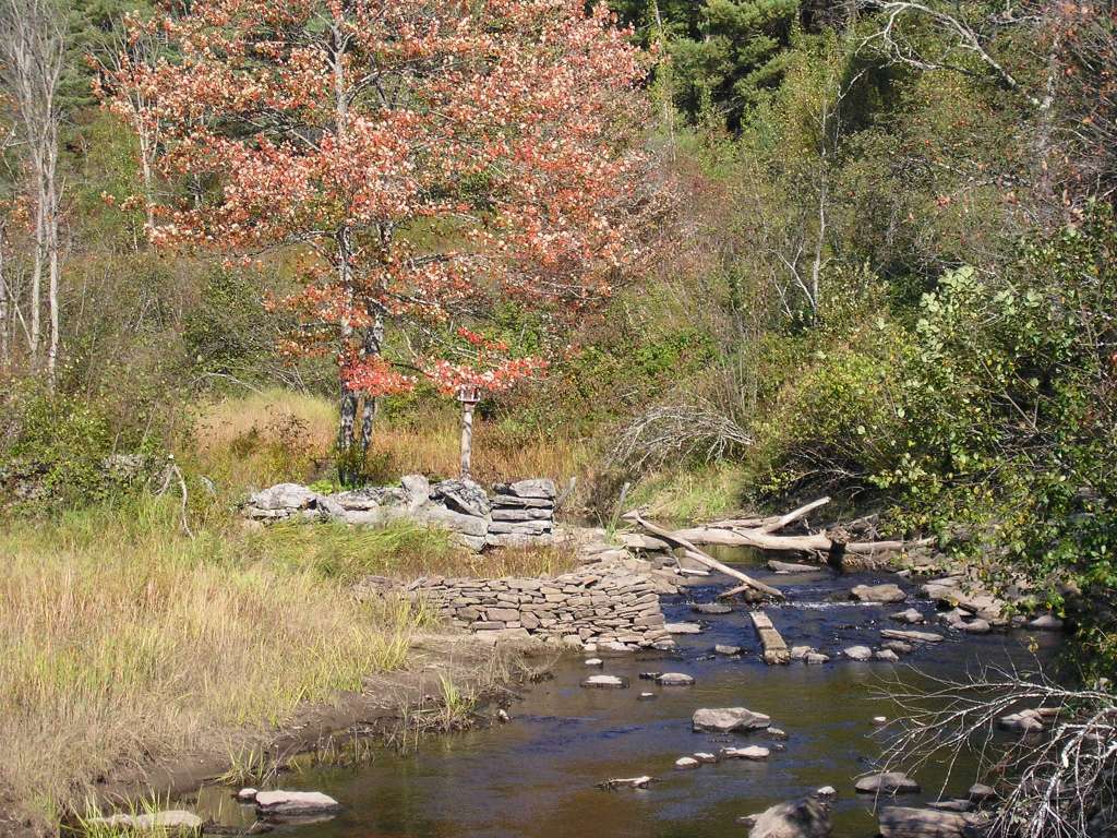
| Description | This photograph shows the view looking north upstream from Highway 194 where it crosses over the Dyer River. It is a close-up of one of the previous pictures showing an old dam. |
| Filename | sheep_2004-10-08_11-25-42.jpg |
| Filesize | 207271 |
| Path | sheep_ifr_04\sheep_2004-10-08_11-25-42.jpg |
| Photodate | 10/8/2004 |
| Photographer | Eli Asarian |
| Restriction | None |
| Series | Tour- Dyer River Stream Photos 2004 |
| SubBasin | Dyer River |
| UpdateDate | 10/20/2004 |
| UpdateName | JEA |
| Agency | Institute for Fisheries Resources |
| Basin | Sheepscot |
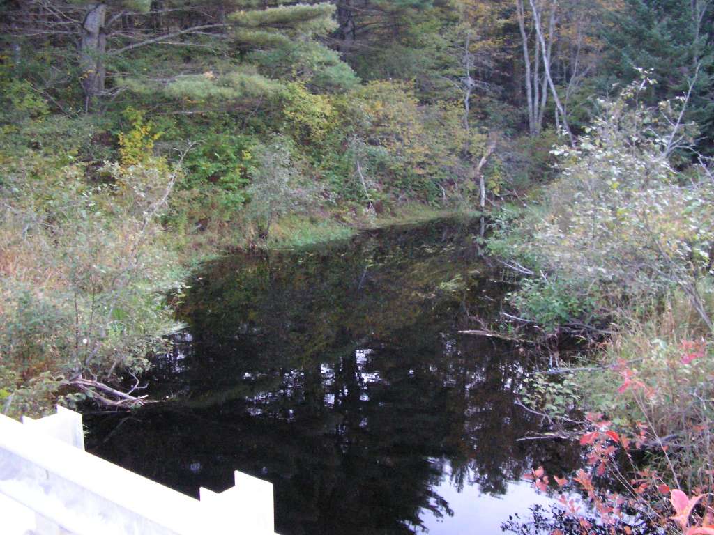
| Caption | This photograph shows the Dyer River looking upstream (northeast) from where it flows under Highway 215 (Clary Road). This site is located in the Dyer River sub-basin. Photograph was taken by Eli Asarian on 10/8/2004. |
| CaptionTemplate | [description] This site is located in the [SubBasin] sub-basin. Photograph was taken by [photographer] on [photodate]. |
| Category | Watershed Tour |
| Description | This photograph shows the Dyer River looking upstream (northeast) from where it flows under Highway 215 (Clary Road). |
| Filename | sheep_2004-10-08_14-46-51.jpg |
| Filesize | 121263 |
| Path | sheep_ifr_04\sheep_2004-10-08_14-46-51.jpg |
| Photodate | 10/8/2004 |
| Photographer | Eli Asarian |
| Restriction | None |
| Series | Tour- Dyer River Stream Photos 2004 |
| SubBasin | Dyer River |
| UpdateDate | 10/20/2004 |
| UpdateName | JEA |
| Agency | Institute for Fisheries Resources |
| Basin | Sheepscot |
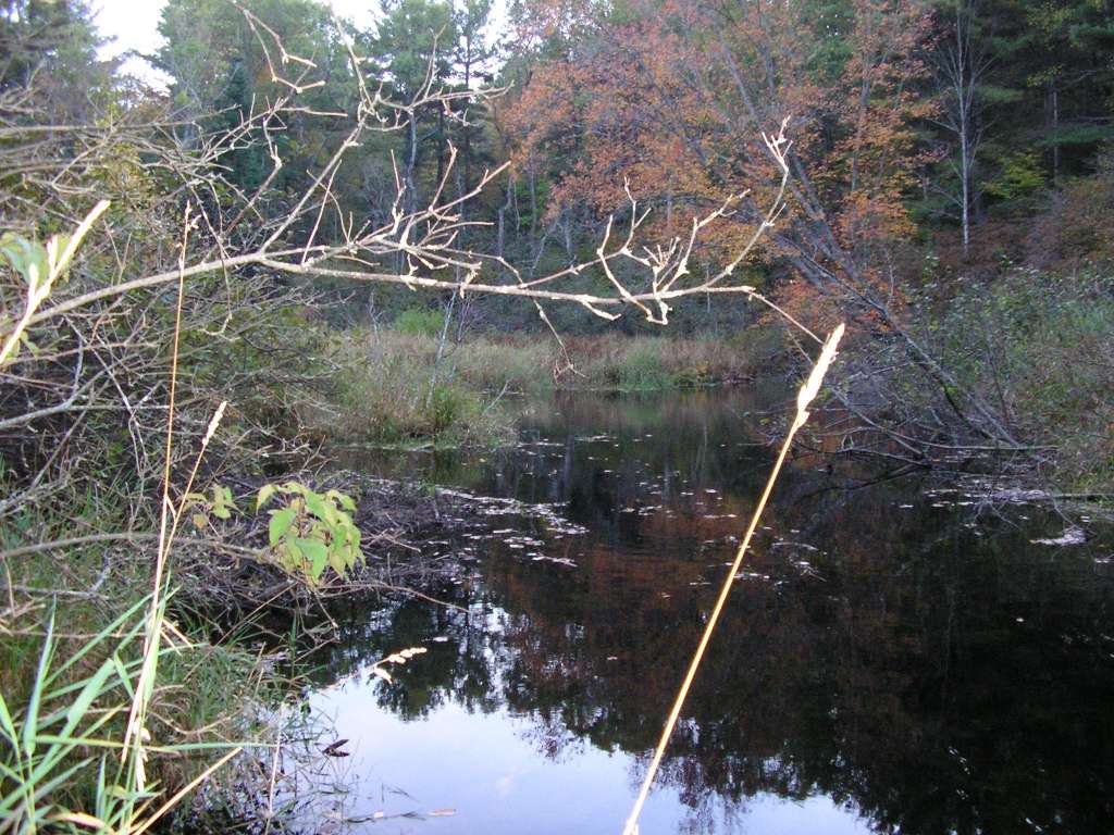
| Caption | This photograph shows the Dyer River looking downstream (southwest) from where it flows under Highway 215 (Clary Road). In this reach, the river is a slow-flowing "deadwater." This site is located in the Dyer River sub-basin. Photograph was taken by Eli Asarian on 10/8/2004. |
| CaptionTemplate | [description] This site is located in the [SubBasin] sub-basin. Photograph was taken by [photographer] on [photodate]. |
| Category | Watershed Tour |
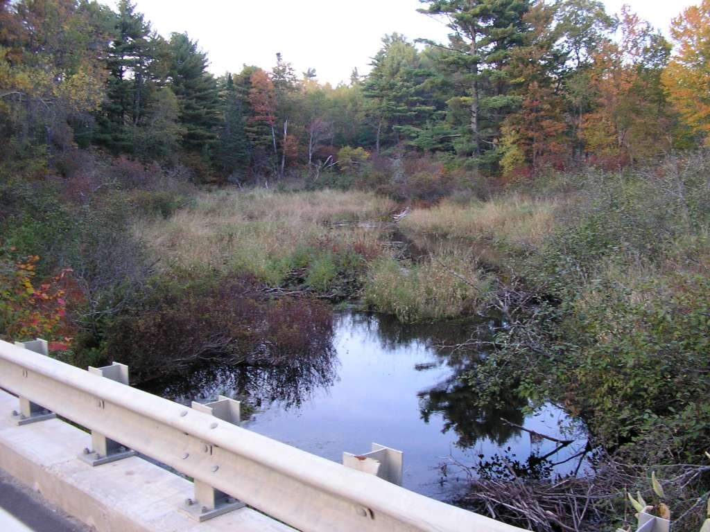
| Description | This photograph shows the Dyer River looking downstream (southwest) from where it flows under Highway 215 (Clary Road). In this reach, the river is a slow-flowing "deadwater." |
| Filename | sheep_2004-10-08_14-47-19.jpg |
| Filesize | 124916 |
| Path | sheep_ifr_04\sheep_2004-10-08_14-47-19.jpg |
| Photodate | 10/8/2004 |
| Photographer | Eli Asarian |
| Restriction | None |
| Series | Tour- Dyer River Stream Photos 2004 |
| SubBasin | Dyer River |
| UpdateDate | 10/20/2004 |
| UpdateName | JEA |
| Agency | Institute for Fisheries Resources |
| Basin | Sheepscot |
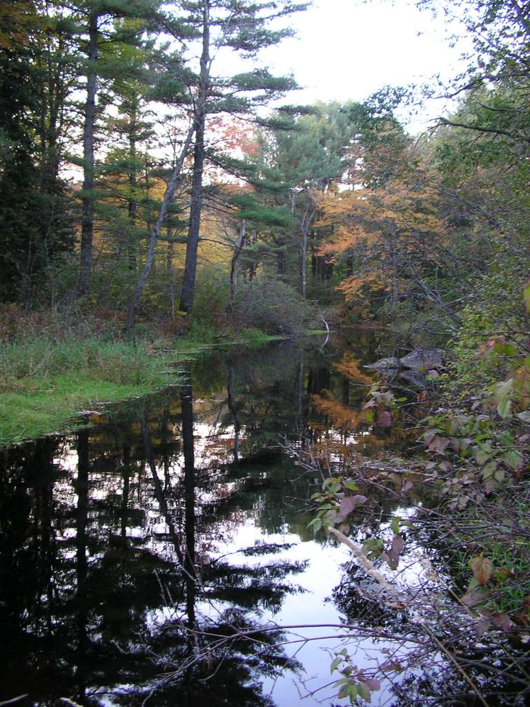
| Caption | This photograph shows the Dyer River, taken several hundred meters downstream from where it flows under Highway 215 (Clary Road), looking upstream. In this reach, the river is a slow-flowing "deadwater." This site is located in the Dyer River sub-basin. Photograph was taken by Eli Asarian on 10/8/2004. |
| CaptionTemplate | [description] This site is located in the [SubBasin] sub-basin. Photograph was taken by [photographer] on [photodate]. |
| Category | Watershed Tour |
| Description | This photograph shows the Dyer River, taken several hundred meters downstream from where it flows under Highway 215 (Clary Road), looking upstream. In this reach, the river is a slow-flowing "deadwater." |
| Filename | sheep_2004-10-08_14-48-56.jpg |
| Filesize | 143363 |
| Path | sheep_ifr_04\sheep_2004-10-08_14-48-56.jpg |
| Photodate | 10/8/2004 |
| Photographer | Eli Asarian |
| Restriction | None |
| Series | Tour- Dyer River Stream Photos 2004 |
| SubBasin | Dyer River |
| UpdateDate | 10/20/2004 |
| UpdateName | JEA |
| Agency | Institute for Fisheries Resources |
| Basin | Sheepscot |
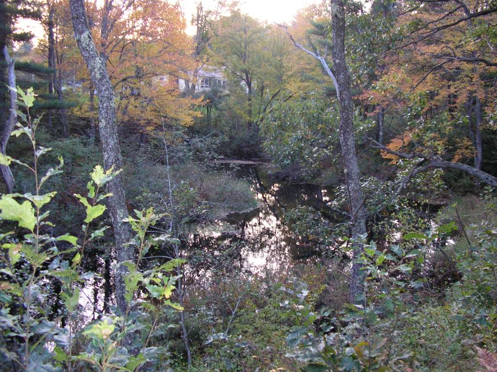
| Caption | This photograph shows the Dyer River, taken several hundred meters downstream from where it flows under Highway 215 (Clary Road), looking downstream. In this reach, the river is a slow-flowing "deadwater." This site is located in the Dyer River sub-basin. Photograph was taken by Eli Asarian on 10/8/2004. |
| CaptionTemplate | [description] This site is located in the [SubBasin] sub-basin. Photograph was taken by [photographer] on [photodate]. |
| Category | Watershed Tour |
| Description | This photograph shows the Dyer River, taken several hundred meters downstream from where it flows under Highway 215 (Clary Road), looking downstream. In this reach, the river is a slow-flowing "deadwater." |
| Filename | sheep_2004-10-08_14-49-22.jpg |
| Filesize | 154782 |
| Path | sheep_ifr_04\sheep_2004-10-08_14-49-22.jpg |
| Photodate | 10/8/2004 |
| Photographer | Eli Asarian |
| Restriction | None |
| Series | Tour- Dyer River Stream Photos 2004 |
| SubBasin | Dyer River |
| UpdateDate | 10/20/2004 |
| UpdateName | JEA |
| Agency | Institute for Fisheries Resources |
| Basin | Sheepscot |
| Caption | This photograph shows the Dyer River, taken several hundred meters downstream from where it flows under Highway 215 (Clary Road), looking downstream. In this reach, the river is a slow-flowing "deadwater." This site is located in the Dyer River sub-basin. Photograph was taken by Eli Asarian on 10/8/2004. |
| CaptionTemplate | [description] This site is located in the [SubBasin] sub-basin. Photograph was taken by [photographer] on [photodate]. |
| Category | Watershed Tour |
| Description | This photograph shows the Dyer River, taken several hundred meters downstream from where it flows under Highway 215 (Clary Road), looking downstream. In this reach, the river is a slow-flowing "deadwater." |
| Filename | sheep_2004-10-08_14-50-20.jpg |
| Filesize | 166943 |
| Path | sheep_ifr_04\sheep_2004-10-08_14-50-20.jpg |
| Photodate | 10/8/2004 |
| Photographer | Eli Asarian |
| Restriction | None |
| Series | Tour- Dyer River Stream Photos 2004 |
| SubBasin | Dyer River |
| UpdateDate | 10/20/2004 |
| UpdateName | JEA |
| www.krisweb.com |