| Agency |
Institute for Fisheries Resources |
| Basin |
Sheepscot |
| Caption |
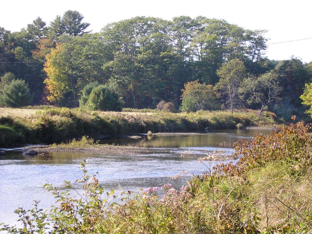
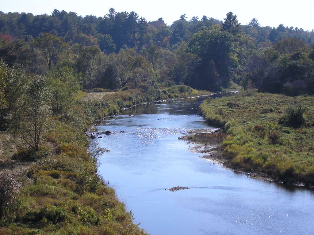
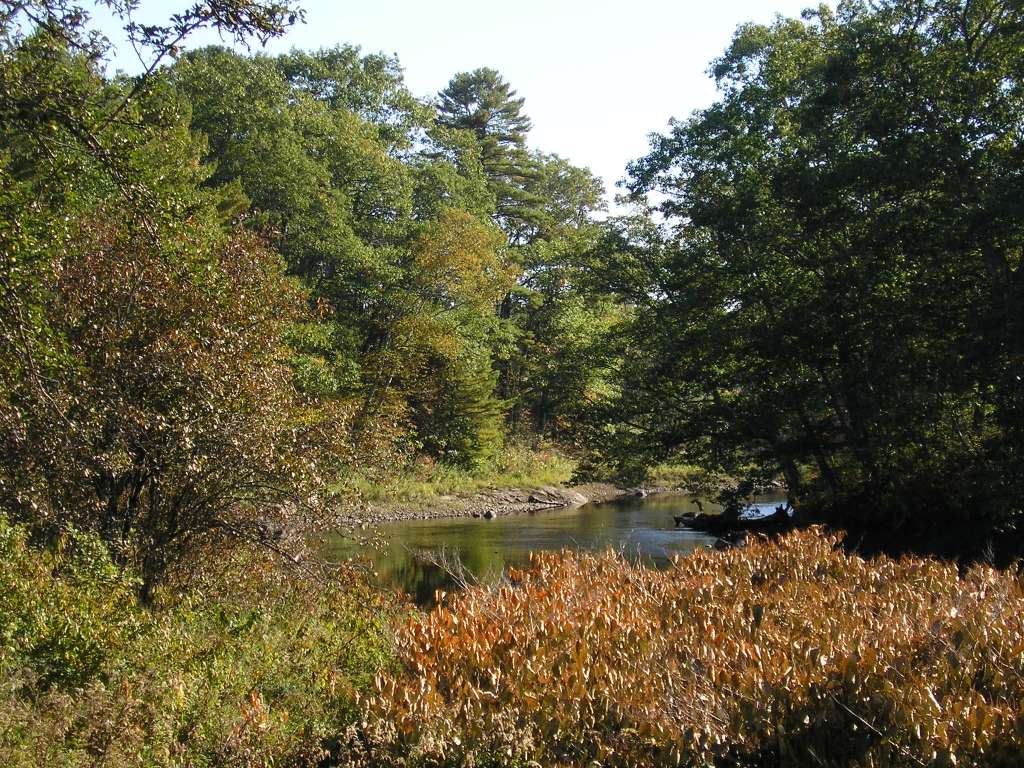
This photograph shows the Sheepscot River, looking upstream. The corner pool shown in this photograph contains several trees, large woody debris that increase habitat complexity but are uncommon in the Sheepscot River. The area depicted is in the tidally-influenced reach downstream of Head Tide Dam and upstream of Ben Brook. The picture is taken from Highway 194. This site is located in the Below Head Tide sub-basin. Photograph was taken by Eli Asarian on 10/8/2004. |
| CaptionTemplate |
[description] This site is located in the [SubBasin] sub-basin. Photograph was taken by [photographer] on [photodate]. |
| Category |
Watershed Tour |
| Description |
This photograph shows the Sheepscot River, looking upstream. The corner pool shown in this photograph contains several trees, large woody debris that increase habitat complexity but are uncommon in the Sheepscot River. The area depicted is in the tidally-influenced reach downstream of Head Tide Dam and upstream of Ben Brook. The picture is taken from Highway 194. |
| Filename |
sheep_2004-10-08_11-42-54.jpg |
| Filesize |
80728 |
| Path |
sheep_ifr_04\sheep_2004-10-08_11-42-54.jpg |
| Photodate |
10/8/2004 |
| Photographer |
Eli Asarian |
| Restriction |
None |
| Series |
Tour- Sheepscot R. below Carlton Rd 2004 |
| SubBasin |
Below Head Tide |
| UpdateDate |
10/20/2004 |
| UpdateName |
JEA |

| Agency |
Institute for Fisheries Resources |
| Basin |
Sheepscot |
| Caption |
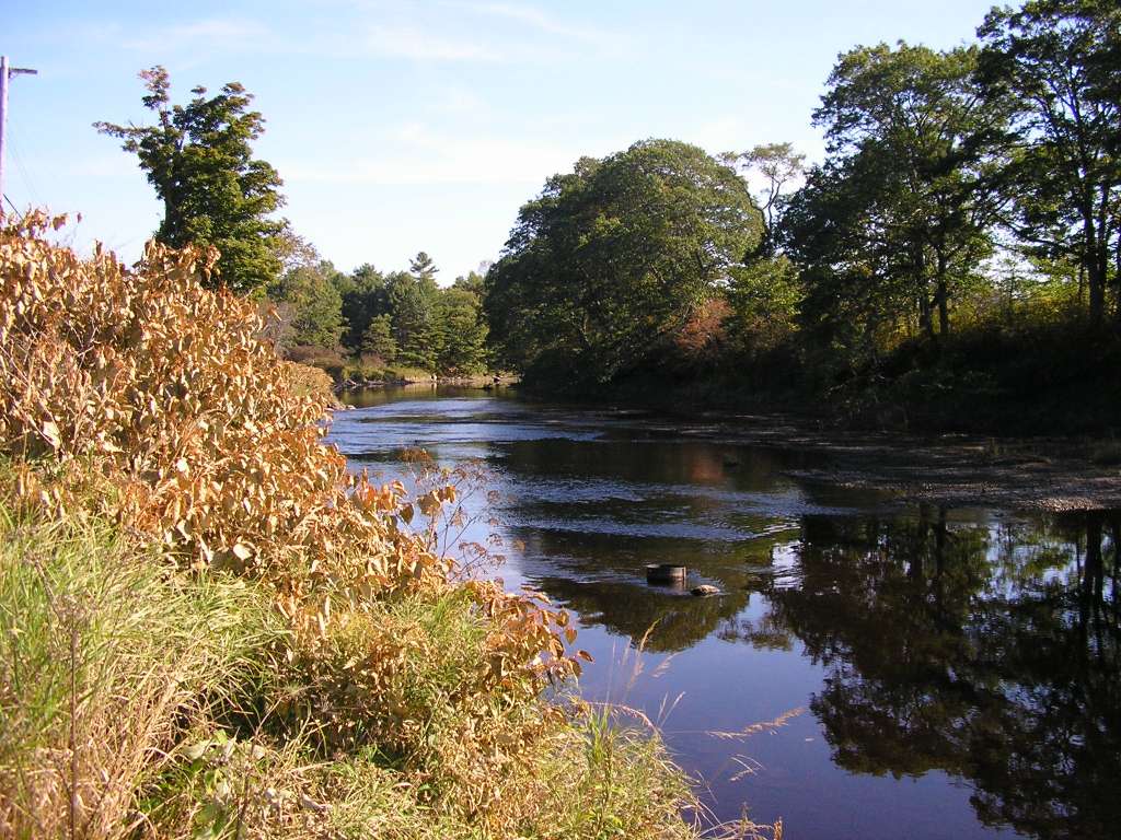
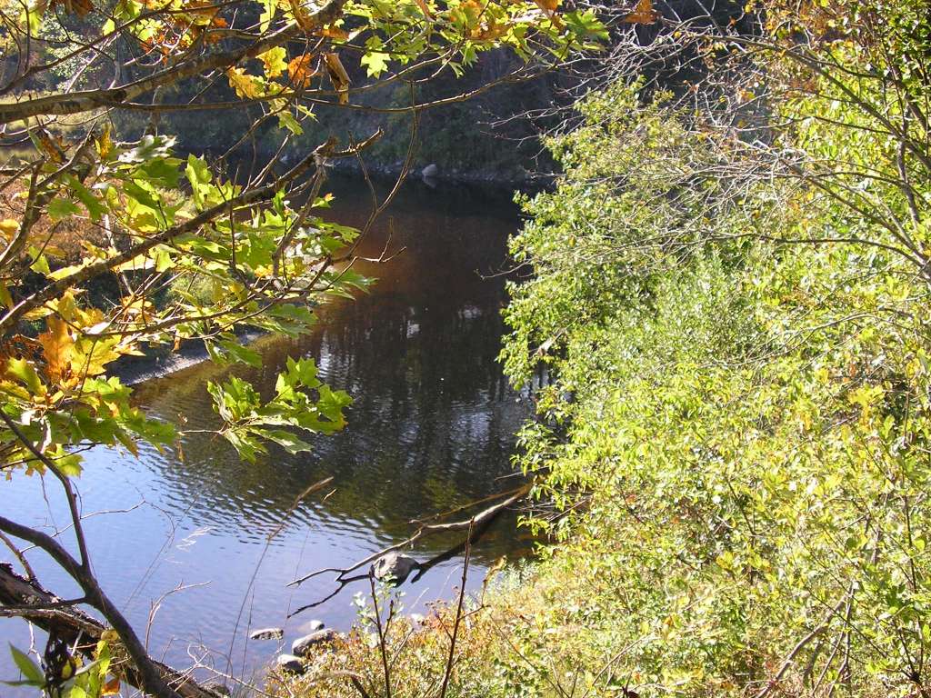
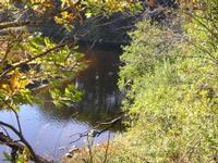
This photograph shows the Sheepscot River, looking upstream. The area depicted is in the tidally-influenced reach downstream of Head Tide Dam and upstream of Ben Brook. The picture is taken from Highway 194. This site is located in the Below Head Tide sub-basin. Photograph was taken by Eli Asarian on 10/8/2004. |
| CaptionTemplate |
[description] This site is located in the [SubBasin] sub-basin. Photograph was taken by [photographer] on [photodate]. |
| Category |
Watershed Tour |
| Description |
This photograph shows the Sheepscot River, looking upstream. The area depicted is in the tidally-influenced reach downstream of Head Tide Dam and upstream of Ben Brook. The picture is taken from Highway 194. |
| Filename |
sheep_2004-10-08_11-43-16.jpg |
| Filesize |
113696 |
| Path |
sheep_ifr_04\sheep_2004-10-08_11-43-16.jpg |
| Photodate |
10/8/2004 |
| Photographer |
Eli Asarian |
| Restriction |
None |
| Series |
Tour- Sheepscot R. below Carlton Rd 2004 |
| SubBasin |
Below Head Tide |
| UpdateDate |
10/20/2004 |
| UpdateName |
JEA |
| Agency |
Institute for Fisheries Resources |
| Basin |
Sheepscot |
| Caption |
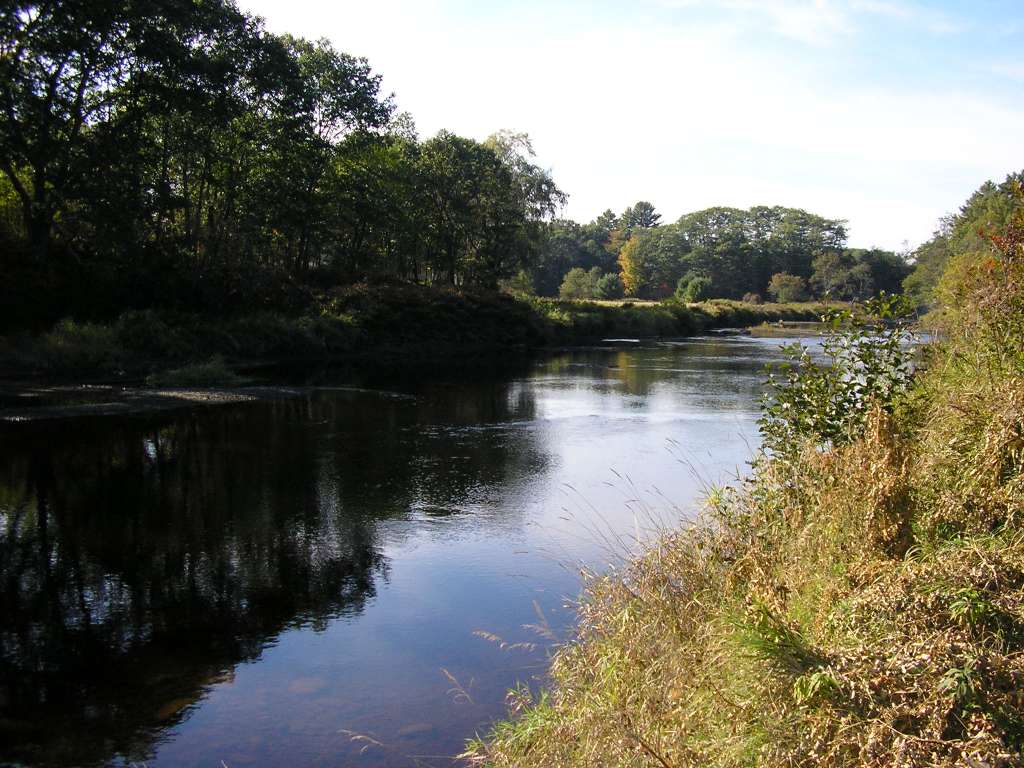
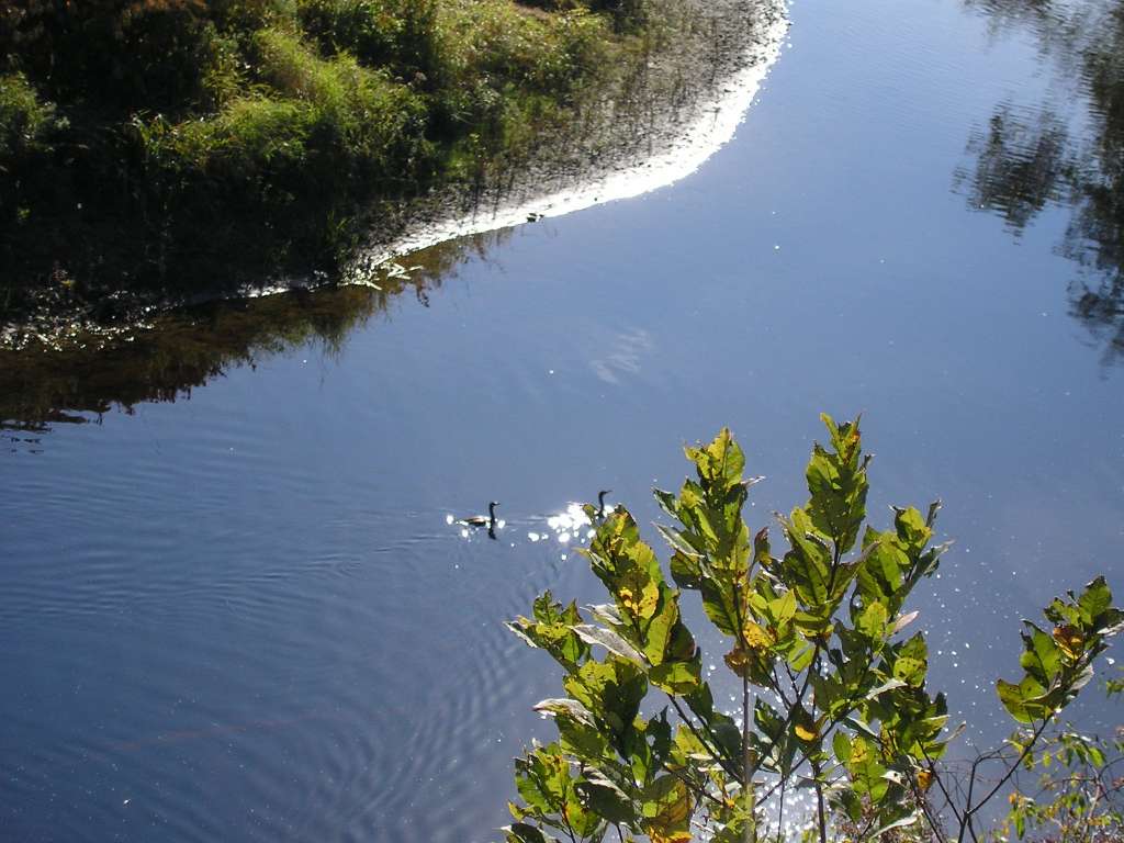
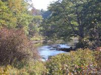
This photograph shows the Sheepscot River, looking upstream. The corner pool shown in this photograph contains several trees, large woody debris that increase habitat complexity but are uncommon in the Sheepscot River. The area depicted is in the tidally-influenced reach downstream of Head Tide Dam and upstream of Ben Brook. The picture is taken from Highway 194. This site is located in the Below Head Tide sub-basin. Photograph was taken by Eli Asarian on 10/8/2004. |
| CaptionTemplate |
[description] This site is located in the [SubBasin] sub-basin. Photograph was taken by [photographer] on [photodate]. |
| Category |
Watershed Tour |
| Description |
This photograph shows the Sheepscot River, looking upstream. The corner pool shown in this photograph contains several trees, large woody debris that increase habitat complexity but are uncommon in the Sheepscot River. The area depicted is in the tidally-influenced reach downstream of Head Tide Dam and upstream of Ben Brook. The picture is taken from Highway 194. |
| Filename |
sheep_2004-10-08_11-44-38.jpg |
| Filesize |
212811 |
| Path |
sheep_ifr_04\sheep_2004-10-08_11-44-38.jpg |
| Photodate |
10/8/2004 |
| Photographer |
Eli Asarian |
| Restriction |
None |
| Series |
Tour- Sheepscot R. below Carlton Rd 2004 |
| SubBasin |
Below Head Tide |
| UpdateDate |
10/20/2004 |
| UpdateName |
JEA |

| Agency |
Institute for Fisheries Resources |
| Basin |
Sheepscot |
| Caption |
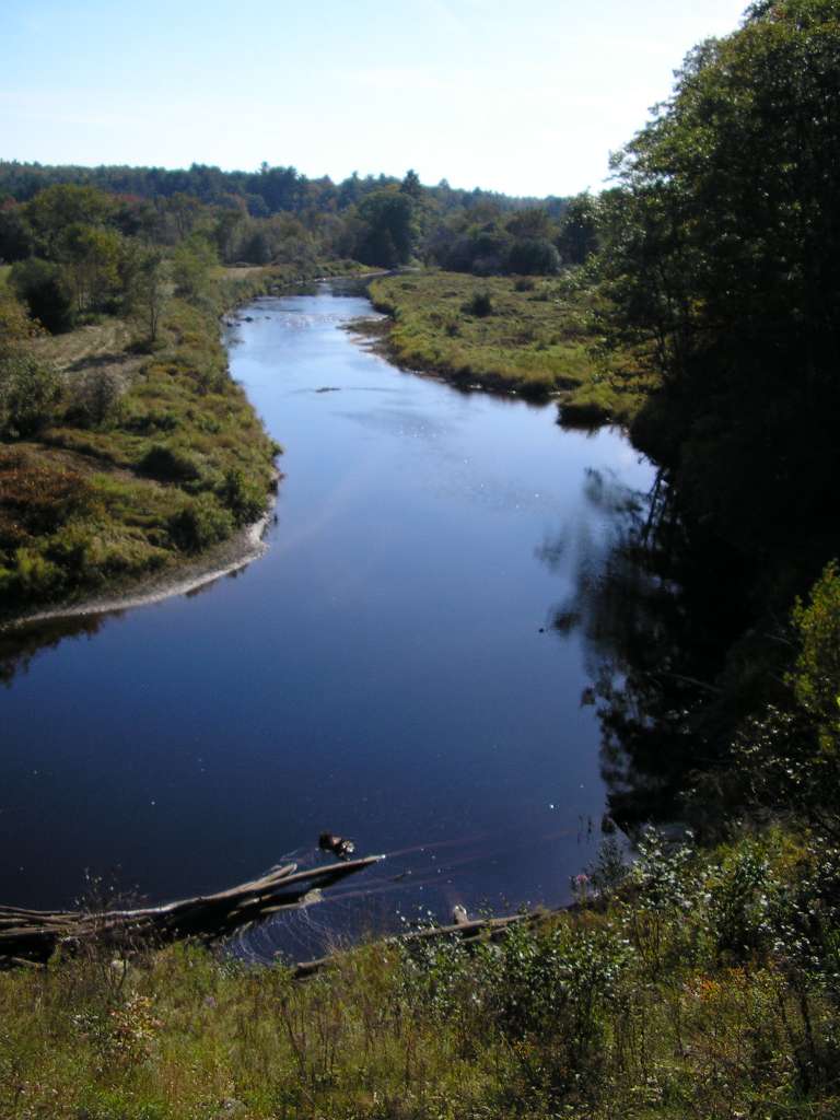
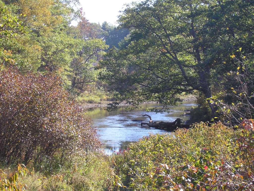
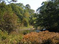
This photograph shows the Sheepscot River, looking upstream. The corner pool shown in this photograph contains several trees, large woody debris that increase habitat complexity but are uncommon in the Sheepscot River. The area depicted is in the tidally-influenced reach downstream of Head Tide Dam and upstream of Ben Brook. The picture is taken from Highway 194. This site is located in the Below Head Tide sub-basin. Photograph was taken by Eli Asarian on 10/8/2004. |
| CaptionTemplate |
[description] This site is located in the [SubBasin] sub-basin. Photograph was taken by [photographer] on [photodate]. |
| Category |
Watershed Tour |
| Description |
This photograph shows the Sheepscot River, looking upstream. The corner pool shown in this photograph contains several trees, large woody debris that increase habitat complexity but are uncommon in the Sheepscot River. The area depicted is in the tidally-influenced reach downstream of Head Tide Dam and upstream of Ben Brook. The picture is taken from Highway 194. |
| Filename |
sheep_2004-10-08_11-45-24.jpg |
| Filesize |
88708 |
| Path |
sheep_ifr_04\sheep_2004-10-08_11-45-24.jpg |
| Photodate |
10/8/2004 |
| Photographer |
Eli Asarian |
| Restriction |
None |
| Series |
Tour- Sheepscot R. below Carlton Rd 2004 |
| SubBasin |
Below Head Tide |
| UpdateDate |
10/20/2004 |
| UpdateName |
JEA |
| Agency |
Institute for Fisheries Resources |
| Basin |
Sheepscot |
| Caption |
This photograph shows the Sheepscot River, looking upstream. The area depicted is in the tidally-influenced reach downstream of Head Tide Dam and upstream of Ben Brook. The picture is taken from Highway 194. This site is located in the Below Head Tide sub-basin. Photograph was taken by Eli Asarian on 10/8/2004. |
| CaptionTemplate |
[description] This site is located in the [SubBasin] sub-basin. Photograph was taken by [photographer] on [photodate]. |
| Category |
Watershed Tour |
| Description |
This photograph shows the Sheepscot River, looking upstream. The area depicted is in the tidally-influenced reach downstream of Head Tide Dam and upstream of Ben Brook. The picture is taken from Highway 194. |
| Filename |
sheep_2004-10-08_11-49-36.jpg |
| Filesize |
222035 |
| Path |
sheep_ifr_04\sheep_2004-10-08_11-49-36.jpg |
| Photodate |
10/8/2004 |
| Photographer |
Eli Asarian |
| Restriction |
None |
| Series |
Tour- Sheepscot R. below Carlton Rd 2004 |
| SubBasin |
Below Head Tide |
| UpdateDate |
10/20/2004 |
| UpdateName |
JEA |
| Agency |
Institute for Fisheries Resources |
| Basin |
Sheepscot |
| Caption |
This photograph shows the Sheepscot River, looking upstream. The area depicted is in the tidally-influenced reach downstream of Head Tide Dam and upstream of Ben Brook. The picture is taken from Highway 194. This site is located in the Below Head Tide sub-basin. Photograph was taken by Eli Asarian on 10/8/2004. |
| CaptionTemplate |
[description] This site is located in the [SubBasin] sub-basin. Photograph was taken by [photographer] on [photodate]. |
| Category |
Watershed Tour |
| Description |
This photograph shows the Sheepscot River, looking upstream. The area depicted is in the tidally-influenced reach downstream of Head Tide Dam and upstream of Ben Brook. The picture is taken from Highway 194. |
| Filename |
sheep_2004-10-08_11-50-16.jpg |
| Filesize |
206317 |
| Path |
sheep_ifr_04\sheep_2004-10-08_11-50-16.jpg |
| Photodate |
10/8/2004 |
| Photographer |
Eli Asarian |
| Restriction |
None |
| Series |
Tour- Sheepscot R. below Carlton Rd 2004 |
| SubBasin |
Below Head Tide |
| UpdateDate |
10/20/2004 |
| UpdateName |
JEA |