|
Area/Topic | Bibliography | Background | Hypotheses | Home |
Photo Database: Meta Information Page
This page contains detailed information from the KRIS Photodatabase table about photos in series Tour- Sheepscot River Below Head Tide Dam 2004.
| Agency | Institute for Fisheries Resources |
| Basin | Sheepscot |
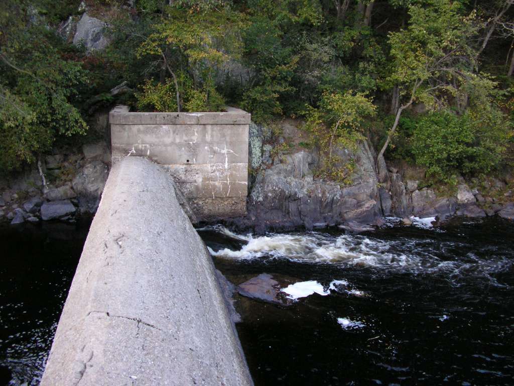
| Caption | This photograph shows Head Tide dam, as viewed from the viewing platform next to the dam. This site is located in the Below Head Tide sub-basin. Photograph was taken by Eli Asarian on 10/6/2004. |
| CaptionTemplate | [description] This site is located in the [SubBasin] sub-basin. Photograph was taken by [photographer] on [photodate]. |
| Category | Watershed Tour |
| Description | This photograph shows Head Tide dam, as viewed from the viewing platform next to the dam. |
| Filename | sheep_2004-10-06_14-56-11.jpg |
| Filesize | 117454 |
| Path | sheep_ifr_04\sheep_2004-10-06_14-56-11.jpg |
| Photodate | 10/6/2004 |
| Photographer | Eli Asarian |
| Restriction | None |
| Series | Tour- Sheepscot River Below Head Tide Dam 2004 |
| SubBasin | Below Head Tide |
| UpdateDate | 10/20/2004 |
| UpdateName | JEA |
| Agency | Institute for Fisheries Resources |
| Basin | Sheepscot |
| Caption | This photograph shows the view looking downstream from the viewing platform at Head Tide dam. This site is located in the Below Head Tide sub-basin. Photograph was taken by Eli Asarian on 10/6/2004. |
| CaptionTemplate | [description] This site is located in the [SubBasin] sub-basin. Photograph was taken by [photographer] on [photodate]. |
| Category | Watershed Tour |
| Description | This photograph shows the view looking downstream from the viewing platform at Head Tide dam. |
| Filename | sheep_2004-10-06_14-57-15.jpg |
| Filesize | 106181 |
| Path | sheep_ifr_04\sheep_2004-10-06_14-57-15.jpg |
| Photodate | 10/6/2004 |
| Photographer | Eli Asarian |
| Restriction | None |
| Series | Tour- Sheepscot River Below Head Tide Dam 2004 |
| SubBasin | Below Head Tide |
| UpdateDate | 10/20/2004 |
| UpdateName | JEA |
| Agency | Institute for Fisheries Resources |
| Basin | Sheepscot |
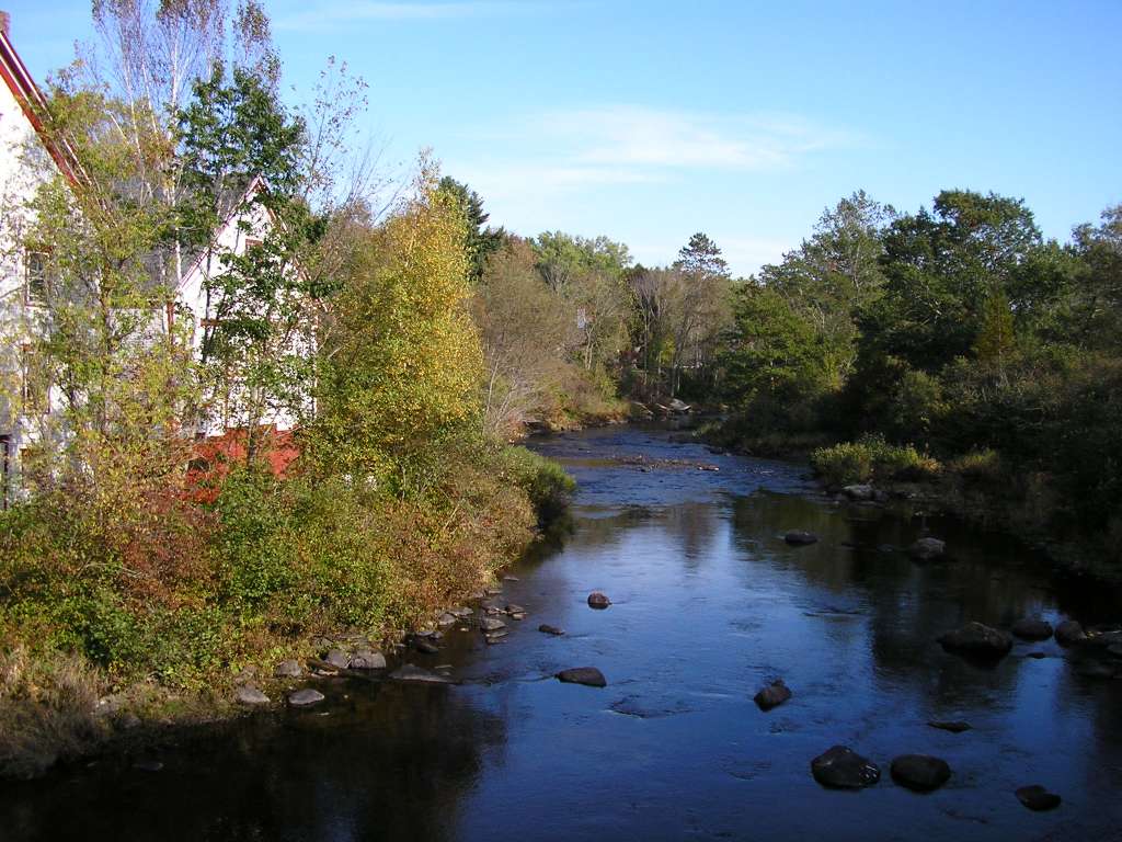
| Caption | This photograph shows the Sheepscot River, looking upstream with the bridge below Head Tide Dam visible in the distance. The picture was taken from the along Highway 194. This site is located in the Below Head Tide sub-basin. Photograph was taken by Eli Asarian on 10/8/2004. |
| CaptionTemplate | [description] This site is located in the [SubBasin] sub-basin. Photograph was taken by [photographer] on [photodate]. |
| Category | Watershed Tour |
| Description | This photograph shows the Sheepscot River, looking upstream with the bridge below Head Tide Dam visible in the distance. The picture was taken from the along Highway 194. |
| Filename | sheep_2004-10-08_12-22-38.jpg |
| Filesize | 202789 |
| Path | sheep_ifr_04\sheep_2004-10-08_12-22-38.jpg |
| Photodate | 10/8/2004 |
| Photographer | Eli Asarian |
| Restriction | None |
| Series | Tour- Sheepscot River Below Head Tide Dam 2004 |
| SubBasin | Below Head Tide |
| UpdateDate | 10/20/2004 |
| UpdateName | JEA |
| Agency | Institute for Fisheries Resources |
| Basin | Sheepscot |
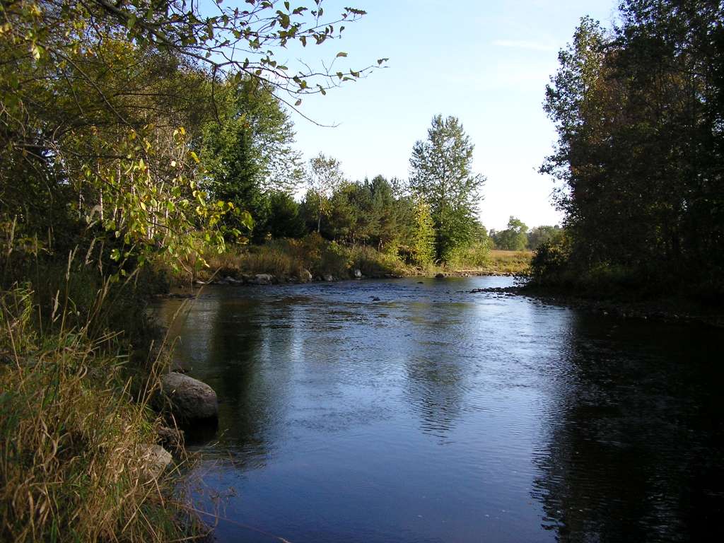
| Caption | This photograph shows the Sheepscot River, looking upstream with the bridge below Head Tide Dam visible. This site is located in the Below Head Tide sub-basin. Photograph was taken by Eli Asarian on 10/8/2004. |
| CaptionTemplate | [description] This site is located in the [SubBasin] sub-basin. Photograph was taken by [photographer] on [photodate]. |
| Category | Watershed Tour |
| Description | This photograph shows the Sheepscot River, looking upstream with the bridge below Head Tide Dam visible. |
| Filename | sheep_2004-10-08_12-22-48.jpg |
| Filesize | 167844 |
| Path | sheep_ifr_04\sheep_2004-10-08_12-22-48.jpg |
| Photodate | 10/8/2004 |
| Photographer | Eli Asarian |
| Restriction | None |
| Series | Tour- Sheepscot River Below Head Tide Dam 2004 |
| SubBasin | Below Head Tide |
| UpdateDate | 10/20/2004 |
| UpdateName | JEA |
| Agency | Institute for Fisheries Resources |
| Basin | Sheepscot |
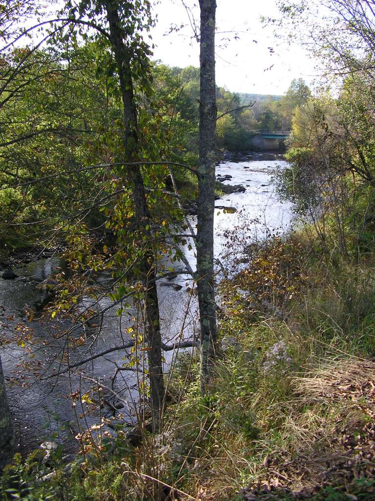
| Caption | This photograph shows the Sheepscot River, looking downstream from a few hundred meters downstream from the bridge below Head Tide Dam. The picture was taken from near Highway 194. This site is located in the Below Head Tide sub-basin. Photograph was taken by Eli Asarian on 10/8/2004. |
| CaptionTemplate | [description] This site is located in the [SubBasin] sub-basin. Photograph was taken by [photographer] on [photodate]. |
| Category | Watershed Tour |
| Description | This photograph shows the Sheepscot River, looking downstream from a few hundred meters downstream from the bridge below Head Tide Dam. The picture was taken from near Highway 194. |
| Filename | sheep_2004-10-08_12-23-55.jpg |
| Filesize | 131515 |
| Path | sheep_ifr_04\sheep_2004-10-08_12-23-55.jpg |
| Photodate | 10/8/2004 |
| Photographer | Eli Asarian |
| Restriction | None |
| Series | Tour- Sheepscot River Below Head Tide Dam 2004 |
| SubBasin | Below Head Tide |
| UpdateDate | 10/20/2004 |
| UpdateName | JEA |
| Agency | Institute for Fisheries Resources |
| Basin | Sheepscot |
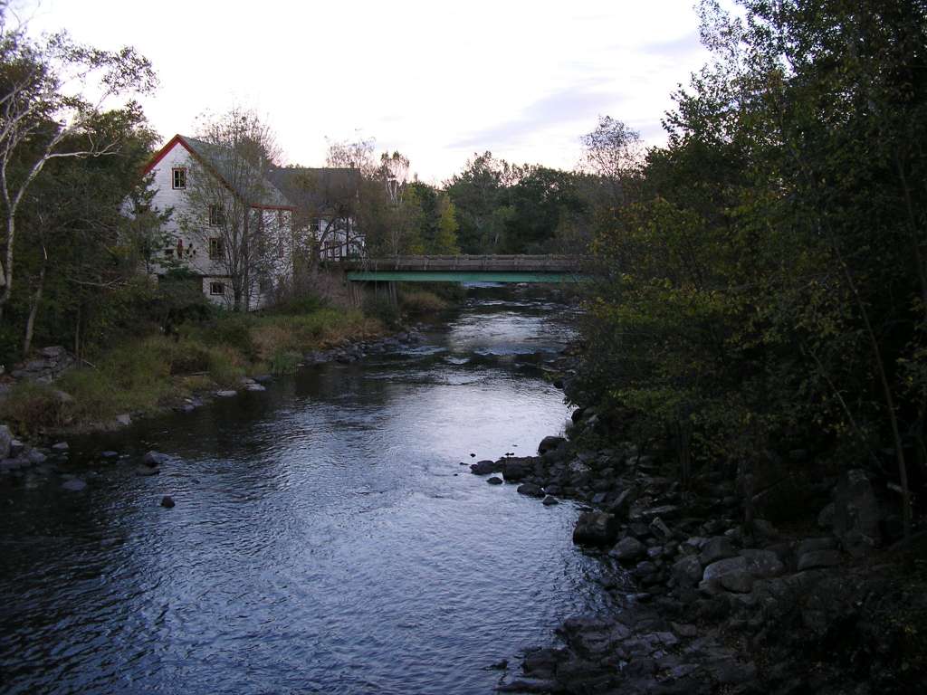
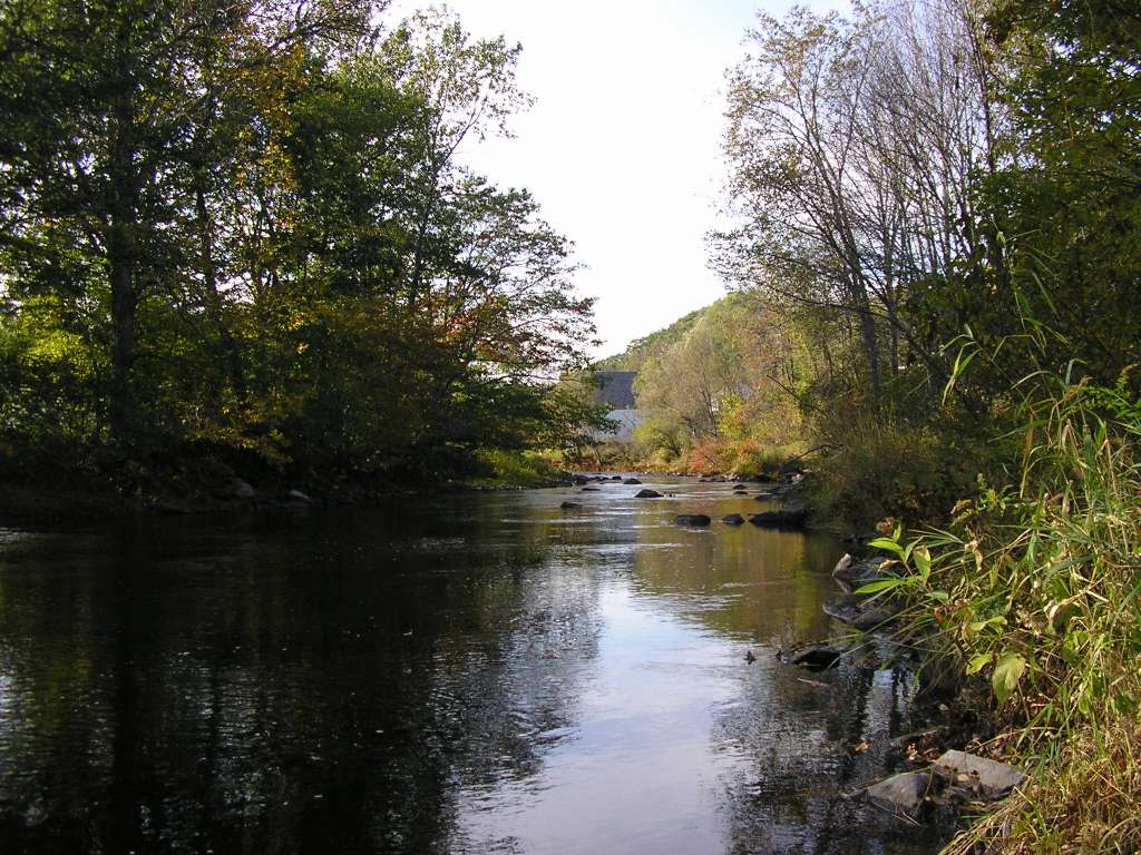
| Caption | This photograph shows the Sheepscot River, looking upstream toward some buildings below the Head Tide Dam. This site is located in the Below Head Tide sub-basin. Photograph was taken by Eli Asarian on 10/8/2004. |
| CaptionTemplate | [description] This site is located in the [SubBasin] sub-basin. Photograph was taken by [photographer] on [photodate]. |
| Category | Watershed Tour |
| Description | This photograph shows the Sheepscot River, looking upstream toward some buildings below the Head Tide Dam. |
| Filename | sheep_2004-10-08_12-24-20.jpg |
| Filesize | 158661 |
| Path | sheep_ifr_04\sheep_2004-10-08_12-24-20.jpg |
| Photodate | 10/8/2004 |
| Photographer | Eli Asarian |
| Restriction | None |
| Series | Tour- Sheepscot River Below Head Tide Dam 2004 |
| SubBasin | Below Head Tide |
| UpdateDate | 10/20/2004 |
| UpdateName | JEA |
| Agency | Institute for Fisheries Resources |
| Basin | Sheepscot |
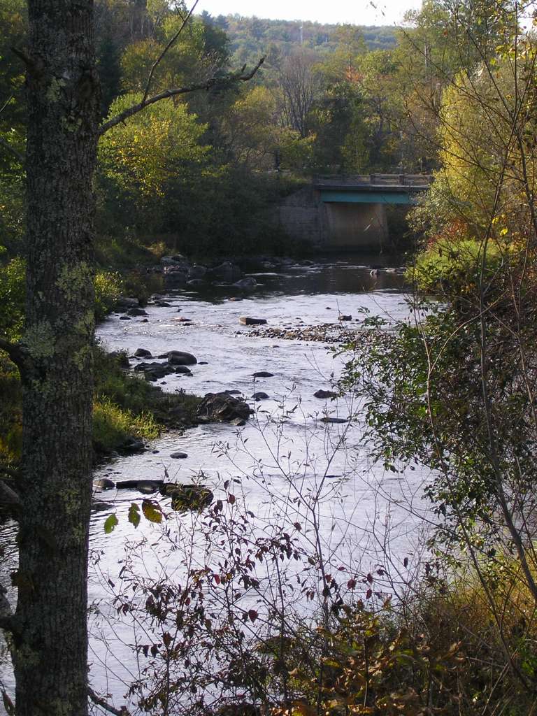
| Caption | This photograph shows the Sheepscot River, looking downstream from the bridge below Head Tide Dam. This site is located in the Below Head Tide sub-basin. Photograph was taken by Eli Asarian on 10/8/2004. |
| CaptionTemplate | [description] This site is located in the [SubBasin] sub-basin. Photograph was taken by [photographer] on [photodate]. |
| Category | Watershed Tour |
| Description | This photograph shows the Sheepscot River, looking downstream from the bridge below Head Tide Dam. |
| Filename | sheep_2004-10-08_12-27-32.jpg |
| Filesize | 124555 |
| Path | sheep_ifr_04\sheep_2004-10-08_12-27-32.jpg |
| Photodate | 10/8/2004 |
| Photographer | Eli Asarian |
| Restriction | None |
| Series | Tour- Sheepscot River Below Head Tide Dam 2004 |
| SubBasin | Below Head Tide |
| UpdateDate | 10/20/2004 |
| UpdateName | JEA |
| Agency | Institute for Fisheries Resources |
| Basin | Sheepscot |
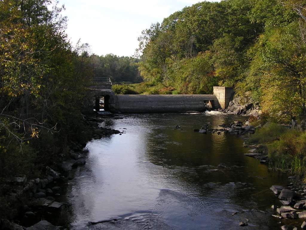
| Caption | This photograph shows Head Tide Dame and the Sheepscot River, as looking upstream from the bridge that crosses the Sheepscot River. This site is located in the Below Head Tide sub-basin. Photograph was taken by Eli Asarian on 10/8/2004. |
| CaptionTemplate | [description] This site is located in the [SubBasin] sub-basin. Photograph was taken by [photographer] on [photodate]. |
| Category | Watershed Tour |
| Description | This photograph shows Head Tide Dame and the Sheepscot River, as looking upstream from the bridge that crosses the Sheepscot River. |
| Filename | sheep_2004-10-08_12-27-55.jpg |
| Filesize | 127926 |
| Path | sheep_ifr_04\sheep_2004-10-08_12-27-55.jpg |
| Photodate | 10/8/2004 |
| Photographer | Eli Asarian |
| Restriction | None |
| Series | Tour- Sheepscot River Below Head Tide Dam 2004 |
| SubBasin | Below Head Tide |
| UpdateDate | 10/20/2004 |
| UpdateName | JEA |
| www.krisweb.com |