|
Area/Topic | Bibliography | Background | Hypotheses | Home |
Photo Database: Meta Information Page
This page contains detailed information from the KRIS Photodatabase table about photos in series Tour- Spring Creek 2004.
| Agency | Institute for Fisheries Resources |
| Basin | Sheepscot |
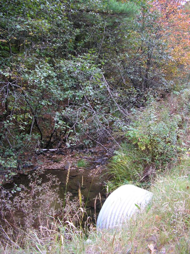
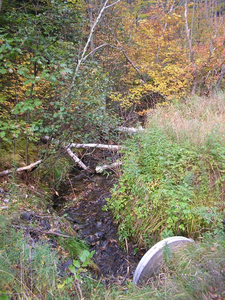
| Caption | This photograph shows Spring Creek, looking upstream from where it crosses under Highway 218. This site is located in the Mainstem Sheepscot sub-basin. Photograph was taken by Eli Asarian on 10/9/2004. |
| CaptionTemplate | [description] This site is located in the [SubBasin] sub-basin. Photograph was taken by [photographer] on [photodate]. |
| Category | Watershed Tour |
| Description | This photograph shows Spring Creek, looking upstream from where it crosses under Highway 218. |
| Filename | sheep_2004-10-09_06-32-55.jpg |
| Filesize | 216137 |
| Path | sheep_ifr_04\sheep_2004-10-09_06-32-55.jpg |
| Photodate | 10/9/2004 |
| Photographer | Eli Asarian |
| Restriction | None |
| Series | Tour- Spring Creek 2004 |
| Streamname | Spring Creek |
| SubBasin | Mainstem Sheepscot |
| UpdateDate | 10/20/2004 |
| UpdateName | JEA |
| Agency | Institute for Fisheries Resources |
| Basin | Sheepscot |
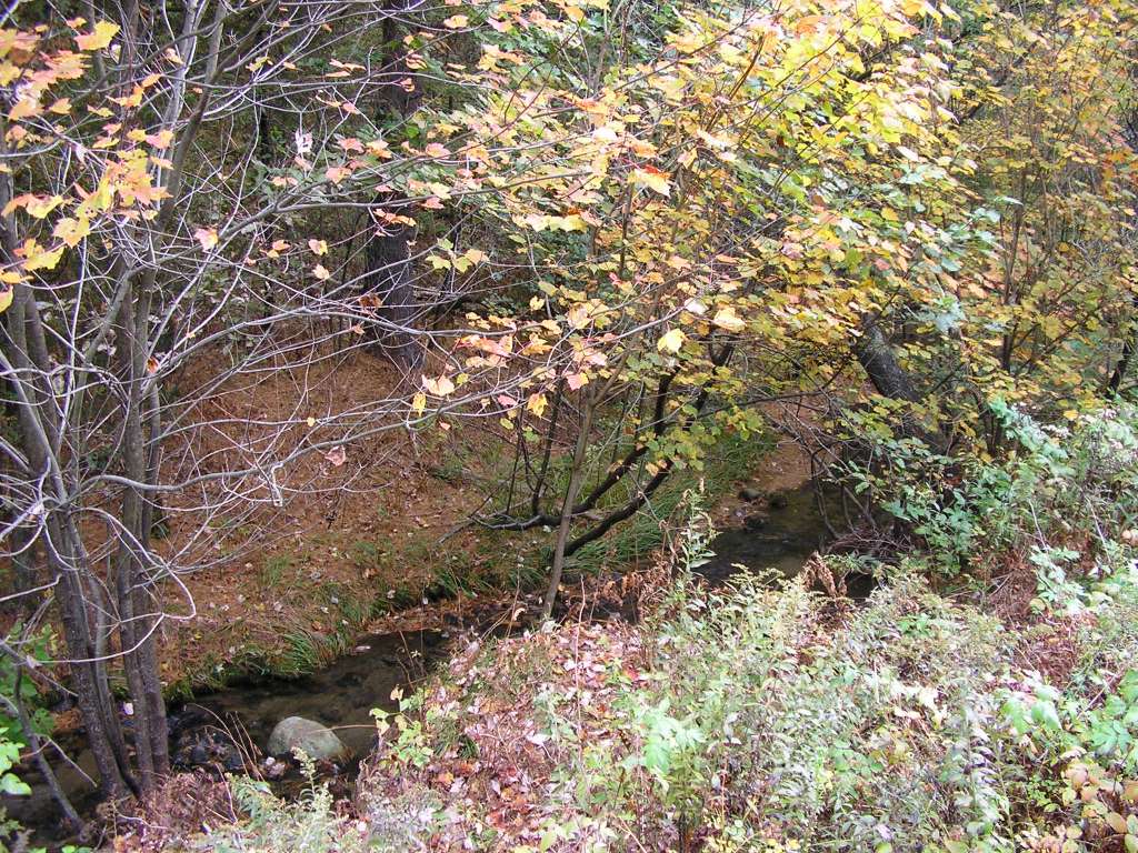
| Caption | This photograph shows Spring Creek, looking downstream from where it crosses under Highway 218. Sediment, likely road sand, appear to have accumulated in the creek. This site is located in the Mainstem Sheepscot sub-basin. Photograph was taken by Eli Asarian on 10/9/2004. |
| CaptionTemplate | [description] This site is located in the [SubBasin] sub-basin. Photograph was taken by [photographer] on [photodate]. |
| Category | Watershed Tour |
| Description | This photograph shows Spring Creek, looking downstream from where it crosses under Highway 218. Sediment, likely road sand, appear to have accumulated in the creek. |
| Filename | sheep_2004-10-09_06-33-38.jpg |
| Filesize | 201104 |
| Path | sheep_ifr_04\sheep_2004-10-09_06-33-38.jpg |
| Photodate | 10/9/2004 |
| Photographer | Eli Asarian |
| Restriction | None |
| Series | Tour- Spring Creek 2004 |
| Streamname | Spring Creek |
| SubBasin | Mainstem Sheepscot |
| UpdateDate | 10/20/2004 |
| UpdateName | JEA |
| Agency | Institute for Fisheries Resources |
| Basin | Sheepscot |
| Caption | This photograph shows Spring Creek, looking downstream from where it crosses under Highway 218. Sediment, likely road sand, appear to have accumulated in the creek. This site is located in the Mainstem Sheepscot sub-basin. Photograph was taken by Eli Asarian on 10/9/2004. |
| CaptionTemplate | [description] This site is located in the [SubBasin] sub-basin. Photograph was taken by [photographer] on [photodate]. |
| Category | Watershed Tour |
| Description | This photograph shows Spring Creek, looking downstream from where it crosses under Highway 218. Sediment, likely road sand, appear to have accumulated in the creek. |
| Filename | sheep_2004-10-09_06-34-55.jpg |
| Filesize | 231788 |
| Path | sheep_ifr_04\sheep_2004-10-09_06-34-55.jpg |
| Photodate | 10/9/2004 |
| Photographer | Eli Asarian |
| Restriction | None |
| Series | Tour- Spring Creek 2004 |
| Streamname | Spring Creek |
| SubBasin | Mainstem Sheepscot |
| UpdateDate | 10/20/2004 |
| UpdateName | JEA |
| Agency | Institute for Fisheries Resources |
| Basin | Sheepscot |
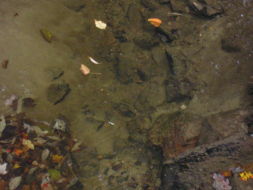
| Caption | This photograph shows Spring Creek, looking downstream from where it crosses under Highway 218. Sediment, likely road sand, appear to have accumulated in the creek. A brook trout is visible in the upper portion of the picture. This site is located in the Mainstem Sheepscot sub-basin. Photograph was taken by Eli Asarian on 10/9/2004. |
| CaptionTemplate | [description] This site is located in the [SubBasin] sub-basin. Photograph was taken by [photographer] on [photodate]. |
| Category | Watershed Tour |
| Description | This photograph shows Spring Creek, looking downstream from where it crosses under Highway 218. Sediment, likely road sand, appear to have accumulated in the creek. A brook trout is visible in the upper portion of the picture. |
| Filename | sheep_2004-10-09_06-36-31.jpg |
| Filesize | 81511 |
| Path | sheep_ifr_04\sheep_2004-10-09_06-36-31.jpg |
| Photodate | 10/9/2004 |
| Photographer | Eli Asarian |
| Restriction | None |
| Series | Tour- Spring Creek 2004 |
| Streamname | Spring Creek |
| SubBasin | Mainstem Sheepscot |
| UpdateDate | 10/20/2004 |
| UpdateName | JEA |
| Agency | Institute for Fisheries Resources |
| Basin | Sheepscot |
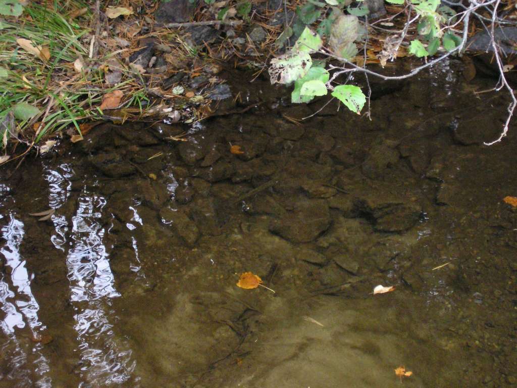
| Caption | This photograph shows Spring Creek, looking downstream from where it crosses under Highway 218. Sediment, likely road sand, appear to have accumulated in the creek. A brook trout is visible in the center of the picture. This site is located in the Mainstem Sheepscot sub-basin. Photograph was taken by Eli Asarian on 10/9/2004. |
| CaptionTemplate | [description] This site is located in the [SubBasin] sub-basin. Photograph was taken by [photographer] on [photodate]. |
| Category | Watershed Tour |
| Description | This photograph shows Spring Creek, looking downstream from where it crosses under Highway 218. Sediment, likely road sand, appear to have accumulated in the creek. A brook trout is visible in the center of the picture. |
| Filename | sheep_2004-10-09_06-36-57.jpg |
| Filesize | 109068 |
| Path | sheep_ifr_04\sheep_2004-10-09_06-36-57.jpg |
| Photodate | 10/9/2004 |
| Photographer | Eli Asarian |
| Restriction | None |
| Series | Tour- Spring Creek 2004 |
| Streamname | Spring Creek |
| SubBasin | Mainstem Sheepscot |
| UpdateDate | 10/20/2004 |
| UpdateName | JEA |
| www.krisweb.com |