Photo Database Series Historical Photos- 1950 Head Tide Dam and Downstream
Click on any thumbnail to see a larger photo.
For detailed information on these photos click here.
64 KB
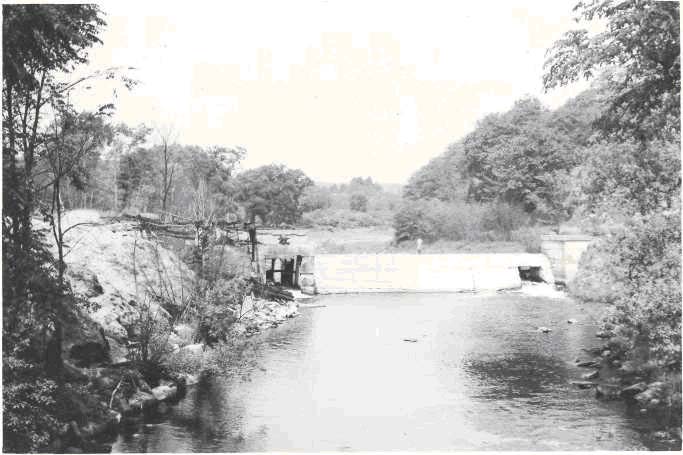
Sheepscot River, June 30, 1950. Jewett Dam at Head Tide, looking upstream. Both sluices or passages through the dam cam be seen. Right bank sluice (left side of picture) has burned remains of old gate blocking fish passage. Debris in left bank sluice. L.B. sluice probably best approach for fish passage if improved. Dam is 79 feet long between abutments and 10 to 11 feet high above water, located approximately 2 miles above Alna Bridge.
68 KB
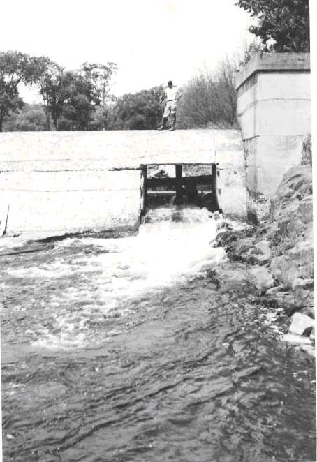
Sheepscot River, June 30, 1950. Left bank sluice of Jewett's Dam, at Head Tide, looking upstream. Turbulent white water caused by sloping submerged ledge makes poor approach for 30 ft. below, and needs jump pool. Jump approximately 2 ft. high and bothered by ledge below.
55 KB
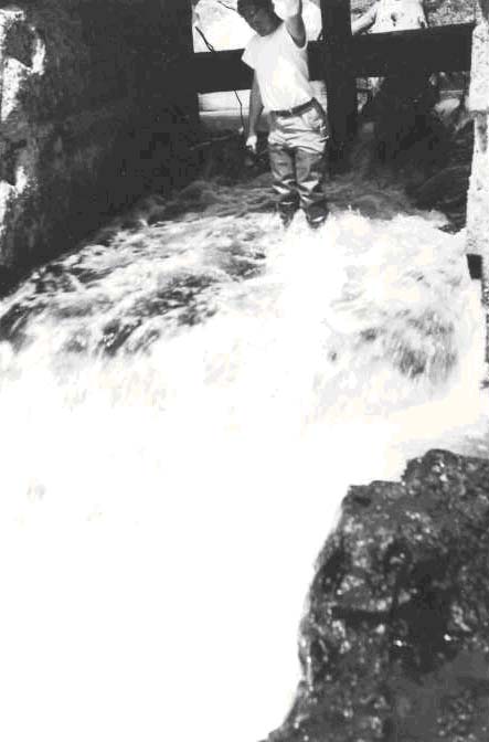
Sheepscot River, June 30, 1950. Left bank sluice of Jewett's Dam, at Head Tide. To left of picture can be seen the shallow water over ledge below lip of spill. Ledge rock projecting, from bank below deflects water causing further turbulence, and making for poor fish passage. Note debris and plank block that was partially removed by the survey crew.
43 KB
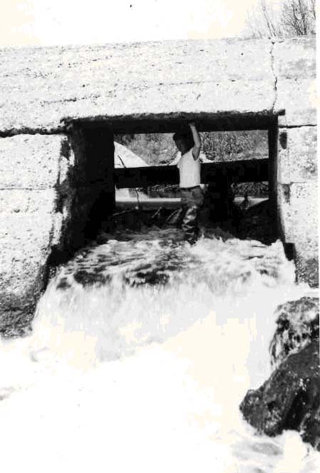
Sheepscot River, June 30, 1950. Left bank sluice in Jewett's Dam, at Head Tide, showing force of water on sluice floor, water 10 in. deep. Debris behind would bother fish if they could get onto floor of sluice. Needs good gates and fish passage improvement.
77 KB
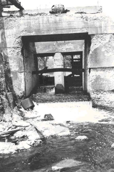
Main Sheepscot River, June 30, 1950: Right bank sluice at Jewett's Dam, Head Tide, looking upstream from ledge rock below dam. Small, shallow jump pool affords poor approach. Shallow water over concrete floor of sluice is bad and there is no possible way for fish to jump over burned gates at head of sluice although stop logs create a pool in the sluice way. Sluiceway is 8ft. wide and 12.5 ft. long (through the concrete dam). At center of spill, water is 11" deep and a vertical jump of 20 inches to sluice floor.
74 KB
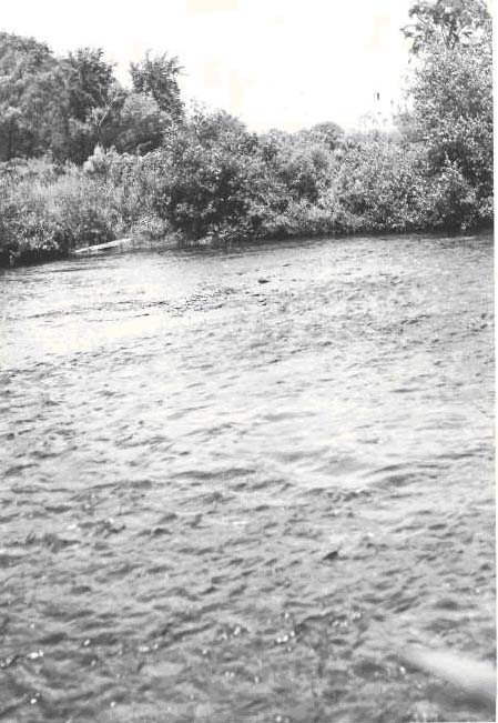
Sheepscot River, June 30, 1950. Excellent riffle at 2,500 yards (1.5 miles) above Alna Bridge and approx. one-half mile below Jewett's Dam at Head Tide.
 68 KB
68 KB
 55 KB
55 KB
 43 KB
43 KB
 77 KB
77 KB
 74 KB
74 KB