
| Area | Below Head Tide |
| Topic | Habitat: Survey Reach Length in Below Head Tide Sub-basin 1997-1999 |
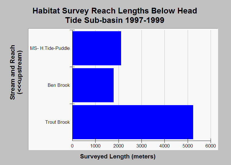
| Caption: The chart shows the total length in meters of each reach surveyed during habitat surveys conducted by the Maine Atlantic Salmon Commission and U.S. Fish and Wildlife Service in the Below Head Tide sub-basin in 1997-1999. See Info Links for more information. | |
 |
To learn more about this topic click Info Links .
To view additional information (data source, aquisition date etc.) about this page, click Metadata .
To view the table with the chart's data, click Chart Table web page.
To download the table with the chart's data, click sheep_hab_bh_usfws_1997_1999_chart.db (size 18,432 bytes)
To download the table with the chart's data as an Excel spreadsheet, click sheep_hab_bh_usfws_1997_1999_chart.db.xls (size 10,752 bytes) .
| www.krisweb.com |