
| Area | Basin-wide/Regional |
| Topic | Fish: Electrofishing - Salmon Density at Many Sheepscot Sites 2002 |
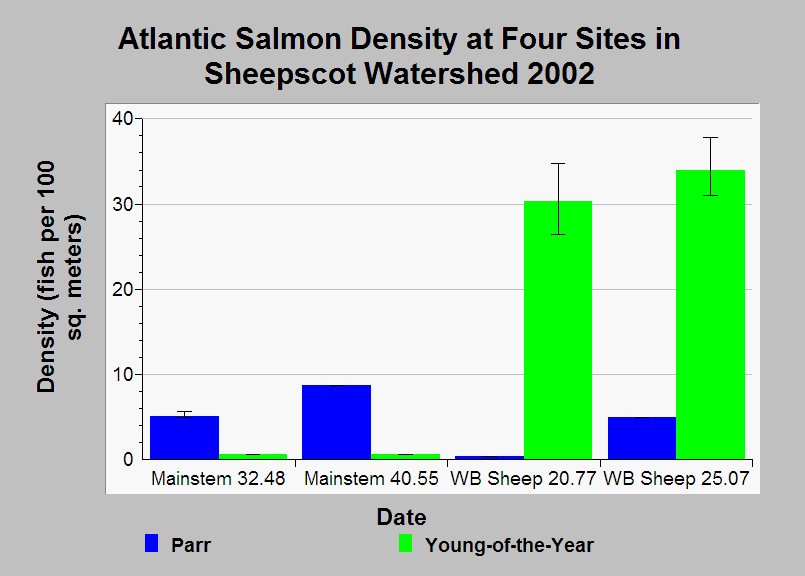
| Caption: This Chart shows Atlantic salmon densities calculated from electrofishing surveys at four sites in the Sheepscot River watershed in the year 2002. Each site was sampled on one day between August 27 and September 11. The numbers at the end of the site names (i.e. 32.48) are the distance in kilometers from the mouth of the stream to the sampling site. The colored bars in the chart are point estimates and error-bars represent the 95% confidence limits. The Maine Atlantic Salmon Commission (ASC) assembled the data and calculated density estimates. See Info Links for more information. | |
 |
To learn more about this topic click Info Links .
To view additional information (data source, aquisition date etc.) about this page, click Metadata .
To view the table with the chart's data, click Chart Table web page.
To download the table with the chart's data, click fish_efish_sheep_asc_2002_density.db (size 18,432 bytes)
To download the table with the chart's data as an Excel spreadsheet, click fish_efish_sheep_asc_2002_density.db.xls (size 6,144 bytes) .
| www.krisweb.com |