
| Area | Basin-wide/Regional |
| Topic | Flow: Annual Peaks - Sheepscot at North Whitefield, 1939-2002 |
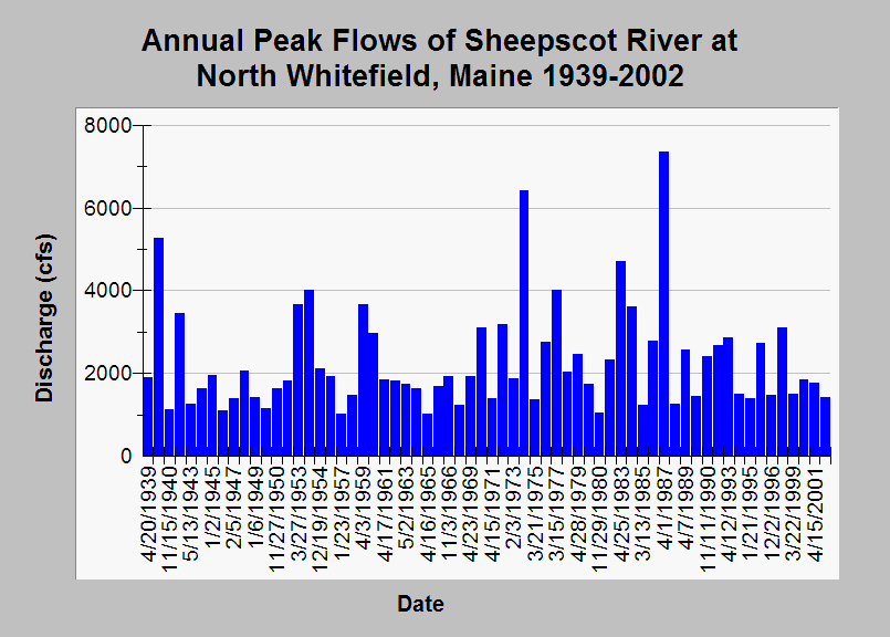
| Caption: This chart displays annual peak discharge (cfs) for the Sheepscot River at North Whitefield, Maine (USGS gage 01038000) between 1939 and 2002. The maximum peak occurred 4/1/1987 at 7350 cfs and the minimum observed annual peak flow was on 1/23/1957 of 1010 cfs. See Info Links for more Information. | |
 |
To learn more about this topic click Info Links .
To view additional information (data source, aquisition date etc.) about this page, click Metadata .
To view the table with the chart's data, click Chart Table web page.
To download the table with the chart's data, click flow_annual_peaks_sheepscot.dbf (size 2,338 bytes)
To download the table with the chart's data as an Excel spreadsheet, click flow_annual_peaks_sheepscot.dbf.xls (size 10,752 bytes) .
| www.krisweb.com |