
| Area | Basin-wide/Regional |
| Topic | Flow: Daily - Sheepscot at North Whitefield, 1989-1998 |
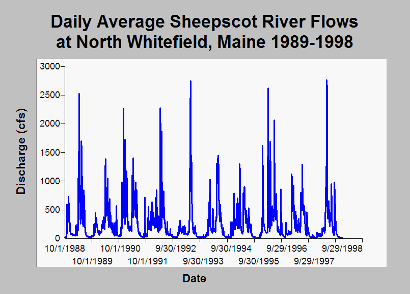
| Caption: This chart displays daily average Sheepscot River flows (cfs) at North Whitefield, Maine during water years 1989 to 1998. Flow data were measured by the US Geological Survey at gauging station #01038000. See Info Links for more information. | |
 |
To learn more about this topic click Info Links .
To view additional information (data source, aquisition date etc.) about this page, click Metadata .
To view the table with the chart's data, click Chart Table web page.
To download the table with the chart's data, click flow_dailyave_sheepscot_usgs1989_1998.dbf (size 117,026 bytes)
To download the table with the chart's data as an Excel spreadsheet, click flow_dailyave_sheepscot_usgs1989_1998.dbf.xls (size 279,131 bytes) .
| www.krisweb.com |