
| Area | Basin-wide/Regional |
| Topic | Land Use: Historic Census- Human Pop. in Sheepscot Counties 1790-1990 |
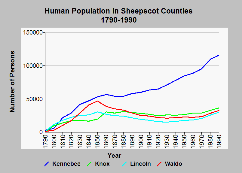
| Caption: This chart shows the human population for the Sheepscot counties for the years 1790-1990. Peak agricultural activity occurred in the mid 19th century and has been declining ever since. The US Geological Survey compiled the data from US Bureau of Census records. See Info Links for more background information. | |
 |
To learn more about this topic click Info Links .
To view additional information (data source, aquisition date etc.) about this page, click Metadata .
To view the table with the chart's data, click Chart Table web page.
To download the table with the chart's data, click census_bw_pop_1790_1990.db (size 18,432 bytes)
To download the table with the chart's data as an Excel spreadsheet, click census_bw_pop_1790_1990.db.xls (size 5,120 bytes) .
| www.krisweb.com |