
| Area | Basin-wide/Regional |
| Topic | Land Use: Sheepscot Population and Housing Units, 2000-2015 |
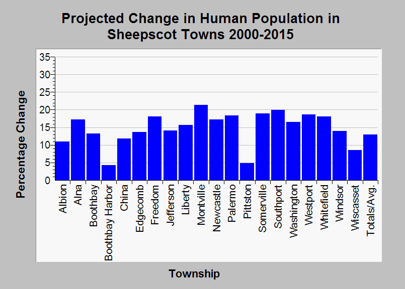
| Caption: This chart shows the project change in human population from 2000 - 2015 in the townships of the Sheepscot River watershed. The number of people is expected to rise in each Sheepscot town, with the total increase predicted to be 13%. Data were contributed by the Maine State Planning Office. See Info Links for more information. | |
 |
To learn more about this topic click Info Links .
To view additional information (data source, aquisition date etc.) about this page, click Metadata .
To view the table with the chart's data, click Chart Table web page.
To download the table with the chart's data, click landuse_sheep_mspo_1990_2000.db (size 18,432 bytes)
To download the table with the chart's data as an Excel spreadsheet, click landuse_sheep_mspo_1990_2000.db.xls (size 10,752 bytes) .
| www.krisweb.com |