
| Area | Basin-wide/Regional |
| Topic | Temperature: Water and Air - Sheepscot at North Whitefield 1977-1994 |
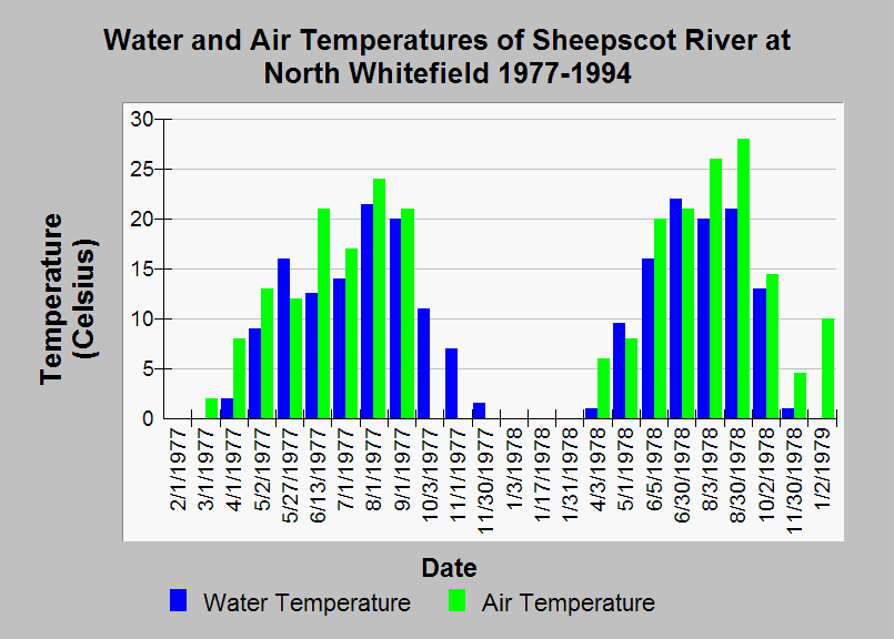
| Caption: This chart shows a relationship between water and air temperatures in the Sheepscot River at monthly discrete points between 1977 and 1994. Air temperature above the stream surface is a major factor in increasing water temperatures and is reflected in this chart. These data were taken at the USGS gauging station on the Sheepscot River at North Whitefield (gage 01038000). See Info Links for more information. | |
 |
To learn more about this topic click Info Links .
To view additional information (data source, aquisition date etc.) about this page, click Metadata .
To view the table with the chart's data, click Chart Table web page.
To download the table with the chart's data, click sheepscot_usgs_wq_revised_cross.db (size 10,240 bytes)
To download the table with the chart's data as an Excel spreadsheet, click sheepscot_usgs_wq_revised_cross.db.xls (size 12,114 bytes) .
| www.krisweb.com |