
| Area | Basin-wide/Regional |
| Topic | WQ: Chloride MDEP Baseflow Study Summary 1999-2001 |
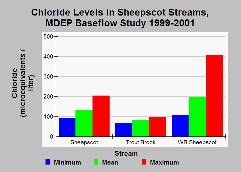
| Caption: This chart shows the minimum, mean, and maximum Chloride (Cl) levels measured during the Maine Department of Environmental Protection WQM Program's 1999-2001 baseflow study. Data were collected in June-October. Cl levels were generally higher in the West Branch than in the mainstem Sheepscot and in Trout Brook. High Cl levels have been associated with winter maintainance of roads (Dill, et. al. 2002). See Info Links for more information. | |
 |
To learn more about this topic click Info Links .
To view additional information (data source, aquisition date etc.) about this page, click Metadata .
To view the table with the chart's data, click Chart Table web page.
To download the table with the chart's data, click wq_bw_dep_baseflow99_01_summary.db (size 24,576 bytes)
To download the table with the chart's data as an Excel spreadsheet, click wq_bw_dep_baseflow99_01_summary.db.xls (size 12,073 bytes) .
| www.krisweb.com |