
| Area | Basin-wide/Regional |
| Topic | WQ: Chloride MDEP Stormflow Study Summary 2000-2002 |
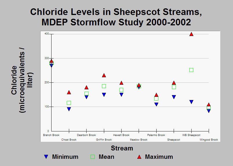
| Caption: This chart shows the minimum, mean, and maximum Chloride (Cl) levels measured during the Maine Department of Environmental Protection WQM Program's 2000-2002 stormflow study. Data were collected in October-July. High Cl levels have been associated with winter maintainance of roads (Dill, et. al. 2002). See Info Links for more information. | |
 |
To learn more about this topic click Info Links .
To view additional information (data source, aquisition date etc.) about this page, click Metadata .
To view the table with the chart's data, click Chart Table web page.
To download the table with the chart's data, click wq_bw_dep_69_02_stormflow_summary.db (size 18,432 bytes)
To download the table with the chart's data as an Excel spreadsheet, click wq_bw_dep_69_02_stormflow_summary.db.xls (size 21,961 bytes) .
| www.krisweb.com |