
| Area | Basin-wide/Regional |
| Topic | WQ: Potassium MDEP Stormflow Study Summary 2000-2002 |
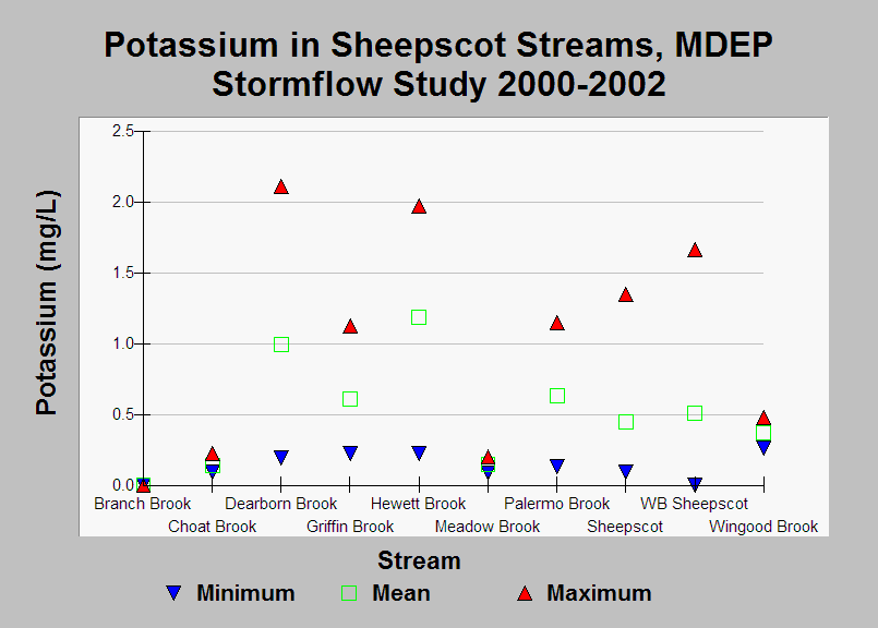
| Caption: This chart shows the minimum, mean, and maximum Potassium levels measured during the Maine Department of Environmental Protection WQM Program's 2000-2002 stormflow study. Samples were taken during high flow events (after major rainfall events of 1.0 inch of rain or more, or during significant melt events). See Info Links for more information. | |
 |
To learn more about this topic click Info Links .
To view additional information (data source, aquisition date etc.) about this page, click Metadata .
To view the table with the chart's data, click Chart Table web page.
To download the table with the chart's data, click wq_bw_dep_69_02_stormflow_summary.db (size 18,432 bytes)
To download the table with the chart's data as an Excel spreadsheet, click wq_bw_dep_69_02_stormflow_summary.db.xls (size 21,961 bytes) .
| www.krisweb.com |