| Area |
Basin-wide/Regional |
| Topic |
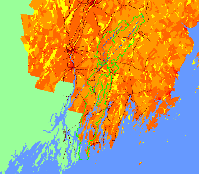
Map: 1H. Human Population Density by Census Tract, Sheepscot |
To view a more detailed version of this map click
here
|
This map shows the human population density in census tracts in the Sheepscot River watershed and surrounding areas for the year 2000, displayed with
KRIS sub-basins, major roads, and the Sheepscot River. The total number of people in census tracts that are inside or intersect the Sheepscot River
watershed boundary is 19404. Data were provided by the U.S. Department of Commerce (USDOC), Bureau of the Census (USCB), and Maine Office
of Geographic Information Systems (MEGIS).
|
|
|
 |
 |
To view metadata about a map layer, click on a link in the table below.
If you obtain KRIS on a CD and install it on your hard drive as a desktop program, you will have access to increased map capabilities such as zooming in/out, turning layers on/off, adding layers and changing legends.
