
| Area | Basin-wide/Regional |
| Topic | WQ: Nitrate MDEP Stormflow Study Summary 2000-2002 |
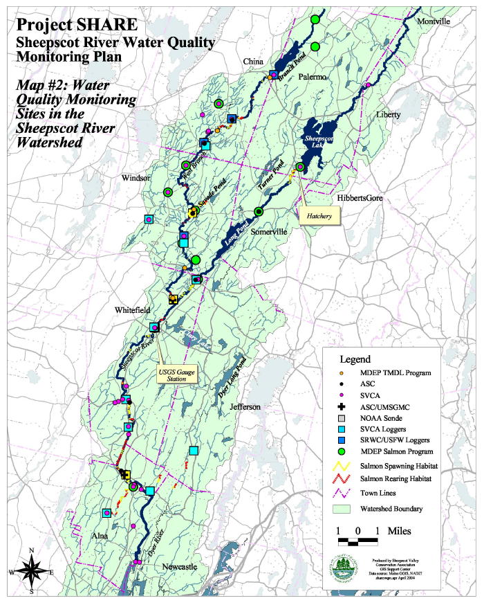
This map from Arter (2004) shows the location of water quality monitoring sites in the Sheepscot River watershed. Green circles are the Maine Department of Environmental Protection monitoring stations.
 Click on image to enlarge (168K).
To learn more about this topic click Info Links
To view additional information (data source, aquisition date etc.) about this page, click Metadata
| www.krisweb.com |