
| Area | Dyer River |
| Topic | Habitat: Habitat Categories in Dyer River Sub-basin 1997-1999 |
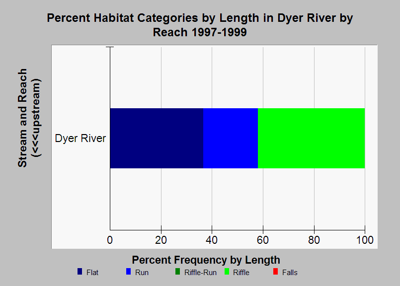
| Caption: This chart shows a summary of habitat categories by length from Atlantic salmon habitat typing surveys conducted in the Dyer River sub-basin by the Maine Atlantic Salmon Commission and U.S. Fish and Wildlife Service in 1997-1999. Only one reach was surveyed in the Dyer River sub-basin, but the data in this chart was included so it could be compared with charts of similar data from other sub-basins. See Info Links for more information. | |
 |
To learn more about this topic click Info Links .
To view additional information (data source, aquisition date etc.) about this page, click Metadata .
To view the table with the chart's data, click Chart Table web page.
To download the table with the chart's data, click sheep_hab_dr_usfws_1997_1999_chart.db (size 18,432 bytes)
To download the table with the chart's data as an Excel spreadsheet, click sheep_hab_dr_usfws_1997_1999_chart.db.xls (size 5,120 bytes) .
| www.krisweb.com |