| Area |
Mainstem Sheepscot |
| Topic |
WQ: Conductivity in Sheepscot R. above Head Tide (RKm10.35) 2001-2003 |
To view a more detailed version of this map click
here
|
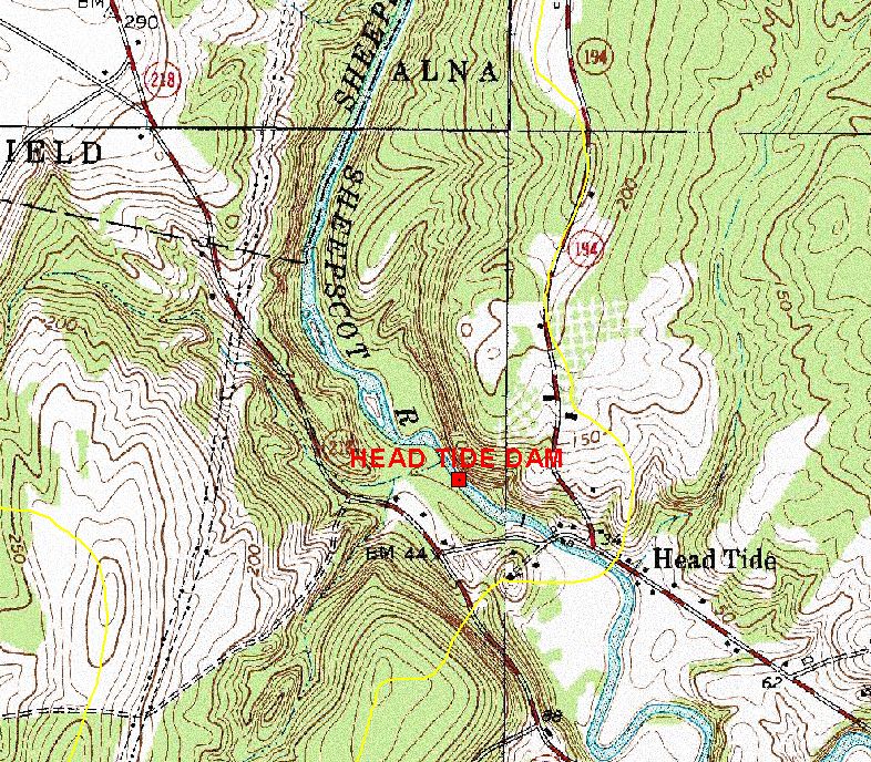
This map shows the location of the NOAA Fisheries water quality data logger in the Sheepscot River in Alna just above Head Tide dam (the red square
at the center of the map). Data were contributed by the U.S. Geological Survey (USGS) and Maine Office of Geographic Information Systems
(MEGIS). Scale = 1:14,490 .
|
|
|
 |
 |
To view metadata about a map layer, click on a link in the table below.
| Name of Layer in Map Legend | Metadata File Name |
|---|
| Dams, Levees, & Impoundments (labels) [US ACE] | impounds.shp.txt |
| Dams, Levees, & Impoundments (by height) [US ACE] | impounds.shp.txt |
| Subbasins (no labels) | subbasins.shp.txt |
| Topographic Map (1:24k scale) | Unavailable |
If you obtain KRIS on a CD and install it on your hard drive as a desktop program, you will have access to increased map capabilities such as zooming in/out, turning layers on/off, adding layers and changing legends.
