
| Area | Mainstem Sheepscot |
| Topic | Temperature: Floating Weekly Max - Sheepscot RKm26.66, 2001-2003 |
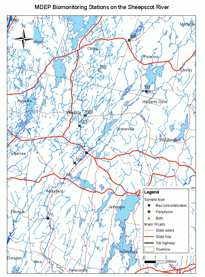
This map shows the location of Maine Department of Environmental Protection (biomonitoring program) stations in the Sheepscot River watershed sub-basin.
 Click on image to enlarge (119K).
To learn more about this topic click Info Links
To view additional information (data source, aquisition date etc.) about this page, click Metadata
| www.krisweb.com |