
| Area | West Branch Sheepscot |
| Topic | Fish: Electrofishing - Salmon Density in Lower West Branch 1989-1998 |
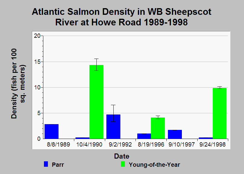
| Caption: This Chart shows Atlantic salmon densities calculated from electrofishing surveys in the lower West Branch Sheepscot River at Howe Road (river kilometer 0.54) from 1989-1998. The colored bars in the chart are point estimates and error-bars represent the 95% confidence limits. The Maine Atlantic Salmon Commission (ASC) assembled the data and calculated density estimates. See Info Links for more information. | |
 |
To learn more about this topic click Info Links .
To view additional information (data source, aquisition date etc.) about this page, click Metadata .
To view the table with the chart's data, click Chart Table web page.
To download the table with the chart's data, click fish_efish_11westbr0.54_asc_89_98_density.db (size 18,432 bytes)
To download the table with the chart's data as an Excel spreadsheet, click fish_efish_11westbr0.54_asc_89_98_density.db.xls (size 10,752 bytes) .
| www.krisweb.com |