
| Area | Basinwide/General |
| Topic | Sediment: Matthews Sediment Transport by sub-basin and Type 1933-1999 |
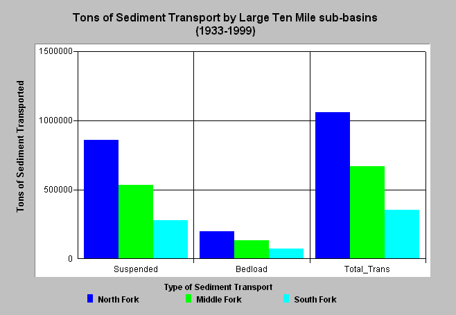
| Caption: The chart above shows the amount of sediment transport in tons per acre for three large Ten Mile River sub-basin areas. The references shown on the X-axis are suspended sediment transport, bedload transport and total transport in both forms. The highest sediment transport has come from the North Fork sub-basin followed by the Middle Fork. Sediment transport is a function of stream power (gradient) as well as supply. Click on Info Links for more information. | |
 |
To learn more about this topic click here .
To view the table with the chart's data, click Chart Table web page.
To download the table with the chart's data, click sedtypetotals.dbf (size 294 bytes) .
To see meta information about the data table used for this topic click here
To view the table with the chart's source data, click Source Table web page.
To download the table with the chart's source data, click sedtransource.dbf (size 6,246 bytes)
| www.krisweb.com |