
| Area | Basin-wide |
| Topic | Watershed Area: Above each of 50 Battle WA Sites |
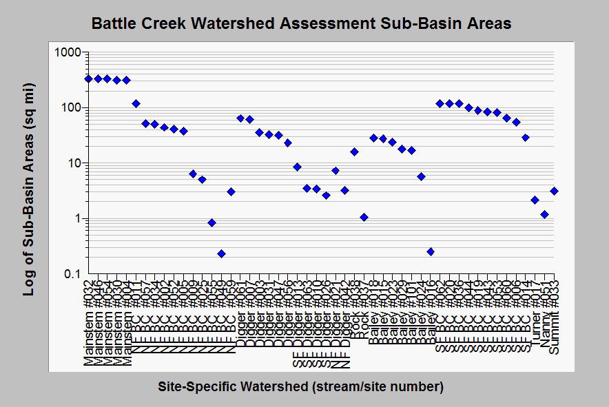
| Caption: Battle Creek Watershed Assessment sub-basin areas above aquatic monitoring sites are shown here in square miles on a logarithmic scale. The South Fork is the largest sub-basin within the Battle Creek watershed, which is approximately 370 square miles total. Lassen National Forest scientists noted that some of the smaller watersheds may have EMDS values that differ from favorable because they are under the watershed size used to devise the curves (10,000-40,000 acres or 15-60 sq mi)). Data are from Terraqua (2004), but derived from GIS data by Dr. Paul Trichilo of the KRIS team. See Info Links for more information. | |
 |
To learn more about this topic click Info Links .
To view additional information (data source, aquisition date etc.) about this page, click Metadata .
To view the table with the chart's data, click Chart Table web page.
To download the table with the chart's data, click mikes_res_corr_stats.dbf (size 11,288 bytes)
To download the table with the chart's data as an Excel spreadsheet, click mikes_res_corr_stats.dbf.xls (size 19,592 bytes) .
| www.krisweb.com |