
| Area | Basin-wide |
| Topic | Vegetation: Meadows in Near Stream Areas of Battle WA Sub-basins |
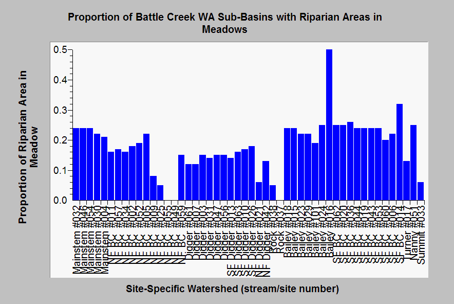
| Caption: Terraqua (2004) used remote sensing vegetation data to try to discern grazing impacts by assigning riparian areas (100 m on each side) in Non-Forest condition as "meadow". This chart shows the percentage or proportion (1.0 = 100%) of riparian zones in sub-basins above Battle WA aquatic monitoring sites that are in "meadow". Landsat vegetation data from the USFS Spatial Analysis Lab and data summary run by Dr. Paul Trichilo of Kier Associates at the request of Terraqua. See Info Links for more information. | |
 |
To learn more about this topic click Info Links .
To view additional information (data source, aquisition date etc.) about this page, click Metadata .
To view the table with the chart's data, click Chart Table web page.
To download the table with the chart's data, click mikes_res_corr_stats.dbf (size 11,288 bytes)
To download the table with the chart's data as an Excel spreadsheet, click mikes_res_corr_stats.dbf.xls (size 19,592 bytes) .
| www.krisweb.com |