
| Area | Basin-wide |
| Topic | Climate: Rainfall at Volta Powerhouse 1920-22, 1926-1997 |
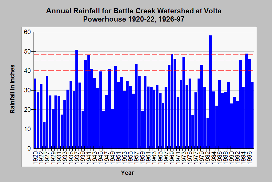
| Caption: The annual rainfall in the Battle Creek basin as measured at Volta Powerhouse is displayed above. Only years for which complete records are available were included and there are no data shown above for 1923, 1924 and 1925. The red lines show the minimum (13.41" in 1926) and maximum (58.18" in 1983) rainfall for all years and the dashed green line is the average, which is approximately 33" per year at this gauge site. This gauge is at 2200 feet and averages about half of the rainfall at the Manzanita Lake gauge which is at approximately 5500 feet due to orographic effects. See the North Fork Sub-Basin Topics for other summaries of Volta Powerhouse rainfall data. See Info Links for more information. | |
 |
To learn more about this topic click Info Links .
To view additional information (data source, aquisition date etc.) about this page, click Metadata .
To view the table with the chart's data, click Chart Table web page.
To download the table with the chart's data, click annrain.dbf (size 3,255 bytes)
To download the table with the chart's data as an Excel spreadsheet, click annrain.dbf.xls (size 6,144 bytes) .
| www.krisweb.com |