
| Area | Basin-wide |
| Topic | Sediment: Road Densities by Battle WA Sub-Basin |
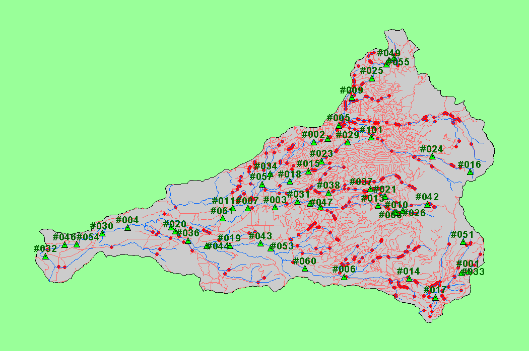
| This map shows roads in the Battle Creek basin, displayed with 1:100,000 scale streams, KRIS sub-basins, and the locations sampled as part of the Battle Creek Watershed Assessment (Terraqua, 2004). Data were provided by the U.S. Geological Survey, Sierra Pacific Industries and Lassen National Forest. Click the check box next to a layer to toggle it on/off. Available layers include Slope, Topographic Map, Grayscale Hillshade, and Soil Erodibility. Scale = 1:298,670 . | |||
 |
 |
||
To view metadata about a map layer, click on a link in the table below.
| Name of Layer in Map Legend | Metadata File Name |
|---|---|
| Watershed Analysis Sample Sites (labels) | samplesites.shp.txt |
| Watershed Analysis Sample Sites | samplesites.shp.txt |
| Sub-basins (no labels) | subbasins.shp.txt |
| Streams (1:100k scale)(no labels) | stms100.shp.txt |
| Roads (1:24k scale) [SPI, Lassen NF] | bcroads.shp.txt |
| Project Area | battl_outl.shp.txt |
| www.krisweb.com |