
| Area | Basin-wide |
| Topic | Vegetation: Landsat Veg/Tree Size Summary for All Battle WA Sub-Basins |
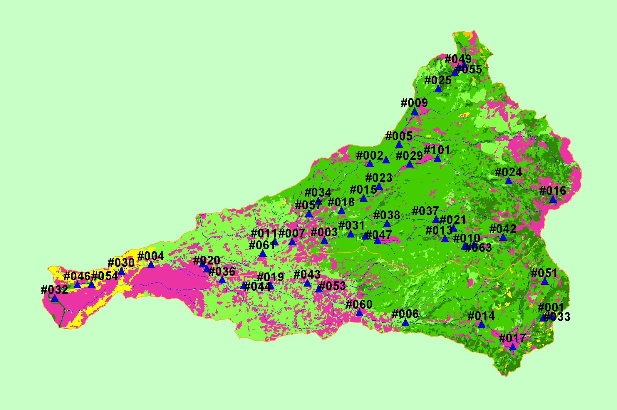
| This is a map of 1994 vegetation size data in the Battle Creek basin, displayed with KRIS sub-basins, 1:100,000 scale streams, and the locations sampled as part of the Battle Creek Watershed Assessment (Terraqua, 2004). The tree size classifications were derived from Landsat multi-spectral images taken in 1994. Stand conditions are accurately represented at the one hectare scale. Data were provided by the U.S. Forest Service Pacific Southwest Region Remote Sensing Lab, in cooperation with the California Department of Forestry. | |||
 |
 |
||
To view metadata about a map layer, click on a link in the table below.
| Name of Layer in Map Legend | Metadata File Name |
|---|---|
| Watershed Analysis Sample Sites (labels) | samplesites.shp.txt |
| Watershed Analysis Sample Sites | samplesites.shp.txt |
| Sub-basins (no labels) | subbasins.shp.txt |
| Sub-basins (no labels) | subbasins.shp.txt |
| Streams (1:100k scale)(no labels) | stms100.shp.txt |
| USFS Vegetation Size (1996)(TIFF) | vegsize96.tif.txt |
| Project Background | battl_outl.shp.txt |
| www.krisweb.com |