
| Area | Basinwide/Regional |
| Topic | Sediment: Matthews Road Locations for All Sub-basins 2000 |
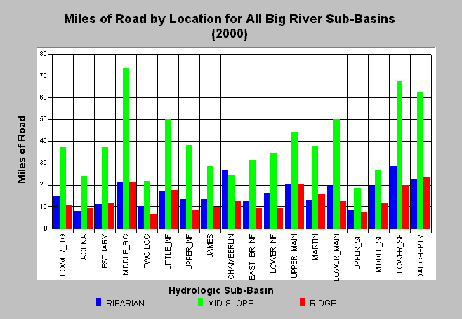
| Caption: The chart above shows the existing miles of road by location in the Big River basin as of year 2000. The majority of roads are located mid-slope in all sub-basins. These locations have significantly more risk of sliding than do ridge top roads. Stream side roads generally yield higher fine sediment, particularly if there are winter operations. Data is from Matthews and Associates (2001). See Info Links for more background information and links to references. | |
 |
To learn more about this topic click here .
To view the table with the chart's data, click Chart Table web page.
To download the table with the chart's data, click roads_type_location_allsubs.dbf (size 1,874 bytes) .
To see meta information about the data table used for this topic click here
| www.krisweb.com |