
| Area | Basin-wide/General |
| Topic | Sediment: TMDL Source Analysis, All Gualala Subbasins |
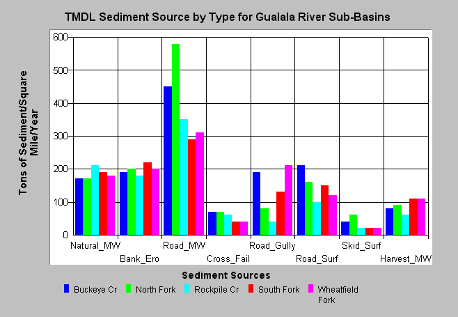
| Caption: The chart above shows the sources of sediment estimated by the Technical Support Document (TSD) for the Gualala TMDL which was formally titled the "Technical Support Document for the Gualala River Watershed Water Quality Attainment Action Plan for Sediment" (CWRCB, 2001). The sub-basin comparison shows that the North Fork has the highest estimated sediment yield and that mass wasting associated with roads (Road_MW) is the largest estimated source of sediment for all Gualala sub-basins. Estimated sediment yield is shown as tons of sediment yielded per square mile per year. Please note that the California Geologic Survey has reservations about the TSD results and methods. See Info Links for more information. | |
 |
To learn more about this topic click Info Links .
To view a table of information about this data click Metadata .
To view the table with the chart's data, click Chart Table web page.
To download the table with the chart's data, click tmdl_sed_source_tons_sqmi_yr.dbf (size 682 bytes) .
| www.krisweb.com |