
| Area | Wheatfield |
| Topic | Sediment: TMDL Source Analysis Wheatfield Fork Sub Basin |
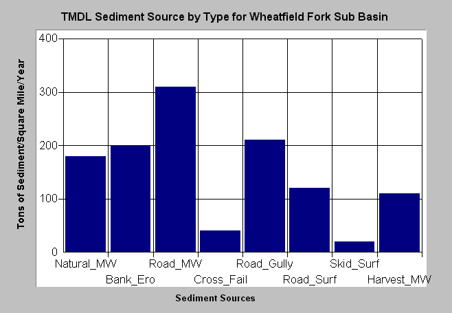
| Caption: The chart above shows the sources of sediment estimated for the Wheatfield Fork by the "Technical Support Document for the Gualala River Watershed Water Quality Attainment Action Plan for Sediment" (CWRCB, 2001). The Wheatfield basin shows a similar pattern to the Gualala basin as a whole with roads being the largest estimated sediment source. High road surface erosion and gully erosion problems are in part owing to the Kelly Road, which passes through the upper Wheatfield watershed. Estimated sediment yield is shown as tons of sediment yielded per square mile per year. Please note that the California Geologic Survey has reservations about the TSD results and methods. See Info Links for more information. | |
 |
To learn more about this topic click Info Links .
To view a table of information about this data click Metadata .
To view the table with the chart's data, click Chart Table web page.
To download the table with the chart's data, click tmdl_sed_source_tons_sqmi_yr.dbf (size 682 bytes) .
| www.krisweb.com |