Photo Database Series GIS: 3-D View of Freshwater Creek Timber Harvests 1988-2002
Click on any thumbnail to see a larger photo.
For detailed information on these photos click here.
70 KB
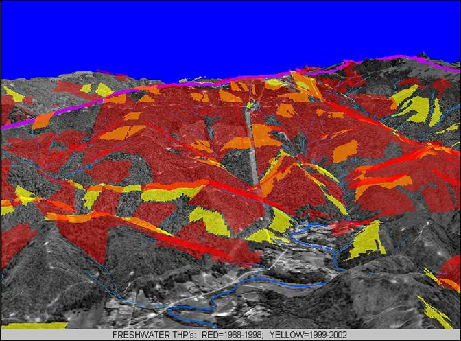
This three-dimensional GIS map shows timber harvest plans approved in the Freshwater Creek watershed from 1998-2002 draped over aerial photographs. Image downloaded from www.freshwater-kneeland.org.