
| Area | Arcata |
| Topic | Roads: Densities in Arcata Sub-Basins 2000 |
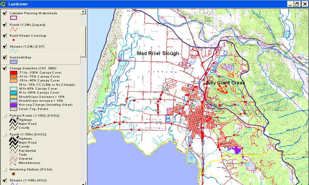
This is a map image of Arcata Calwater Planning Watersheds with roads, stream crossings and landscape change scene detection from the USFS Spatial Analysis Lab and California Department of Forestry FRAP Division. The latter is derived from comparison of 1994 and 1998 Landsat images.
 Click on image to enlarge (185K).
To learn more about this topic click Info Links
To view additional information (data source, aquisition date etc.) about this page, click Metadata
| www.krisweb.com |