
| Area | Basin-wide/Regional |
| Topic | Roads: Stream Crossings in Humboldt Bay, All Sub-Basins 2000 |
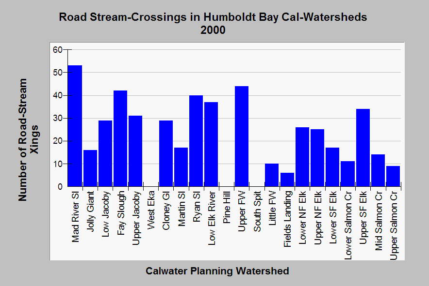
| Caption: This chart shows the number of road-stream crossings in all Humboldt Bay Calwater Planning Watersheds. Stream crossings can be sources of pollution and pose risk in some locations of catastrophic failure. Road-stream crossings may be under-represented because both streams and road maps are not detailed, so these data should be considered conservative. In urban areas, stream crossings may be low because streams are in culverts underneath streets. See Info Links for access to more background information. | |
 |
To learn more about this topic click Info Links .
To view additional information (data source, aquisition date etc.) about this page, click Metadata .
To view the table with the chart's data, click Chart Table web page.
To download the table with the chart's data, click road_dens_xing_hb_1999.dbf (size 2,008 bytes)
To download the table with the chart's data as an Excel spreadsheet, click road_dens_xing_hb_1999.dbf.xls (size 10,752 bytes) .
| www.krisweb.com |