
| Area | Elk River |
| Topic | Roads: Stream Crossings in Elk River Sub-Basins 2000 |
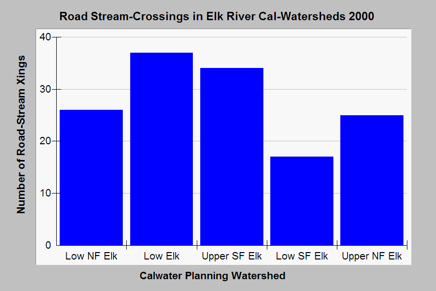
| Caption: This chart shows the number of road-stream crossings in all Elk River Calwater Planning Watersheds. Stream crossings can be sources of pollution and pose risk in some locations of catastrophic failure. Road-stream crossings may be under-represented because both streams and road maps are not detailed, so these data should be considered conservative. Data provided by Legacy the Landscape Connection and summary statistics calculated by the Institute for Fisheries Resources. See Info Links for access to more background information. | |
 |
To learn more about this topic click Info Links .
To view additional information (data source, aquisition date etc.) about this page, click Metadata .
To view the table with the chart's data, click Chart Table web page.
To download the table with the chart's data, click er_roads_xings_2000.dbf (size 2,871 bytes)
To download the table with the chart's data as an Excel spreadsheet, click er_roads_xings_2000.dbf.xls (size 4,096 bytes) .
| www.krisweb.com |