
| Area | Elk River |
| Topic | Sediment: Fines <0.85 mm Elk River 1994-96 |
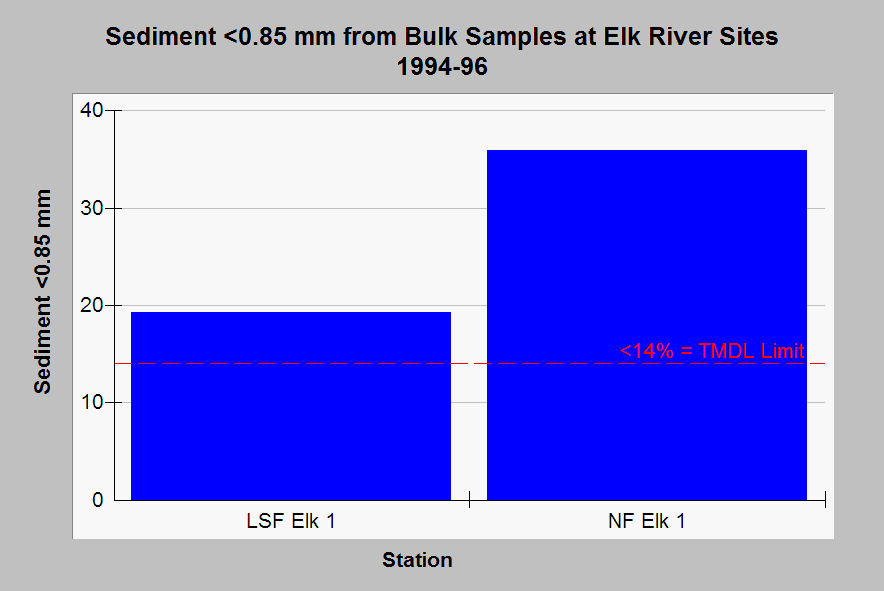
| Caption: This chart shows levels of fine sediment less than 0.85 mm from bulk gravel samples at Elk River PL monitoring stations measured from 1994-96. The reference of 14% fine sediment or less reflects criteria used by U.S. EPA (1998) as a target for recovered aquatic health. Click on Picture to see the location of sites, a map of vegetation of taken from a 1994 Landsat image and selected photos. Data from the PALCO (1998) Habitat Conservation Plan. See Info Links for more discussion of sediment sampling. | |
 |
To learn more about this topic click Info Links .
To view additional information (data source, aquisition date etc.) about this page, click Metadata .
To view the table with the chart's data, click Chart Table web page.
To download the table with the chart's data, click errdsed.dbf (size 1,250 bytes)
To download the table with the chart's data as an Excel spreadsheet, click errdsed.dbf.xls (size 3,584 bytes) .
| www.krisweb.com |