
| Area | Elk River |
| Topic | Roads: Densities in Elk River Sub-Basins 2000 |
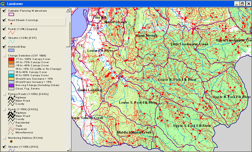
This is a map image of all Elk River Calwater Planning Watersheds with roads and stream crossings. See map topics for zoom capability.
 Click on image to enlarge (167K).
To learn more about this topic click Info Links
To view additional information (data source, aquisition date etc.) about this page, click Metadata
| www.krisweb.com |