
| Area | Freshwater Creek-Ryan Slough |
| Topic | Vegetation: Camp 12 CW Watershed 1994 |
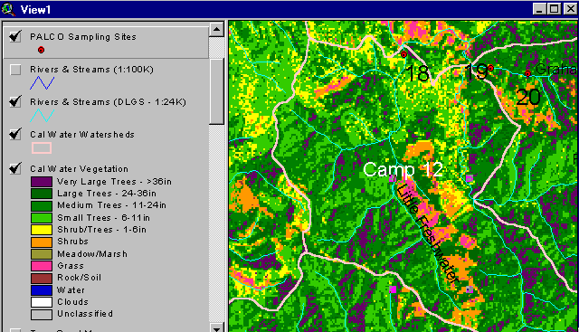
The vegetation image above is of the Camp 12 Calwater planning unit and is derived from a 1994 Landsat image which was classified by the Humboldt State University Spatial Analysis Lab (Click on Info Links for more on method of classification). The high shrub and grass component (orange and pink) indicate watershed disturbance related to logging just prior to 1994. Map by the Institute for Fisheries Resources.
 Click on image to enlarge (39K).
To learn more about this topic click Info Links
To view additional information (data source, aquisition date etc.) about this page, click Metadata
| www.krisweb.com |