
| Area | Salmon Creek |
| Topic | Sediment: Fines <0.85mm Salmon Creek, 1994 |
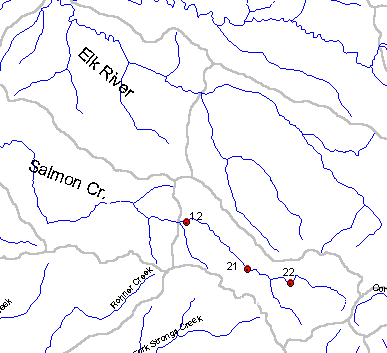
This map shows the PL insect and fine sediment monitoring locations in the Salmon Creek watershed. Station number 12 is Lower Salmon, number 21 is Middle Salmon and 22 is Upper Salmon. Map from Institute for Fisheries Resources.
This map shows the PL insect and fine sediment monitoring locations in the Salmon Creek watershed. Station number 12 is Lower Salmon, number 21 is Middle Salmon and 22 is Upper Salmon. Map from Institute for Fisheries Resources.
 Click on image to enlarge (8K).
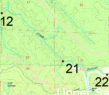 Click on image to enlarge (33K).
To learn more about this topic click Info Links
To view additional information (data source, aquisition date etc.) about this page, click Metadata
| www.krisweb.com |