
| Area | Salmon Creek |
| Topic | Vegetation: Landsat for Lower Salmon Cr Cal-Watershed 1994 |
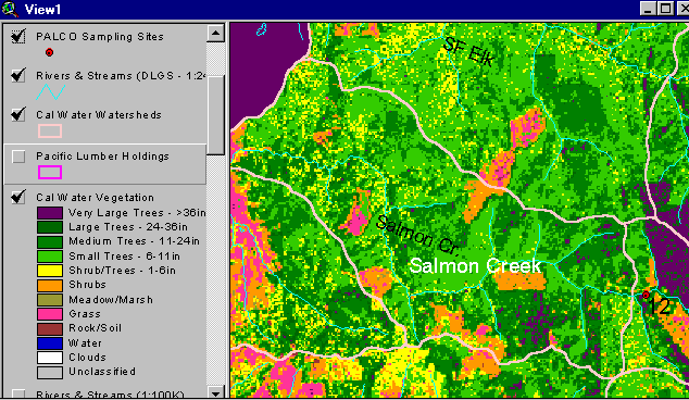
The vegetation image above is derived from a 1994 Landsat image which was classified by the Humboldt State University Spatial Analysis Lab (click on Info Links for more information). Much of this watershed is in early seral stages but with only a small component in shrubs and grass. The orange shapes are shrubs which are generally associated with recent clear cuts. Use the Zoom and Pan functions to see the map in more detail (see Help System).
 Click on image to enlarge (39K).
To learn more about this topic click Info Links
To view additional information (data source, aquisition date etc.) about this page, click Metadata
| www.krisweb.com |