
| Area | Salmon Creek |
| Topic | Vegetation: Landsat for Upper Salmon Cr Cal-Watershed 1994 |
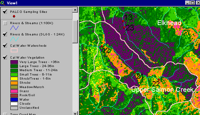
The vegetation image above is derived from a 1994 Landsat image which was classified by the Humboldt State University Spatial Analysis Lab (Click on Info Links for more on method of classification). The dark purple at the top (north) of the watershed is the old growth of Headwaters Forest. The high shrub and shrub/tree component (orange and yellow) indicate recent watershed disturbance related to logging (see Picture 3). Use the Zoom and Pan functions to see the map in more detail (see Help System).
Headwaters Forest spans portions of the Salmon Creek and Little South Fork Elk River watersheds. The large blocks of late seral forest register as dark green and purple on the Landsat vegetation map. This aerial photograph provided courtesy of Doug Thron and Project Lighthawk. Copyright by Doug Thron Nature Photography. Summer 1995.
 Click on image to enlarge (37K).
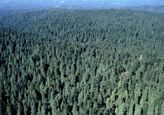 Click on image to enlarge (117K).
To learn more about this topic click Info Links
To view additional information (data source, aquisition date etc.) about this page, click Metadata
| www.krisweb.com |