| Area |
Anderson Creek |
| Topic |
Tour: Restoration Tebbutt's Before/Damage from 1983 Floods |
 Click on image to enlarge (67K). Click here to display a larger version (288K).
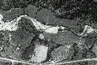
This 1984 aerial photo of Anderson Creek shows bends expanding to 500 feet, 300 feet and 325 feet wide on the Tebbutt property and those just upstream and downstream. Bank erosion was caused by sediment over-supply during El Nińo high flows in 1983. Only those curves in Anderson with vegetation were able to resist the erosive force of the water. As of 2003, Chris Tebbutt has treated all the reaches from above the bend at left to where the riparian of Anderson Creek narrows to the right of center and adjacent properties in cooperation with the Mendocino RCD. Photo provided by Chris Tebbutt. 1984.
 Click on image to enlarge (69K). Click here to display a larger version (303K).
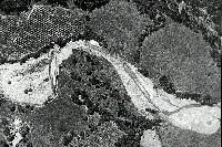
This zoom in shows the stream widening which occurred as the result of high flows in 1983. The Tebbutt riparian acquisition extended from the bend at left downstream to where the wetted channel of Anderson Creek bends cross to meet the riparian on the west bank (upper in photo). Photo by Chris Tebbutt. 1984.
 Click on image to enlarge (45K). Click here to display a larger version (197K).
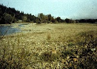
A vast gravel bar 325 feet wide is shown here looking downstream on Anderson Creek on the Tebbutt property in 1984 before the start of restoration. This is the same locations as shown in aerially in Pictures #1-2. Photo by Chris Tebbutt.
 Click on image to enlarge (105K).
Chris Tebbutt on his recently acquired real estate in the "simplified" riparian zone of Anderson Creek before commencement of his subsequent, intensive management of recovery of this area from 1984-2003 (see next Tours). Note the roof of the house for reference in other Tours. Photo by Stephanie Tebbutt. 1984.
 Click on image to enlarge (46K). Click here to display a larger version (203K).
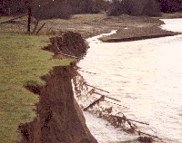
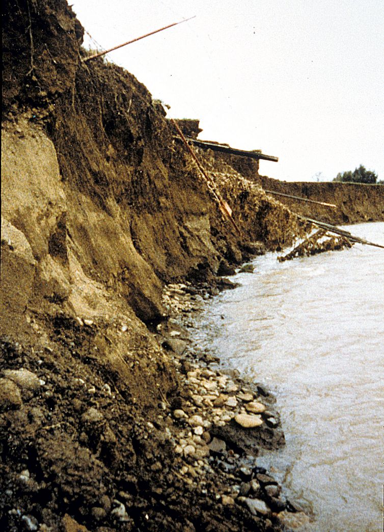
This photo was taken at stream level looking upstream at the 14 foot high failed cut-bank left by the 1983 floods. Chris and Stephanie Tebbutt acquired this piece of Anderson Creek riparian zone after the storm event from their neighbor and began its rehabilitation. Photo by Chris Tebbutt. 1984.
 Click on image to enlarge (109K).
The fence falling into the creek gives some indication of the former bank line, which has been eroded by high flows in 1983. The previous land use at this site was grazing and excavation on the upstream gravel bar is indicative of seasonal "straightening" which was performed prior to winter to try and channel stream energy away from banks. This manipulation may have worked in the drought cycle of the late 1970's and early 1980's, but had counter-productive effects at this site in very high water. Photo by Chris Tebbutt.
To learn more about this topic click Info Links
To view additional information (data source, aquisition date etc.) about this page, click Metadata

 Click on image to enlarge (67K). Click here to display a larger version (288K).
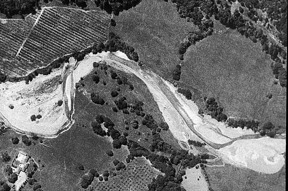 Click on image to enlarge (69K). Click here to display a larger version (303K).
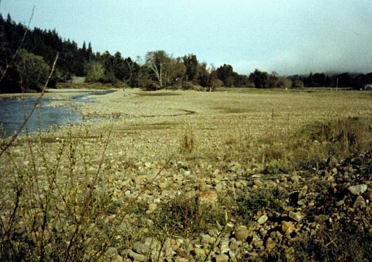 Click on image to enlarge (45K). Click here to display a larger version (197K).
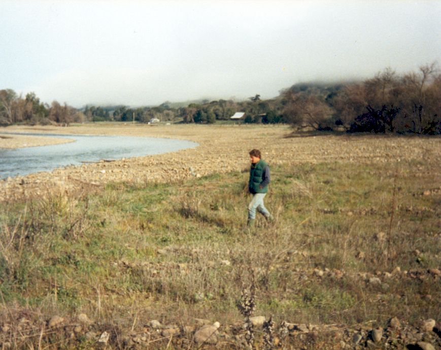 Click on image to enlarge (105K).
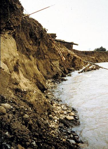 Click on image to enlarge (46K). Click here to display a larger version (203K).
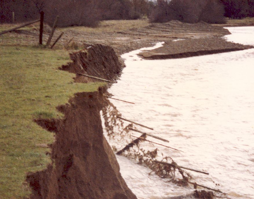 Click on image to enlarge (109K).
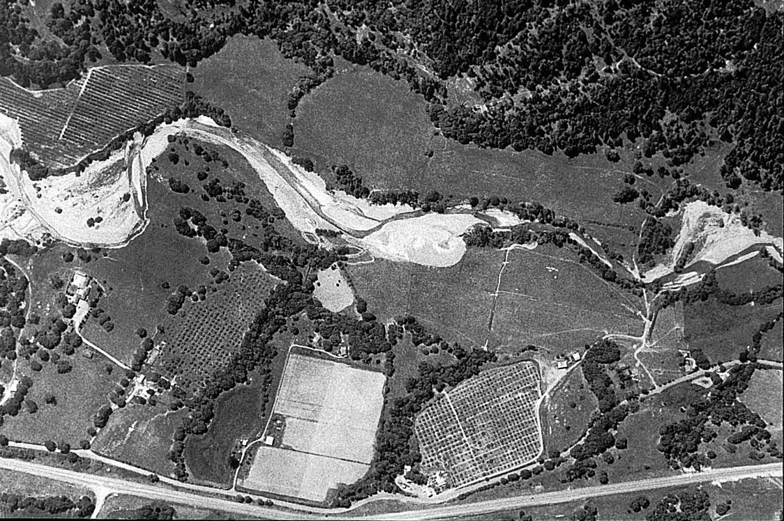