
|
Area/Topic | Bibliography | Background | Hypotheses | Home |
|
Map Page.
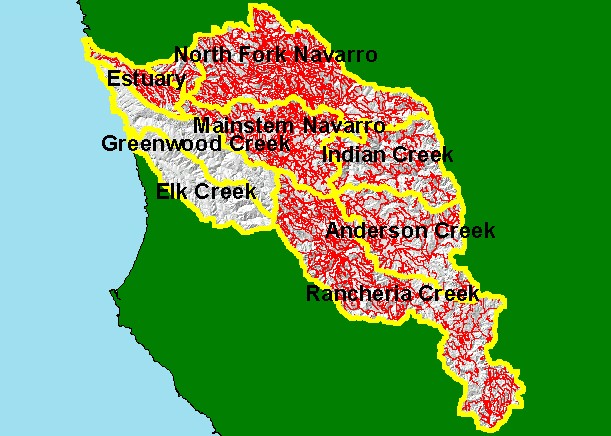
You selected the area Basinwide and the topic Sediment: Road Densities for All Navarro River Planning Watersheds |
| This is a map of the Roads in the KRIS Navarro Project Area. The roads data may under-represent actual roads as USGS maps are only updated periodically and may not have newly constructed roads. Note that areas in the North Fork have a higher density of roads, which is because the California Department of Forestry has updated road maps associated with timber harvest. Greater road densities are related to increased fine sediment yield to streams. | |||
|
|
||
To view metadata about a map layer, click on a link in the table below.
| Name of Layer in Map Legend | Metadata File Name |
|---|---|
| Sub-basins (w/ labels) | subbasins.shp.txt |
| Sub-basins (no labels) | subbasins.shp.txt |
| Project Frame | Unavailable |
| Roads (RWQCB) | navroads.shp.txt |
| Topo Map (1:24k scale) | Unavailable |
| Gray Hillshade of Elevtn (TIFF) | grayscale_xnv_light.tif.txt |
| Project Background | Unavailable |
| www.krisweb.com |