|
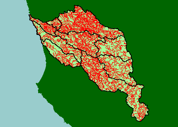
This is a map of the Roads in the KRIS Navarro Project Area with both the North Coast Regional Water Quality Control Board
(RWQCB) data and California Department of Forestry data displayed. While the RWQCB road data were made to support the
Navarro TMDL and are probably the most detailed, they do not cover Elk and Greenwood Creek watersheds. CDF mapped roads
associated with timber harvest including Elk and Greenwood Creeks and some areas with high harvest rates also have high road
densities, such as the North Fork and lower Rancheria Creek. Greater road densities are related to increased fine sediment yield to
streams. USGS 1:24000 road data lack detail because they only represent when the topo map was made and are not up dated.
|
|