
|
Area/Topic | Bibliography | Background | Hypotheses | Home |
|
Map Page.
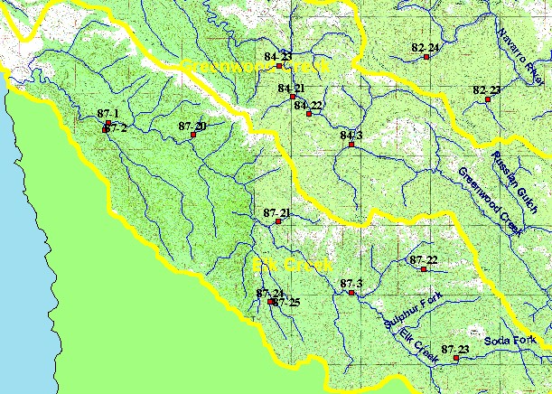
You selected the area Elk Creek and the topic Temperature: FWA at Elk Cr - upper (Site 87-3) 1997, 2001 |
| This is a map of Mendocino Redwood Company stream temperature monitoring sites for the Elk Creek watershed, displayed with a topographic map, KRIS sub-basins, and 1:24,000 scale streams. Scale = 1:98,262 . | |||
|
|
||
To view metadata about a map layer, click on a link in the table below.
| Name of Layer in Map Legend | Metadata File Name |
|---|---|
| MRC Temperature Stations | temp89_01.shp.txt |
| Streams (1:24k scale)(w/ labels) | streams24.shp.txt |
| Subbasin w/ Labels | subbasins.shp.txt |
| Frame Project Outline | Unavailable |
| Topo Map (1:24k scale) | Unavailable |
| www.krisweb.com |